


Formation of the delta of the Rhone - The diluvial wash - The alluvium spread over this - The three stages the river pursues - The zone of erosion - The zone of compensation - The zone of deposit - River mouths - Estuaries and deltas - The formation of bars - Of lagoons - The lagoons of the Gulf of Lyons - The ancient position of Arles between the river and the lagoons - Neglect of the lagoons in the Middle Ages - They become morasses - Attempt at remedy - Embankments and drains - A mistake made - The Camargue now a desert - Les Saintes Maries - No evidence to support the legend - Based on a misapprehension.
As I said when speaking of the Crau, the whole delta of the Rhone, which extended in the diluvial epoch from Cette to Fos, consists of a vast sloping plain of rolled stones from the Alps. What is now a great convexity thrust into the Mediterranean, perpetually gaining ground on the sea, was at the commencement of the present geologic epoch a great bay, and the waves of the Mediterranean broke against the cliffs of les Monts Garrigues, at Lodeve, the heights of Nimes and Beaucaire, against the limestone crags of the Alpines, and swirled against that calcareous spur that now separates the lagoon of Berre from the desert of la Crau.
But, at an epoch which it is impossible to fix, which, however, is posterior to the last geologic dislocations of the soil, two formidable deluges swept from the Alps down the troughs of the Rhone and the Durance, carrying with them vast masses of stone torn from the flanks of the mountains. They were veritable avalanches of water, mud and rubble, that filled the entire bay and covered the land, wherever they poured, with the wreckage of the Alps. The stones were broken into a thousand pieces in their course, their angles rubbed down, and their surfaces polished by friction, and this vast bed of rubble measures near the mouth of the Rhone some sixty feet in depth, and extends under the blue surface of the sea to the distance of many miles.
But, when the diluvium ceased, and the rivers Rhone and Durance assumed approximately their present character, a change of procedure took place. The volume of water rolled down was by no means so great, the inclination of the fall was vastly lessened, consequently the rivers were enabled to do what they had not been able to do in the diluvial period, chew up their food of stone, and reduce it to the condition of mud. This is what the two rivers are engaged upon now, and instead of strewing their embouchures with pebbles, they distribute over them, or would do so, if permitted, a film of fertilising mud.
Through many ages the Rhone has rambled at its sweet will over the vast tract of rubble that formed its delta in the diluvial age, changing its course capriciously, and always, wherever it went, covering up the pebble bed with a deposit of fertile soil. Other streams helped in the good work - the Herault, rich with red mud, the Ley, that flows past Montpellier, and the Vidourle from Lunel: consequently a very large portion of the rubble bed is covered with rich soil, that grows vines, mulberries, and olives. The plough and spade, however, speedily reach the boulders that lie but slightly buried beneath the surface. The canal of Craponne, that conveys the charged waters of the Durance over the Crau of Arles, is effecting artificially over that portion of the rubbly desert, the work that was done by Nature herself in past ages over the whole region from Cette to Aiguesmortes.
Now let us examine very shortly the stages through which every mountain-born river runs.
When young, sprung from eternal snows, gushing from under glaciers, it cuts its way through mountain gorges, receiving the rocks that fall from above, and carrying them along in its course, tearing its way round rocky spurs, and breaking them in its fury, and, as it travels down into the lower ground, it carries with it a vast mass of stone. Every tributary does the same. This first stage is called the zone of erosion.
But, as the river leaves the Alps, its course becomes less rapid, and the fall is not so abrupt. The bed widens, and what was a boiling torrent becomes a rapid river. As it rolls along, it carries down with it the stones that it has brought from the mountains, turning them over and over in its course, rubbing down all rough points, and becoming itself discoloured with the particles it has rubbed off the pebbles. All this matter thus produced has a tendency to fall to the bottom and form banks of gravel; but the violence of the stream is constantly altering the shape and position of these beds, carrying the gravel farther, and throwing down in their place half-triturated deposits of the same character.
This is called the zone of compensation.
Any traveller who has visited the Vallais may see the Rhone at work in its first stage. In the second he can trace the river from below Lyons, and see the thousand gravel-banks formed, swept away, and reformed, at every flood, that mark the course of the river in its second stage.
By the time the Rhone has reached Arles all its gravel has been champed up and reduced to impalpable mud. That blue crystalline flood that gushed from the Lake of Leman, unsullied by a particle of earth, is now a river of brown mud - thick as pea-soup, and as nutritious. The stones that would have killed all vegetation have been pounded into a condition so attenuated, that they form rich alluvial matter. The river now seeks to deposit all this mud. On reaching the sea, the difference in gravity between the meeting waters, and their variation in temperature, produces rapid precipitation of all the earthy matter held in suspense by the stream. This last stage in the river's course is called the zone of deposit.
The inclination of the bed of the Rhone between Tarascon and Arles is four feet three inches in the mile; but at Arles the elevation of the bank is but three feet six inches above the level of the sea; and the river has to run sixty-two miles before it reaches salt waves. Consequently the bed widens, the river branches, and the rapidity of its movement diminishes progressively. The alluvium is deposited, banks multiply, the mouths are encumbered with submarine islets, locally called theys, which the waves and currents of the sea displace and remodel continuously, and render the entrance to the river impracticable. [1]
[Footnote 1: Lentheric: 'Les Villes Mortes du Golfe de Lyon,' Paris, 1883.]
River mouths vary greatly; they are either estuaries, like those of the Thames, the Seine, and the S. Lawrence, or they are deltas, like those of the Nile, the Po, and the Rhone. Very generally in tidal seas we have estuaries; but in those that are tideless, as the Mediterranean and the Black Sea, they are deltas. Where there is a tide, the mouth of the river is washed out and kept open by the flux and reflux of the sea; but where there is no tide there is nothing to interfere with the river choking its mouth with its deposits. In such a case, after a while, the mass of deposit becomes so great as to interfere with the course of the river. The sea beating against this bar throws up sand and gravel upon it, and at every storm raises it higher. Then the river divides into two or more branches, and forms for itself new beds, which are destined in turn to undergo the same process.
Now, when a river has formed its bar choking its mouth, and is then forced to make a fresh mouth, it leaves a lagoon behind this bar. At every flood its waters overflow, and are unable to escape to the sea when left behind the bar. Sometimes, in like manner, in a gale of wind on shore, the waves are carried over the bar, and there are left as a brackish pool, unable to return to the sea.
Thus the whole of the Bay of the Gulf of Lyons is masked by a false coastline of old bars, behind which lie lagoons all formed in the way indicated. Between Rousillon and Leucate is the Etang de Salses; Narbonne anciently was seated in the lap of another great inland lake or lagoon. The vast Etang de Tau has a barrier between it and the sea on which is planted Cette. Lagoons behind bars extend thence the whole way to Aiguesmortes; and between the mouths of the Rhone, as they flow at present, is the Etang de Valcares.
After the river has deserted its old bed, and the lagoon has been formed behind the bar, or littoral cord, wave and storm working upon this long line of mud and sand succeed in breaking through; then, as the inclination of the land is but 0'm, 01 in the metre - almost nothing, the sweet and salt water mingle in these lakes, they never run dry, though in many cases not three feet deep.
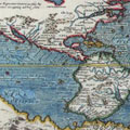
A look at the map of the Gulf of Lyons will show the reader that its special characteristic is the chain of lagoons separated from the sea by a narrow ribbon of sand. It may have caused perplexity in the mind of many that the Gulf should bear the name it does. It cannot take its name from the city of Lyons - the ancient Lugdunum - which is two hundred and twenty miles inland. It certainly cannot derive it from the wild beasts - lions - for there are none nearer than Africa.
The fact is, that the Gulf takes its title from the Keltic word for a lagoon, lon or lyn, a name that recurs in Maguelonne - the Dwelling on the Pool - in the Canal des Lonnes, a channel connecting the ponds and lagoons of the Durance and Rhone, and, indeed, in our own London (Londinium) the Dinas, Castle on the Lon, or pool of the Thames and the Essex marshes.
Anciently, in historic times, Arles, that lies near the apex of the triangle formed by the branches of the Rhone, was bathed on one side by the river, by which she received merchandise from the north; and, on the other side by the lones, or submerged land, that extended to the sea; and after Marius had connected these lones with his canal, she exported and imported merchandise over the Mediterranean through the lagoons, as the sea could not be reached by the river on account of its bars.
Moreover, the Greek and Roman cities along the coast are not found on the actual coast, on the bars, but were planted on the lagoons, which afforded them perfect harbourage for their merchant vessels. These lagoons, through which flowed salt and fresh water, were always healthy, and remained healthy as long as communication was maintained with the sea and the river. But wind and wave and alluvium working together choke these communications, and directly the mouth seawards of a lagoon is closed it is converted into a stagnating marsh that exhales malaria.
During the Middle Ages no attention was paid to this fact, and those stations which had been perfectly wholesome in the Classic Epoch were rendered pestilential, and dwindled from populous cities to a cluster of fever-smitten peasants' hovels. In later times this desperate condition of affairs called for remedy. Louis XIV. sent engineers to examine and report on the state of this region, and works were begun which have been maintained and extended annually, the raising of dykes against overflow by the Rhone and by the sea. Drains have been cut in all directions to carry off the stagnant water, opening by traps into the sea. The extent of dyke now reaches two hundred and thirty miles. The banks of the two main branches of the Rhone are protected, as well as the sea-face of the Camargue, the triangle between them, and the annual cost to the country to keep them in repair is one hundred and twenty thousand francs. A flood, however, often breaks through the banks, and submerges a large district. On such occasions the additional expense is heavy.
Now, what is the result of all this outlay? The engineers and scientific authorities of the coast-works and dykes are pretty unanimous in saying that a great mistake was made in the beginning by Louis XIV. The Rhone ought never to have been embanked. What should have been done was to keep open the mouths of the lagoons, to preserve them from festering.
Formerly, the large island of the Camargue, occupying nearly twenty thousand acres, was periodically inundated by the Rhone, and when the waters fell, a film of the richest deposit was left behind, just as in Egypt the Nile overflows and fertilises its delta. At every overflow eighteen thousand cubic yards of alluvium was deposited over this district, all of which is now carried into the Mediterranean and thrown down in the construction of new bars; utterly wasted.
In the time of the Roman domination the Camargue was a second Egypt, and was called "The granary of the Roman army;" and Arles was given the designation of "The Breasts," so flowing with plenty was it held to be. At the initial cost of millions of pounds, and an annual outlay of five thousand pounds, the Camargue has been reduced to absolute sterility.
The protected lands, deprived of the sweet water which would have washed from them the salt that now spoils their fertility, and of the natural dressing that Providence sends down to them every spring and autumn, are now productive of only a little coarse wiry grass and thistles, and the dried soil is white with saline efflorescence. At the present day the value of land in the neighbourhood of Arles that is subject to periodic inundation is three times that of the land guarded by costly embankments against the bounties of the river.
On descending the sinuous course of the lesser Rhone the hills disappear, the horizon is level as the sea, and all around is desert. Then the current of the Rhone seems to fail wholly, the waters of the river and of the lagoons on both sides of its bed mingle, and become confounded in one sheet. All nature is dead. The dull and sluggish water, streaked with lines of ooze, extend on all sides as far as the eye can reach. The effects of the mirage add bewilderment. One can hardly distinguish water from sky. Nothing can be more dreary than this naked surface, hushed into silence, where vegetation is reduced to a few tufts of rushes and tamarisks.
But, suddenly, out of the marshy, submerged plain, a strange pile of buildings is seen cutting the horizon, half a castle, half a cathedral, imposing in a mass as it towers above the fragile and squalid hovels crouched at the feet. This building is Les Saintes Maries.
Probably nowhere in the world is to be seen a spot so desolate and so wretched. The village is planted at the extreme west angle of the Camargue. It can be reached by one road only, rough to travel over, and impracticable in winter. This road leaves Arles, or rather Trinquetailles, opposite Arles, traverses the marsh of the Grand Mar, follows the dyke of the river, and then threads its way among morasses, and over soil white with salt, and burning under the rays of the sun. Once in the year this route is crowded with pilgrims, who come to pay their devotions at the spot where it is supposed that the Three Marys, Mary, the mother of James, Mary Salome, and their servant Sara, landed. The legend is somewhat mixed. According to one version, those who came to Provence, flying from the persecution raised by the Jews, were Lazarus, Mary Magdalene, and Martha. Lazarus, as we have seen, has been appropriated by Marseilles as its apostle; Martha has been settled at Tarascon, and Mary Magdalene has been given a cell in La Sainte Baume. Here, at Les Saintes Maries, however, the apostolic three are said to be Mary, mother of James, Mary, wife of Cleopas, and Sara, their servant; but a concession to the other tradition is made, in that it is allowed that these three brought with them Lazarus and Martha.
Nothing was known of all this till the time of good King Rene. The church at this point was called in the sixth century S. Maria de Ratis, S. Mary of the Boats, by S. Caesarius, Bishop of Arles. William, Count of Provence, in his will, A.D. 992, gives it the same designation; so Raimbald, Archbishop of Arles in A.D. 1061, "The Church of the Ever Virgin Mother of God, Mary of the Boats." So also Bertrand II., Count of Provence, at the same date. Two bulls of popes in 1123 and 1200 speak of the church as that of S. Mary on the Sea. So does Gervais of Tilbury. In 1241 Raymond Berengarius, Count of Provence, entitles it Notre Dame de la Mer. And so it continued to be called in documents down to 1395. If not Our Lady of the Sea, it was S. Maria de la Mar, of the Mere, the Lagoon.
However, in 1448, King Rene took it into his head that Mary and the Mere were distinct persons, that Mary was not, could not be, the Virgin, she must be one of the other Marys; so with a little putting together of heads and puzzlement, he and his advisers decided that the two Marys were Mary, the mother of James, and Mary Salome. The next thing to be done was to find their bodies there, but that naturally presented no difficulty. There were bones there - from Pagan times. Since that date a great pilgrimage has taken place annually to Les Saintes Maries; and the cure of Les Baux, being very satisfied that the Tremaie in his parish must be the Three Marys, erected a chapel under the rock sculptured with the figures of Marius, Martha, and Julia.
The Magdalen is probably a personation of the perished city of Maguelonne, as one of the Marys is the Mar or Mere; and Martha, there can hardly be a question, is the Syrian prophetess who accompanied Marius, but who in her place inherited the attributes and cult of Martis, the Phoenician goddess, venerated, doubtless, at all the settlements of these mercantile adventurers along the coast.