


13.1. B. HERSCHEL BABBAGE.
The unsolved problem of the extent and other details of that vast region of salt lakes and flat country then known under the generic name of Lake Torrens still greatly occupied the attention and excited the imaginations of the colonists of South Australia. And the accounts brought back by the different exploring parties were conflicting in the extreme. In 1851, two squatters, named Oakden and Hulkes, out run-hunting, pushed westward of Lake Torrens, and found suitable grazing country. They also discovered a lake of fresh water, and heard from the natives of other lakes to the north-west some fabulous legends of strange animals. Their horses giving in, Oakden and Hulkes returned, but although they applied for a squatting licence for the country they had been over, it was not then settled or stocked. In 1856, Surveyor Babbage made some explorations in the field partly traversed by Eyre and Frome. He penetrated through the plains that were supposed to occupy the central portion of the horseshoe formation at that time associated in the public opinion with Lake Torrens. More fortunate than his predecessors, he found permanent water in a gum-tree creek, and saw some fair-sized sheets of water, one of which he named Blanche Water, or Lake Blanche. Some further excursions led to the discovery of more fresh water and well-grassed pastoral country. The aboriginals, too, directed him to what they said was a crossing-place in that portion of Lake Torrens that had been sighted, in 1845, by Poole and Browne of Captain Sturt's party, when Poole thought he saw an inland sea. Their directions, however, proved unreliable, or Babbage failed to find the place, for he lost his horse in the attempt to cross the lake.
In 1857, another excursion to the westward of Lake Torrens was made by a Mr. Campbell, who discovered a creek of fresh water, which he called the Elizabeth. He also visited Lake Torrens, of which he reported in similar terms to those of previous explorers - that it was surrounded with barren country.
In April of the same year, a survey conducted by Deputy Surveyor-General Goyder, over the same country as that lately explored by Babbage, led to some absurd mistakes. A few miles north of Blanche Water he came to many surface springs surrounding a fine lagoon. To the north of them was an isolated hill, which he called Weathered Hill. From the summit of this hill he had a curious example of the effects of refraction in this region in a similar illusion to that which suggested Poole's inland sea. To the northward he saw a belt of gigantic gum-trees, and beyond them what appeared to be a sheet of water with elevated land on the far side. To the eastward was another large lake. But all this was but the glamourie of the desert - on closer examination the gigantic gums dwindled down to stunted bushes, and the mountainous ground to broken clods of earth.
But the greatest surprise reserved for Goyder was at Lake Torrens, where he found the water quite fresh. He described the Lake as stretching from fifteen to twenty miles to the north-west, with a water horizon, with an extensive bay forming to the southward; while to the north, a bluff headland and perpendicular cliffs were clearly to be discerned with the telescope. From the appearance of the flood-marks, Goyder came to the conclusion that there was little or no rise and fall in the lake, drawing the natural conclusion that its size was such as not to be influenced appreciably by flood waters, but that it absorbed them without showing any variation in its level.
Adelaide was overjoyed at the news. The threatening desert that hemmed in their fair province to the north was suddenly converted into a land of milk and honey. The Surveyor-General, Colonel Freeling, immediately started out, taking with him both a boat and an iron punt with which to float on these new waters. But there was a sudden fall to their hopes when a letter was received from him stating that the cliffs, the bay, and the head-lands were all built up on the airy foundation of a mirage. The elves and sprites of this desolate region had been playing a hoax upon Goyder's party. But it is no wonder that Goyder had been so open to deception after unexpectedly finding fresh water in the lake that had been so long known as salter than the sea.
On reaching the lake, Freeling found the water still almost fresh; but one of Goyder's men who accompanied him, told him that it had already receded half-a-mile since the latter's visit. An attempt to float the punt was made, but after dragging it through mud and a few inches of water for a quarter of a mile, the men abandoned the attempt as hopeless. Freeling and some of the party then started to wade through the slush, but after proceeding three miles, and then sounding only six inches of water, they returned. Some of the more adventurous extended their muddy wade, but only met with a similar result. Lake Torrens was re-invested with its evil name, only somewhat shrunken in proportions.
In the same year, 1857, Stephen Hack started with a party from Streaky Bay to examine the Gawler Range of Eyre, and investigate the country west of Lake Torrens. He reached the Gawler Range and examined the country very carefully, finding numerous fresh-water springs, and large plains covered with both grass and saltbush. He also discovered a large salt lake, Lake Gairdner. Simultaneously with Hack's expedition, a party under Major Warburton was out in the same neighbourhood; in fact, Hack's party crossed Warburton's tracks on one or two occasions. Strange to say, the reports of the two were flatly contradictory. Warburton described the country as dry and arid; but Hack's account was distinctly favourable. Of the two men, however, it is most probable that Hack possessed the more experience and knowledge of country, and, moreover, Time, the great arbitrator, has endorsed his words.
The year 1857 saw much exploration done in South Australia. One party, consisting of Swinden, Campbell, Thompson, and Stock, at about seventy miles from the head of Spencer's Gulf, found good pastoral country and a permanent water-hole called by the natives Pernatty. to the north they came upon Campbell's former discovery of the Elizabeth, but their provisions failing they were forced to return.
A month afterwards Swinden started again from Pernatty. North of the Gawler Range he found available pastoral country, which became known as Swinden's country. During this year also, Miller and Dutton explored the country at the back of Fowler's Bay. Forty miles to the north they saw treeless, grassy plains stretching far inland, but could find no permanent water. Warburton afterwards reported in depreciatory terms of this region; but Delisser and Hardwicke, who also visited it, stated that it would make first-class pastoral country if only surface water could be obtained. During the whole of Warburton's career, his judgment of the pastoral value of country seems to have been lamentably defective. He made no allowance for the varying nature of the seasons. A suggestion that he made to the South Australian Government to explore the interior, which had turned back such men as Sturt and Gregory, with the aid of the police, verges on the ludicrous.
In 1858, the South Australian Government voted a sum of money to fit out a party to continue the northern explorations. This party was put under the leadership of Babbage; but he was not given a free hand, being hampered with official instructions, and there being no allowance made for unforeseen exigencies. His instructions were to examine the country between Lakes Torrens and Gairdner, and to map the respective western and eastern shores of the two lakes, so as to remove for the future any doubt as to their actual formation and accurate position. This alone, apart from any extended exploration, meant a work of considerable time; but, unfortunately for the surveyor in charge, the general public was just then eager for fresh discoveries of available pastoral land, and was inclined to regard survey work as of secondary importance. It took several months to complete the survey work of the two lakes, and when Babbage returned to Port Augusta he found that Harris, the second in command of his depot camp, had started to return to Adelaide with many of the drays and horses. Babbage rode one hundred and sixty miles before he overtook him at Mount Remarkable, and there learned that the South Australian Government had changed its official mind with regard to the conduct of the expedition, and had decided that it should be conducted in future with pack-horses only.
It was A.C. Gregory's arrival in Adelaide with pack-horses from his last expedition down the Barcoo that had led to this change of tactics. Charles Gregory, who had accompanied his brother, was now engaged by the Government to overtake Babbage and acquaint him with their intention, but when he reached Port Augusta, Gregory took it upon himself to order the drays home, Babbage being away surveying. Babbage overtook them and ordered them back; but pleading Government orders, they refused to return. Babbage wrote to the authorities pointing out the unfairness of their action, and, mustering up a small party, returned to continue his work with six months' provisions.
On this occasion, Babbage gave more time to discovery than he had done before. He went out beyond the boundaries of his survey, and pushed on to Chambers Creek, so called by Stuart, who discovered it while Babbage was busy at Lake Gairdner. Babbage traced Chambers Creek into Lake Eyre, and was thus the first discoverer of this lake, which he called Lake Gregory. He found a range which he called Hermit Range, but from its crest discerned no sign of Lake Torrens, thus settling a certain limit to its extension to the north. He made further explorations to the west of Lake Gregory, now Lake Eyre, and found some hot springs. Meanwhile, during the time he was making these researches, the Government had, in a very high-handed manner, appointed Warburton to supersede him. Warburton started out to find Babbage, taking Charles Gregory as his second. Failing to find him at the Elizabeth, he followed and overtook him at the newly-discovered Lake Gregory. Warburton made a few discoveries while seeking for Babbage, amongst them the Douglas, a creek which was afterwards of great assistance to Stuart, and the Davenport Range; and he also came upon some fair pastoral country.
Babbage's surveys and explorations had done much to clear up the mystery and confusion that had hitherto obscured the geography of the salt lake region. His discovery of Lake Eyre (Gregory) and of the complete isolation of Lake Torrens, reduced the component parts of that huge saline basin to some sort of method and order. In addition to these achievements, Surveyor Parry made some further discoveries both of fresh water and available pastoral country to the eastward of the Lake.
B. Herschel Babbage was the eldest son of the well-known inventor of the calculating machine. He had been educated as an engineer, and for a considerable time had followed his profession in Europe. He had been engaged on several main lines in England, and had worked in conjunction with the celebrated Brunel. He had also been commissioned by the Government of Piedmont to report on a line across the Alps by way of Mount Cenis. He had remained in Italy some years until his work was interrupted by the revolution. He had returned to England, and had subsequently come to South Australia in 1851, in the ship Hydaspes. He died at his residence, in 1878, at St. Mary's, South Road, where he had a vineyard.
13.2. JOHN MCDOUALL STUART.
John McDouall Stuart, the great explorer of the centre of Australia, arrived in South Australia in 1839. His first experience of Australian exploration was sufficiently trying, gained as it was when he was acting as a draughtsman with Captain Sturt on his last arduous expedition. But it had kindled in him a high ardour for discovery, and fostered a stubborn resolution to carry through whatever he undertook.
He commenced his early explorations when in a position to do so independently, to the north-west of Swinden's country, in search of some locality called by the natives Wingillpin. Not finding it, he came to the strange conclusion that Wingillpin and Cooper's Creek were one and the same, although he was now on a different watershed. He also, at that period, seems to have entertained somewhat extensive notions of the course of Cooper's Creek, as in one part of his Journal he remarks: -
"My only hope of cutting Cooper's Creek is on the other side of the range. The plain we crossed to-day resembles those of the Cooper, also the grasses. If it is not there, it must run to the north-west, and form the Glenelg of Captain Grey."
Now, although we know that Grey held rather extravagant notions of the importance of the Glenelg, even he would not have thought it possible for the Glenelg to be the outlet of such a mighty river as Cooper's Creek would have become by the time it reached the north-west coast.
Stuart's horses were now too footsore to proceed over the stony country he found himself then in, and he had no spare shoes with him. Failing therefore to find the promised land of Wingillpin, although he had passed over much good and well-watered country, he turned to the south-west, and made some explorations in the neighbourhood of Lake Gairdner. Before this, however, he had found and named Chambers Creek. From Lake Gairdner, he steered for Fowler's Bay, and his description of some of the country he passed is anything but inviting. From a spur of the high peak that he named Mount Finke, he saw: -
"A prospect gloomy in the extreme: I could see a long distance, but nothing met the eye save a dense scrub, as black and dismal as night."
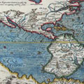
[Map. Stuart's Routes 1858, 1859, 1860, 1861, 1862; Burke and Wills's Route 1860 and 1861.]
From this point the party passed into a sandy spinifex desert, which Stuart says was worse than Sturt's; there had been a little salt-bush there, but here there was nothing but spinifex to be found, and the barren ground provided no food of any kind for the horses.
The state of affairs was becoming desperate with the little band, as their provisions were nearly finished; and though the leader was tempted to persist in the search for good pastoral country, he was at last forced to abandon the search and beat a hasty retreat. Dense scrub and the same "dreary dismal desert," as he calls it in his Journal, surrounded them day after day. Tired out and half-starved they reached the coast, and had but two meals left to carry them to Streaky Bay, where they found relief at Gibson's station. Here the sudden change from starvation to a full diet invalided most of them, and Stuart himself was very ill for some days. Finally they reached Thompson's station at Mount Arden, and there Stuart's first expedition terminated.
But this severe test only whetted Stuart's appetite for further exploration, and in April, 1859, he made another start. After crossing over some of the already-traversed country, Hergott, one of his companions, found the now well-known springs that bear his name. Stuart crossed his former discovery of Chambers Creek, and made for the Davenport Range, discovered by Warburton, finding many of the mound springs that characterize some parts of the interior. On the 6th of June he discovered a large creek, which he called the Neale. It ran through very good country, and Stuart followed it down, hoping to find it increase in volume and value as he went. In this he was not disappointed, as large plains covered with salt-bush and grass were found, and the party encountered several more springs. After satisfying himself of the extent and economic value of the country he had found, Stuart was obliged to return; for his horses' shoes had again worn out, and he had a lively and painful remembrance of the misery which his horses had suffered before from the lack of them.
In November of the same year, he made a third expedition in the vicinity of Lake Eyre, but there is little of interest attaching to the Journal of this trip, as his course was mostly over closely explored country. He reached the Neale again, and instituted a survey of the promising pastoral country he had traversed during his last trip, approaching at times to within sight of what he calls in his Journal Lake Torrens, but which in reality was what is now known as Lake Eyre. All these minor expeditions of Stuart's may be looked upon as preparatory to his great struggle to find an available passage through the unknown fastnesses of the centre of the continent.
It was in 1860 that Stuart made the first of his daring and stubborn attempts to cross Australia from south to north. The South Australian Government had offered a standing reward of 2,000 pounds for the man who should first succeed in this undertaking.
Stuart's party on his first trip was but a very small one: three men in all, with but thirteen horses. It reads lilliputian compared with the princely cavalcade that later on set out with Burke to travel over comparatively well-known country, involving only a short excursion through a land without natural difficulties or obstacles; and yet it actually achieved the greatest part of the task set it.
Stuart started from Chambers Creek, but for part of the journey he was of course travelling over country that was fairly well-known by that time. After passing the Neale, he entered untrodden country, which proved to be good available pastoral land. Numerous well-watered creeks were passed, which were named respectively the Frew, the Finke, and the Stevenson, and on the 6th of April they reached a hill of a remarkable shape, which had for some time attracted and excited their attention and curiosity. They found it to be a column of sandstone, on the apex of a hill. The hill was but a low one of a few hundred feet in height, but the sandstone column that surmounted it was one hundred and fifty feet in height and twenty feet in width. This striking object was named by Stuart Chambers Pillar, to commemorate a friend who had assisted him greatly in his explorations. It stood amongst other elevations of fantastic shapes and grotesque formations, resembling ruined forts and castles. On the 9th of April they sighted two remarkable bluffs, and on the 12th reached the range of which the bluffs formed the centre. The eastern bluff was called Brinkley Bluff and the western Hanson Bluff; the range, which is now well-known as a leading geographical feature of Australia, and on which the most elevated peaks in the interior have since been found, Stuart named the MacDonnell Range, after the then Governor of South Australia. The little band crossed the range, which was rough but had good grass on its slopes. There was, however, a scarcity of water; for they were now approaching the tropical line, and on reaching the northern slope of the range found themselves amongst spinifex and scrub, and obliged to undergo two nights without water for the horses. At a high peak, which was named Mount Freeling, they found a small supply; and as it was now evident that there was dry country ahead, a more careful search was made before pushing any further forward, in order to ensure certain means of retreat. Fortunately they found, amongst some ledges of rock, a large natural reservoir, which promised to be permanent, and capable of supplying their wants on their homeward way.
On the 22nd of April, Stuart camped in the centre of Australia, on the spot which his former leader, Sturt, had vainly undergone so much suffering to reach; and his feeling of elation must have been tempered with regret that his old leader was not then with him to share this success. About two miles and a half to the North-North-East there was a tolerably high hill which he called in reality Central Mount Sturt. It is now, however, erroneously called Stuart, owing to the publishers of his diary having misread his manuscript.
Having, in company with his tried companion Kekwick, climbed the mount, he erected a cairn of stones at the top and hoisted the Union Jack. They then recommenced their northern journey. That night they camped without finding water, but the next morning were lucky enough to get a permanent supply. Then ensued much delay, caused by fruitless attempts to strike either to the eastward or the westward. Stuart tried on several occasions to reach the head of the Victoria River, but failed, and sacrificed some horses. On a creek he called the Phillips, some natives were encountered who, according to Stuart, made and answered a masonic sign.
To the north of this spot, the explorers came to a large gum-tree creek, with very fair-sized sheets of water in it. As they followed down, they passed an encampment of natives, but kept steadily on their course without interfering with them. Not finding any water lower down the creek, the party had to return, and when close to the creek at the point where they had crossed that morning, they were suddenly surrounded by a mob of armed and painted savages, who had emerged unexpectedly from concealment in a clump of scrub. To all attempts at peaceful parley they returned showers of boomerangs and clubs, until the whites were compelled in self-defence to fire on them. Even then they were not deterred from following the party, even up to the camp of the night before. This incident caused Stuart to hesitate. His party was so small that the loss or even disablement of one man would have crippled the expedition; and they had already lost a good many horses. He therefore wisely decided to fall back, as they had penetrated far enough to prove that the passage of the continent could be effected with a few more men. It was on the 27th of June that he began his homeward march, and on the 26th of August he reached Brodie's camp at Hamilton Springs, with the strength of all much reduced, and Stuart himself suffering from scurvy.
After the result of Stuart's journey had been reported in Adelaide, and it was seen how inadequate means only had led to his defeat, the Government voted 2,500 pounds to equip a better-organized party; of this he was to take command.
Stuart judged it best to keep his old track by way of the Finke and the Hugh. On the 12th of April they arrived at the Bonney, and finding it running strong, with abundance of good feed on the banks, they were betrayed into following it down; but it soon spread abroad and was lost in a large plain. Leaving the Bonney, they adhered to the old route, and reached Tennant's Creek on the 21st of April, and four days afterwards they were on the scene of the attack that had been made on them at Attack Creek. But although the tracks of the natives were numerous, the explorers were, at this time, permitted to pass on in peace. Keeping at the foot of the low range, which there has an approximate northerly and southerly direction, Stuart crossed many creeks which promised long courses where they formed in the range, but which were all alike lost when they reached the level country. On the 4th of May they attained to the northern termination of this range, which he called the Ashburton Range. Here he made several attempts to the north and north-west, but could discover neither water nor watercourses in those directions; nothing indeed but plains, beautifully grassed, but heavy to ride over and yielding under the horses' feet. Beyond these plains, the country changed for the worse, and became sandy and scrubby. On the 16th of May he encountered a new description of scrub that grew in a very obstructive manner, and is now known as Stuart's Desert Hedgewood.
On the 23rd he found a magnificent sheet of permanent water which he called the Newcastle Waters, and at first he judged that a clear way north was now assured. But he was deluded, for beyond these waters he could not advance his party a mile; north, north-east, and north-west, there was the one outlook - endless grassy plains, terminating in dense scrubby forest country. He had to give up all hope for the present, and return to Adelaide.
Such however was the confidence of the authorities in him, and such his own energy, that in less than a month after his arrival in Adelaide he was on his way to Chambers Creek to make preparations for a fresh departure. His last two journeys had proved the existence of a long line of good country, fairly well-watered; and although beyond it he had not been able to gain a footing, still there was no knowing what a fresh endeavour would bring to light.
He had brought his party back in safety, with the loss of only a few horses, and had actually reached in point of position as low a latitude as the Victorian explorers had done, and that with a more difficult country to travel through, without camels, and with an inferior equipment in all other respects.
It is not necessary again to follow Stuart's horse-tracks over the northern way he was now pursuing for the third time. On the 14th of April, 1862, we find him encamped at the northern end of Newcastle Waters, once more about to force a passage through the forest of waterless scrub to the north. On the second day he was partly successful, finding an isolated waterhole, surrounded by conglomerate rocks. This he called Frew's Pond; and it is now a well-known camping-place for travellers on the overland telegraph line.
Past this spot he was not able to make any progress. Twice he made strenuous but vain efforts to reach some tributary of the Victoria River. He then spent many days riding through dense mulga and hedgewood scrub. At length, after much hope deferred, finding a few scanty waterholes that did not serve the purpose he had in view, he succeeded in striking the head of a chain of ponds running in a northerly direction. These being followed down, led him to the head of the creek now called Daly Waters Creek, and finally to the large waterhole on which the present telegraph station bearing the name of Daly Waters, stands. The creek was then lost in a swamp, and Stuart was unable to find the channel where it reformed, which has since been named the Birdum. Missing this water-guide, Stuart worked his way to the eastward, to a creek he named the Strangways, which led him down to the Roper River, a river which he had never striven to reach, his sole aim being the Victoria. He crossed the Roper, and followed up a northern tributary, which he named after his constant friend John Chambers.
Scarcity of water was now a thing of the past, but his stock of spare horseshoes had to be most jealously guarded, for his horses were beginning to fall lame, the country he was on was very stony, and he was far removed from Adelaide. From the Chambers he came to the lower course of a creek called by Leichhardt Flying-Fox Creek, re-named by Stuart the Katherine, the name it now bears. Thence he struck across the stony tableland and descended on the head waters of a river which he christened the Adelaide, and on following this river down he found himself in rich tropical scenery, which told him that at last he was approaching the sea-shore.
On the 24th of July he turned a little to the north-east, intending to strike the sea-beach and travel along it to the mouth of the Adelaide. He told only two of the party of the eventful moment awaiting them. As they rode on, Thring, who was riding ahead, suddenly called out, "The Sea," which so took the majority by surprise that they were some time before they understood what was meant, and then three hearty cheers were given.
At this, his first point of contact with the ocean, Stuart dipped his feet and hands in the sea, as at last he gazed across the water he had so perseveringly striven for years to reach.
He attempted to get to the mouth of the Adelaide River along the beach, but found it too boggy for the horses. Wishing to husband the forces at his command, Stuart wisely resolved to push no further; he had a space cleared where they were, and a tall sapling stripped of its boughs to serve as a flagstaff. On this he hoisted the Union Jack which he had carried with him. A record of their arrival, contained in an air-tight case, was then buried at the foot of the impromptu staff, and Stuart cut his initials on the largest tree he could find. The tree has since been found and recognised, but the buried memorial has not been discovered. More fortunate than the ill-fated Burke, Stuart surveyed the open sea from his point of contact with the ocean, instead of having to be content with some mangrove trees and salt water.
McDouall Stuart, whose last expedition we have thus followed out to its successful end, is rightly considered the man to whom the credit for the first crossing the continent is due. His victory was all his own; he had followed in no other person's footsteps; he had crossed the true centre, and he had made the coast at a point much further to the north than that reached by Burke and Wills, their journey having been considerably shortened by its northern end being placed on the southern shore of the great gulf that bites so deeply into north Australia. Along Stuart's track there is now erected the Overland Telegraph Line, an enduring monument to his indomitable perseverance.
Stuart's health was fast failing, and his horses were sadly reduced in strength. He therefore started back the day after the consummation of his dearest ambition. On his way south, after leaving Newcastle Waters, he found the water in many of the short creeks heading from the Ashburton Range to be rapidly diminishing; in some there was none left, in others it was fast drying. The horses commenced to give in rapidly one after the other, and more were lost on successive dry stages. Stuart himself thought that he would never live to see the settled districts. Scurvy had brought him down to a lamentable state, and after all his hard-won success, it seemed as though he would not profit by it. His right hand had become useless to him, and his eyes lost power of sight after sunset. He could not undergo the pain of riding, and a stretcher had to be slung between two horses to carry him on. With painful slowness they crept along until they reached Mount Margaret, the first station. Here the leader, reduced to a mere skeleton, was furnished with a little relief; and after resting and gaining a little strength, he rode on to Adelaide.
This was Stuart's last expedition; for he never recovered his health nor former eyesight. He was rewarded by the government of the colony which he had served so well, and was awarded the gold medal of the Royal Geographical Society. He went to reside in England, where he died in the year 1869, on the 16th of July.