


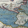


I will briefly bring this record to a conclusion. The map that accompanies it will give the reader an opportunity to more clearly understand the nature of the search conducted by Lieutenant Schwatka over the route of the retreating crews of the 'Erebus' and 'Terror', and by it he can also trace the sledge journey to and from King William Land as well as the preliminary sledge journeys in the winter of 1878 and 1879. The location of each spot where skeletons of the brave fellows were found is marked, and everywhere cenotaphs were erected to their memory. Owing to the length of time that has elapsed since this sad event, it was not always possible to tell the exact number of individuals represented in a pile of bones that we would gather sometimes from an area of nearly a half mile. The skeletons were always incomplete. Sometimes nothing but a skull could be found in the vicinity of a grave, and, again, often the skull would be missing. At one place we could distinguish four right femurs, and could therefore be positive that at least four perished here. This was at the boat place marked on Erebus Bay.
A number of natives whom we interviewed in the Netchillik country asserted most positively that there were two boat places in Erebus Bay, about a quarter of a mile apart; and Captain C. F. Hall obtained the same information while at Shepherd's Bay, in 1869. We therefore made a most careful search for another, after finding the first wreck of a boat at that portion of the coast, but without success. It seemed to us quite important to establish so interesting a fact, but nevertheless the effort was fruitless. We obtained from the natives wooden implements which were made from fragments of each boat, but the wood from one must have been entirely removed previous to our visit. Whether or not this is the same boat seen by McClintock is a matter that can be ascertained, for we have brought home the prow containing the inscription spoken of by him. He, however, saw portions of but two skeletons, while the collection of bones buried by us here were distinctly of four persons.
North of Collinsen Inlet we found but one grave - that of Lieutenant Irving. We, however visited the sites of several cairns, whose positions are marked upon the map. Although the route to and from Cape Felix is marked by a single line only, it should be remembered that our search extended inland so as to make a broad sweep about five miles from the coast. The point marked as the grave of an officer, between Franklin Point and Erebus Bay, is one of especial interest. The care with which the grave had originally been made seems to indicate the popularity of the individual and that the survivors had not yet exhausted their strength to such a degree as to be the cause of neglect. In fact, there were no evidences anywhere that they had ever neglected showing marked respect to the remains of those of their comrades who perished by their side; but, on the contrary, it is probable that all who died on the march were decently interred. A very significant fact in this connection is recognizable in the appearance of a grave which had been opened by the Esquimaux near Tallock Point. It was made of small stones, while larger and more appropriate abounded in the vicinity, showing the reduced physical condition of the party at the time. It was, indeed, a most touching indication of their devotion to each other under these most adverse circumstances that the grave had been made at all. The graves east of this point presented the same general appearance. This might be considered as an evidence that the boat in Erebus Bay had drifted in after the breaking up of the ice there, while these poor fellows were on their way back to the ships in search of food now known to have been there. It is not likely that the sick or dead would have been deserted by their comrades unless in the direst extremity.
The point marked as the location of the hospital tent is the place spoken of by Ahlangyah, where so many dead bodies were seen by her party after they had spent the summer on King William's Land in consequence of failing to get across Simpson Strait before the ice broke up. Where she met the starving explorers is also indicated. On the mainland the place is marked where the old Ookjoolik Esquimau saw the footprints of the last survivors of the 'Erebus' and 'Terror' in the spring snows of the year 1849. Also, near by is where he and his friends unwittingly scuttled the Northwest Passage ship - the Dangerous Rapids near the mouth of Back's River, the home of the Ooqueesiksillik Esquimaux, and the spot where we loaded our sleds with provisions on our way home. The route down Back's River, as we found its course, is put down, while dotted lines show how it is mapped on the Admiralty charts. It is not discreditable to Back's survey that an error should be made in tracing the course of the river, for it is probable that bad weather hid the sun from his observation at that portion of the river where he could travel very swiftly; while upon our return trip we were moving along this river by stages of not more than from five to nine miles a day. Our course up the river could not have been toward the southwest when we saw the sun rise to the right of our line of march almost daily. The place where the records were destroyed may be seen to the west of Point Richardson.
Among the most important relics of the expedition are two medals. The larger one, found at Lieutenant Irving's grave, is of solid silver; and the neat, cleanly cut edges which are as sharp to-day as if just from the die, indicate the value placed upon it and the care taken of it by its owner. It was buried with his remains at a spot about four miles below Victory Point, on King William's Land, and evidently remained undisturbed until the grave was found by Esquimaux who visited the vicinity some time after McClintock's search, more than twenty years ago. From its position when found by Lieutenant Schwatka it would appear that it had been taken out of the grave by the natives and laid upon one of the stones forming the wall of the tomb while they were seeking for further plunder, and was subsequently overlooked by them. The remains which were thus identified were sent to grateful relations in Scotland, and buried with due honor in a graveyard of Lieutenant Irving's native town.
The other medal, which was found at Starvation Cove, is of pewter, and may be described as a token commemorative of the launch of the steamship 'Great Britain', by Prince Albert, in July, 1843. The obverse bears a portrait of His Royal Highness, around it inscribed the words: -
PRINCE ALBERT, BORN AUGUST 26, 1819.
The inscription on the reverse reads as follows: -
THE GREAT BRITAIN.
LENGTH 322 ft; BREADTH 50 ft. 6 in.
DEPTH, 32 ft. 6 in.
WEIGHT OF IRON, 1,500 TONS.
1,000 HORSE POWER.
LAUNCHED, JULY 19,
1843,
by H. R. H. PRINCE ALBERT.
The vessel was built entirely of iron, and was the largest ever constructed at the time of the launch. On that occasion a great banquet was given, and one of the guests carried away the medal, which was destined to be found so many thousand miles away.
Lieutenant Irving's remains were the only ones that could be sufficiently identified to warrant their removal. Had there been others we would have brought them away.
It was a beautiful though saddening spectacle that met our eyes at the only grave upon King William's Land, where the dead had been buried beneath the surface of the ground. Near Point le Vesconte some scattered human bones led to the discovery of the tomb of an officer who had received most careful sepulture at the hands of his surviving friends. A little hillock of sand and gravel - a most rare occurrence upon that forbidding island of clay-stones - afforded an opportunity for Christian-like interment. The dirt had been neatly rounded up, as could be plainly seen, though it had been torn open and robbed by the sacrilegious hands of the savages; and everywhere, amid the debris and mould of the grave, the little wild flowers were thickly spread as if to hide the desecration of unfriendly hands. The fine texture of the cloth and linen and several gilt buttons showed the deceased to have been an officer, but there was nothing to be seen anywhere that would identify the remains to a stranger. Every stone that marked the outline of the tomb was closely scrutinized for a name or initials, but nothing was found. After reinterring the remains, which were gathered together from an area of a quarter of a mile, and erecting a monument, Lieutenant Schwatka plucked a handful of flowers, which he made into a little bouquet, and brought home with him as a memento.