


"How would you like to go to Labrador, Wallace?" It was a snowy night in late November, 1901, that my friend, Leonidas Hubbard, Jr., asked me this question. All day he and I had been tramping through the snow among the Shawangunk Mountains in southern New York, and when the shades of evening fell we had built a lean-to of boughs to shelter us from the storm. Now that we had eaten our supper of bread and bacon, washed down with tea, we lay before our roaring campfire, luxuriating in its glow and warmth.
Hubbard's question was put to me so abruptly that it rather startled me.
"Labrador!" I exclaimed. "Now where in the world is Labrador?"
Of course I knew it was somewhere in the north-eastern part of the continent; but so many years had passed since I laid away my old school geography that its exact situation had escaped my memory, and the only other knowledge I had retained of the country was a confused sense of its being a sort of Arctic wilderness. Hubbard proceeded to enlighten me, by tracing with his pencil, on the fly- leaf of his notebook, an outline map of the peninsula.
"Very interesting," I commented. "But why do you wish to go there?"
"Man," he replied, "don't you realise it's about the only part of the continent that hasn't been explored? As a matter of fact, there isn't much more known of the interior of Labrador now than when Cabot discovered the coast more than four hundred years ago." He jumped up to throw more wood on the fire. "Think of it, Wallace!" he went on, "A great unknown land right near home, as wild and primitive to-day as it has always been! I want to see it. I want to get into a really wild country and have some of the experiences of the old fellows who explored and opened up the country where we are now."
Resuming his place by the blazing logs, Hubbard unfolded to me his plan, then vague and in the rough, of exploring a part of the unknown eastern end of the peninsula. Of trips such as this he had been dreaming since childhood. When a mere boy on his father's farm in Michigan, he had lain for hours out under the trees in the orchard poring over a map of Canada and making imaginary journeys into the unexplored. Boone and Crockett were his heroes, and sometimes he was so affected by the tales of their adventures that he must needs himself steal away to the woods and camp out for two or three days.
It was at this period that he resolved to head some day an exploring expedition of his own, and this resolution he forgot neither while a student nor while serving as a newspaper man in Detroit and New York. At length, through a connection he made with a magazine devoted to out-of-door life, he was able to make several long trips into the wild. Among other places, he visited the Hudson Bay region, and once penetrated to the winter hunting ground of the Mountaineer Indians, north of Lake St. John, in southern Labrador. These trips, however, failed to satisfy him; his ambition was to reach a region where no white man had preceded him. Now, at the age of twenty-nine, he believed that his ambition was about to be realised.
"It's always the way, Wallace," he said; "when a fellow starts on a long trail, he's never willing to quit. It'll be the same with you if you go with me to Labrador. You'll say each trip will be the last, but when you come home you'll hear the voice of the wilderness calling you to return, and it will lure you away again and again. I thought my Lake St. John trip was something, but while there I stood at the portals of the unknown, and it brought back stronger than ever the old longing to make discoveries, so that now the walls of the city seem to me a prison and I simply must get away."
My friend's enthusiasm was contagious. It had never previously occurred to me to undertake the game of exploration; but, like most American boys, I had had youthful dreams of going into a great wild country, even as my forefathers had gone, and Hubbard's talk brought back the old juvenile love of adventure. That night before we lay down to sleep I said: "Hubbard, I'll go with you." And so the thing was settled - that was how Hubbard's expedition had its birth.
More than a year passed, however, before Hubbard was able to make definite arrangements to get away. I believe it was in February, 1903, that the telephone bell in my law office rang, and Hubbard's voice at the other end of the wire conveyed to me the information that he had "bully news."
"Is that so?" I said. "What's up?
"The Labrador trip is all fixed for this summer," was the excited reply. "Come out to Congers to-night without fail, and we'll talk it over."
In accordance with his invitation, I went out that evening to visit my friend in his suburban home. I shall never forget the exuberance of his joy. You would have thought he was a boy about to be released from school. By this time he had become the associate editor of the magazine for which he had been writing, but he had finally been able to induce his employers to consent to the project upon which he had set his heart and grant him a leave of absence.
"It will be a big thing, Wallace," he said in closing; "it ought to make my reputation."
Into the project of penetrating the vast solitudes of desolate Labrador, over which still brooded the fascinating twilight of the mysterious unknown, Hubbard, with characteristic zeal, threw his whole heart and soul. Systematically and thoroughly he went about planning, in the minutest detail, our outfit and entire journey. Every possible contingency received the most careful consideration.
In order to make plain just what he hoped to accomplish and the conditions against which he had to provide, the reader's patience is asked for a few minutes while something is told of what was known of Labrador at the time Hubbard was making preparations for his expedition.
The interior of the peninsula of Labrador is a rolling plateau, the land rising more or less abruptly from the coast to a height of two thousand or more feet above the level of the sea. Scattered over this plateau are numerous lakes and marshes. The rivers and streams discharging the waters of the lakes into the sea flow to the four points of the compass - into the Atlantic and its inlets on the east, into Ungava Bay on the north, Hudson Bay and James Bay on the west, and the Gulf of St. Lawrence on the south. Owing to the abrupt rise of the land from the coast these rivers and streams are very swift and are filled with a constant succession of falls and rapids; consequently, their navigation in canoes - the only possible way, generally speaking, to navigate them - is most difficult and dangerous. In this, to a large extent, lies the explanation as to why only a few daring white men have ever penetrated to the interior plateau; the condition of the rivers, if nothing else, makes it impossible to transport sufficient food to sustain a party for any considerable period, and it is absolutely necessary to run the risk of obtaining supplies from a country that may be plentiful with game one year and destitute of it the next, and in which the vegetation is the scantiest.
The western part of the peninsula, although it, too, contains vast tracts in which no white man has set foot, is somewhat better known than the eastern, most of the rivers that flow into Hudson and James Bays having been explored and correctly mapped. Hubbard's objective was the eastern and northern part of the peninsula, and it is with this section that we shall hereafter deal. Such parts of this territory as might be called settled lie in the region of Hamilton Inlet and along the coast.
Hamilton Inlet is an arm of the Atlantic extending inland about one hundred and fifty miles in a southwesterly direction. At its entrance, which is two hundred miles north of Cape Charles, the inlet is some forty miles wide. Fifty miles inland from the settlement of Indian Harbour (which is situated on one of the White Bear Islands, near the north coast of the inlet at its entrance), is the Rigolet Post of the Hudson's Bay Company - the "Old Company," as its agents love to call it - and here the inlet narrows down to a mere channel; but during the next eighty miles of its course inland it again widens, this section of it being known as Groswater Bay or Lake Melville.
The extreme western end of the inlet is called Goose Bay. Into this bay flows the Grand or Hamilton River, one of the largest in Labrador. From its source among the lakes on the interior plateau, the Grand River first sweeps down in a southeasterly direction and then bends northeasterly to reach the end of Hamilton Inlet. The tributaries of the lakes forming the headwaters of the Grand River connect it indirectly with Lake Michikamau (Big Water). This, the largest lake in eastern Labrador, is between eighty and ninety miles in length, with a width varying from six to twenty-five miles.
The Grand River, as well as a portion of Lake Michikamau, some years ago was explored and correctly mapped; but the other rivers that flow to the eastward have either been mapped only from hearsay or not at all. Of the several rivers flowing into Ungava Bay, the Koksoak alone has been explored. This river, which is the largest of those flowing north, rises in lakes to the westward of Lake Michikamau. Next to the Koksoak, the George is the best known of the rivers emptying into Ungava Bay, as well as the second largest; but while it has been learned that its source is among the lakes to the northward of Michikamau, it has been mapped only from hearsay.
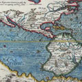
Now if the reader will turn to the accompanying map of Labrador made by Mr. A. P. Low of the Canadian Geological Survey, he will see that the body of water known as Grand Lake is represented thereon merely as the widening out of a large river, called the Northwest, which flows from Lake Michikamau to Groswater Bay or Hamilton Inlet, after being joined about twenty miles above Grand Lake by a river called the Nascaupee. Relying upon this map, Hubbard planned to reach early in the summer the Northwest River Post of the Hudson's Bay Company, which is situated at the mouth of the Northwest River, ascend the river to Lake Michikamau, and then, from the northern end of that lake, beat across the country to the George River.
The Geological Survey map is the best of Labrador extant, but its representation as to the Northwest River (made from hearsay) proved to be wholly incorrect, and the mistake it led us into cost us dear. After the rescue, I thoroughly explored Grand Lake, and, as will be seen from my map, I discovered that no less than five rivers flow into it, which are known to the natives as the Nascaupee, the Beaver, the Susan, the Crooked, and the Cape Corbeau. The Nascaupee is the largest, and as the inquiries I made among the Indians satisfied me that it is the outlet of Lake Michikamau, it is undoubtedly the river that figures on the Geological Survey map as the Northwest, while as for the river called on the map the Nascaupee, it is in all likelihood non- existent. There is a stream known to the natives as Northwest River, but it is merely the strait, one hundred yards wide and three hundred yards long, which, as shown on my map, connects Groswater Bay with what the natives call the Little Lake, this being the small body of water that lies at the lower end of Grand Lake, the waters of which it receives through a rapid.
Hubbard hoped to reach the George River in season to meet the Nenenot or Nascaupee Indians, who, according to an old tradition, gather on its banks in late August or early September to attack with spears the herds of caribou that migrate at that time, passing eastward to the sea coast. It is reported that while the caribou are swimming the river the Indians each year kill great numbers of them, drying the flesh for winter provisions and using the skins to make clothing and wigwam-covering. Hubbard wished not only to get a good story of the yearly slaughter, but to spend some little time studying the habits of the Indians, who are the most primitive on the North American continent.
Strange as it may seem to some, the temperature in the interior of Labrador in midsummer sometimes rises as high as 90 degrees or more, although at sunset it almost invariably drops to near the freezing point and frost is liable at any time. But the summer, of course, is very short. It may be said to begin early in July, by which time the snow and ice are all gone, and to end late in August. There is just a hint of spring and autumn. Winter glides into summer, and summer into winter, almost imperceptibly, and the winter is the bitter winter of the Arctic.
If the season were not too far advanced when he finished studying the Indians, Hubbard expected to cross the country to the St. Lawrence and civilisation; otherwise to retrace his steps over his upward trail. In the event of our failure to discover the Indian encampment, and our finding ourselves on the George short of provisions, Hubbard planned to run down the swift-flowing river in our canoe to the George River Post at its mouth, and there procure passage on some fishing vessel for Newfoundland; or, if that were impossible, to outfit for winter, and when the ice formed and the snow came, return overland with dogs.
Hubbard knew that by ascending the Grand River he would be taking a surer, if longer, route to Lake Michikamau; but it was a part of his project to explore the unknown country along the river mapped as the Northwest. I have called this country unknown. It is true that in the winter of 1838 John McLean, then the agent of the Hudson's Bay Company at Fort Chimo, a post situated on the Koksoak River about twenty miles above its mouth, passed through a portion of this country in the course of a journey he made with dogs from his post to Northwest River Post. His route was up the Koksoak and across country to the northern end of Lake Michikamau, which he followed for some little distance. After leaving the lake he again travelled eastward across country until at length he came upon the "Northwest" or Nascaupee River at a point probably not far above Grand Lake, from which it was easy travelling over the ice to the post. The record left by him of the journey, however, is very incomplete, and the exact route he took is by no means certain.
Whatever route it was, he returned over it the same winter to Fort Chimo. His sufferings during this trip were extreme. He and his party had to eat their dogs to save themselves from starvation, and even then they would surely all have perished had it not been for an Indian who left the party fifty miles out of Chimo and fortunately had strength enough to reach the post and send back relief. Later McLean made several summer trips with a canoe up the George River from Ungava Bay and down the Grand River to Hamilton Inlet; but never again did he attempt to penetrate the country lying between Lake Michikamau and Hamilton Inlet to the north of Grand River. The fact was that he found his Grand River trips bad enough; the record he has left of them is a story of a continuous struggle against heartbreaking hardships and of narrow escapes from starvation.
It is asserted that a priest once crossed with the Indians from Northwest River Post to Ungava Bay by the Nascaupee route; but the result of my inquiries in Labrador convinced me that the priest in question travelled by way of the Grand River, making it certain that previous to Hubbard's expedition no white man other than McLean had ever crossed the wilderness between Hamilton Inlet and Lake Michikamau by any route other than the aforesaid Grand River. As has been pointed out, McLean made but a verv incomplete record of his journey that took him through the country north of the Grand River, so that Hubbard's project called for his plunge into a region where no footsteps would be found to guide him. Not only this, but the George River country, which it was his ultimate purpose to reach, was, and still remains, terra incognita; for although McLean made several trips up and down this river, he neither mapped it nor left any definite descriptions concerning it.
Here, then, was an enterprise fully worthy of an ambitious and venturesome spirit like Hubbard. Here was a great, unknown wilderness into which even the half-breed native trappers who lived on its outskirts were afraid to penetrate, knowing that the wandering bands of Indians who occasionally traversed its fastnesses themselves frequently starved to death in that inhospitable, barren country. There was danger to be faced and good "copy" to be obtained.
And so it was ho for the land of "bared boughs and grieving winds"!