


The western coast of America—Juan de Fuca and De Fonte—The three voyages of Behring and Tschirikow—Exploration of the straits of De Fuca—Survey of the Archipelago of New Georgia and of part of the American coast—Exploration of the interior of America—Samuel Hearn—Discovery of the Coppermine river—Mackenzie, and the river named after him—Fraser river—South America—Survey of the Amazon by Condamine—Journey of Humboldt and Bonpland—Teneriffe—The Guachero cavern—The "Llaños"—The Electric eels—The Amazon, Negro, and Orinoco rivers—The earth-eaters—Results of the journey—Humboldt's second journey—The "Volcanitos," or little volcanoes—The cascade at Tequendama—The bridge of Icononzo—Crossing the Brindisi on men's backs—Pinto and Pinchincha—Ascent of Chimborazo—The Andes—Lima—The transit of Mercury—Exploration of Mexico—Puebla and Cofre de Perote—Return to Europe.
We have more than once had occasion to speak of expeditions for the survey of the coasts of America. We have told of the attempts of Fernando Cortes and of the voyages and explorations of Drake, Cook, La Perouse, and Marchand. It will be well now to go back for a time, and with Fleurieu sum up the series of voyages along the western coast of America, to the close of the eighteenth century.
 |
In 1537, Cortes with Francisco de Ulloa, discovered the huge peninsula of California, and sailed over the greater part of the long and narrow strait now known as the Vermilion Sea.
He was succeeded by Vasquez Coronado and Francisco Alarcon, who—the former by sea, and the latter by land—devoted themselves to seeking the channel which was erroneously supposed to connect the Atlantic and Pacific. They did not, however, penetrate beyond 36° N. lat.
Two years later, in 1542, the Portuguese Rodrique de Cabrillo, reached 44° N. lat., where the intense cold, sickness, want of provisions, and the bad state of his vessel, compelled him to turn back. He made no actual discovery, but he ascertained that, from Port Natividad to the furthest point reached by him, the coast-line was unbroken. The channel of communication seemed to recede before all explorers.
The little success met with appears to have discouraged the Spaniards, for at this time they retired from the ranks of the explorers. It was an Englishman, Drake, who, after having sailed along the western coast as far as the Straits of Magellan, and devastated the Spanish possessions, reached the forty-eighth degree, explored the whole coast, and, returning the same way, gave to the vast districts included within ten degrees the name of New Albion.
Next came, in 1592, the greatly fabulous voyage of Juan de Fuca, who claimed to have found the long-sought Strait of Anian, when he had but found the channel dividing Vancouver's Island from the mainland.
In 1602 Viscaino laid the foundations of Port Monterey in California, and forty years later took place that much contested voyage of Admiral De Fuente, or De Fonte according as one reckons him a Spaniard or a Portuguese, which has been the text of so many learned discussions and ingenious suppositions. To him we owe the discovery of the Archipelago of St. Lazarus above Vancouver's Island; but all that he says about the lakes and large towns he claims to have visited must be relegated to the realms of romance, as well as his assertion that he discovered a communication between the two oceans.
 |
| Port Monterey. (Fac-simile of early engraving.) |
In the eighteenth century the assertions of travellers were no longer blindly accepted. They were examined and sifted, those parts only being believed which accorded with the well authenticated accounts of others. Buache, Delisle, and above all Fleurieu, inaugurated the prolific literature of historical criticism, and we have every reason to be grateful to them.
The Russians, as we know, had greatly extended the field of their knowledge, and there was every reason to suppose that their hunters and Cossacks would soon reach America, if, as was then believed, the two continents were connected in the north. But from such unprofessional travellers no trustworthy scientific details could be expected.
A few years before his death the Emperor Peter I. drew up, with his own hands, a plan of an expedition, with instructions to its members, which he had long had in view, for ascertaining whether Asia and America are united, or separated by a strait.
The arsenal and forts of Kamtchatka being unable to supply the necessary men, stores, &c., captains, sailors, equipment, and provisions, had to be imported from Europe.
Vitus Behring, a Dane, and Alexis Tschirikow, a Russian, who had both given many a proof of skill and knowledge, were appointed to the command of the expedition, which consisted of two vessels built at Kamtchatka. They were not ready to put to sea until July 20th, 1720. Steering north-east along the coast of Asia, of which he never for a moment lost sight, Behring discovered, on the 15th August, in 67° 18' N. lat. a cape beyond which the coast stretched away westwards.
In this first voyage Behring did not apparently see the coast of America, though he probably passed through the strait to which posterity has given his name. The fabulous strait of Anian gave place to Behring Straits. A second voyage made by the same explorers the following year was without results.
Not until June 4th, 1741, were Behring and Tschirikow in a position to start again. This time they meant to bear to the east after reaching 50° N. lat. till they should come to the coast of America; but the two vessels were separated in a gale of wind on the 28th August, and were unable to find each other again throughout the trip. On the 18th July Behring discerned the American continent in 58° 28' N. lat. and the succeeding days were devoted to the survey of the vast bay between Capes St. Elias and St. Hermogenes.
Behring spent the whole of August in sailing about the islands known as the Schumagin archipelago, off the peninsula of Alaska; and after a struggle, lasting until the 24th September, with contrary winds, he sighted the most southerly cape of the peninsula, and discovered part of the Aleutian group.
Exhausted by long illness, however, the explorer was now no longer able to direct the course of his vessel, and could not prevent her from running aground on the little island bearing his name. There, on the 8th December, 1741, this brave man and skilful explorer perished miserably.
The remnant of his crew who survived the fatigues and privations of winter in this desolate spot, succeeded in making a large sloop of the remains of the vessel, in which they returned to Kamtchatka.
Meanwhile Tschirikow, after waiting for his superior officer until the 25th June, made land between 55° 56' N. lat., where he lost two boats with their crews, without being able to find out what had become of them. Unable after this catastrophe to open communication with the natives, he went back to Kamtchatka.
The way was now open, and adventurers, merchants, and naval officers eagerly rushed in, directing their efforts carefully to the Aleutian Islands and the peninsula of Alaska.
The expeditions sent out by the English, and the progress made by the Russians, had, however, aroused the jealousy and anxiety of the Spanish, who feared lest their rivals should establish themselves in a country nominally belonging to Spain, though she owned not a single colony in it.
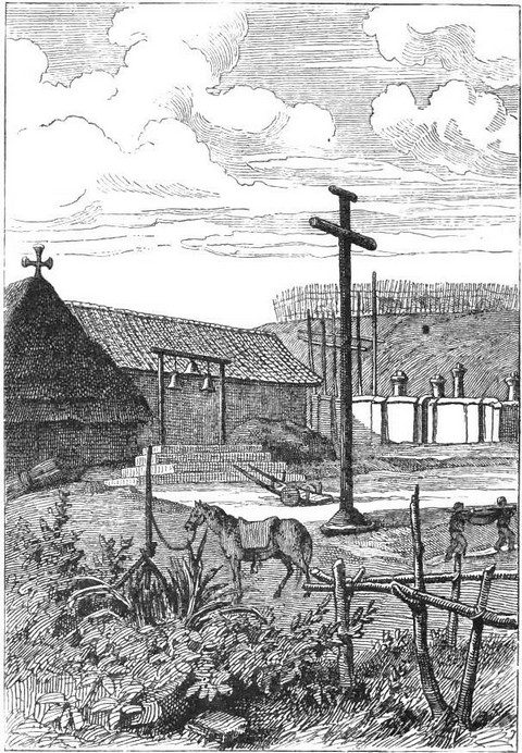
The Viceroy of Mexico now remembered the discovery of an excellent port by Viscaino, and resolved to found a "presidio" there. Two expeditions started simultaneously, the one by land, under Don Gaspar de Partola, the other by sea, consisting of two packets, the San Carlos and San Antonio, and after a year's search found again the harbour of Monterey, alluded to by Viscaino.
After this expedition the Spanish continued the exploration of the Californian coast. The most celebrated voyages were those of Don Juan de Ayala and of La Bodega, which took place in 1775, and resulted in the discovery of Cape Engano and Guadalupe Bay. Next to these rank the expeditions of Arteaga and Maurelle.
We have already related what was done by Cook, La Pérouse, and Marchand, so we can pass on to say a few words on the expeditions of Vancouver. This officer, who had accompanied Cook on his second and third voyage, was naturally appointed to the command of the expedition sent out by the English government with a view to settling the disputes with the Spanish government as to Nootka Sound.
George Vancouver was commissioned to obtain from the Spanish authorities the formal cession of this great harbour, of such vast importance to the fur trade. He was then to survey the whole of the north-west coast, from 30° N. lat. to Cook's River in 61° N. lat. Lastly, he was to give special attention to the Straits of De Fuca and the bay explored in 1749 by the Washington.
The two vessels, the Discovery of 340 tons, and the Chatham of 135—the latter under the command of Captain Broughton—left Falmouth on the 1st of April, 1791. After touching at Teneriffe, Simon Bay, and the Cape of Good Hope, Vancouver steered south-wards, sighted St. Paul's Island, and sailed towards New Holland, between the routes taken by Dampier and Marion, and through latitudes which had not yet been traversed. On the 27th September was sighted part of the coast of New Holland, ending in abrupt and precipitous cliffs, to which the name of Cape Chatham was given. As many of his crew were down with dysentery, Vancouver decided to anchor in the first harbour he came to, to get water, wood, and above all provisions, of which he stood sorely in need. Port George III. was the first reached, where ducks, curlews, swans, fish, and oysters abounded; but no communication could be opened with the natives, although a recently abandoned village of some twenty huts was seen.
We need not follow Vancouver in his cruise along the south-west coast of Holland, as we shall learn nothing new from it.
On the 28th November Van Diemen's Land was doubled, and on the 2nd December the coast of New Zealand was reached and anchor cast by the two vessels in Dusky Bay. Here Vancouver completed the survey left unfinished by Cook. A gale soon separated the Discovery from the Chatham, which was found again in Matavai Bay, Tahiti. During the voyage there from Dusky Bay, Vancouver discovered some rocky islands, which he called the Snares, and a large island named Oparra, whilst Captain Broughton had discovered Chatham Island, on the east of New Zealand. The incidents of the stay at Tahiti resemble those of Cook's story too closely for repetition.
On the 24th January the two vessels started for the Sandwich Islands, and stopped for a short time off Owyhee, Waohoo, and Ottoway. Since the murder of Cook many changes had taken place in this archipelago. English and American vessels now sometimes visited it to take whales, or trade in furs, and their captains had given the natives a taste for brandy and fire-arms. Quarrels between the petty chiefs had become more frequent, the most complete anarchy prevailed everywhere, and the number of inhabitants was already greatly diminished.
 |
On the 17th March, 1792, Vancouver left the Sandwich Islands and steered for America, of which he soon sighted the part called by Drake New Albion. Here he almost immediately met Captain Grey, who was supposed to have penetrated, in the Washington, into De Fuca Strait, and discovered a vast sea. Grey at once disavowed the discoveries with which he was so generously credited, explaining that he had only sailed fifty miles up the strait, which runs from east to west till it reaches a spot where, according to some natives, it veers to the north and disappears.
Vancouver in his turn entered De Fuca Strait, and recognized Discovery Port, Admiralty Entry, Birch Bay, Desolation Sound, Johnston Strait, and Broughton Archipelago. Before reaching the northern extremity of this long arm of the sea, he met two small Spanish vessels under the command of Quadra. The two captains compared notes, and gave their names to the chief island of the large group known collectively as New Georgia.
Vancouver next visited Nootka Sound and the Columbia River, whence he sailed to San Francisco, off which he anchored. It will be understood that it is impossible to follow the details of the minute survey of the vast stretch of coast between Cape Mendocino and Port Conclusion, in N. lat. 56° 37', which required no less than three successive trips.
"Now," says the great navigator, "that we have achieved the chief aim of the king in ordering this voyage, I flatter myself that our very detailed survey of the north-west coast of America will dispel all doubts, and do away with all erroneous opinions as to a north-west passage; surely no one will now believe in there being a communication between the North Pacific and the interior of the American continent in the part traversed by us."
Leaving Nootka, to survey the coast of South America before returning to Europe, Vancouver touched at the small Cocoa-Nut Island—which, as we have already observed, little deserves its name—cast anchor off Valparaiso, doubled Cape Horn, took in water at St. Helena, and re-entered the Thames on the 12th September, 1795.
The fatigue incidental to this long expedition had so undermined the health of the explorer that he died in May, 1798, leaving the account of his voyage to be finished by his brother.
Throughout the arduous survey, occupying four years, of 900 miles of coast, the Discovery and Chatham lost but two men. It will be seen from this how apt a pupil of Cook the great navigator was; and we do not know whether most to admire in Vancouver his care for his sailors and humanity to the natives, or the wonderful nautical skill he displayed in this dangerous cruise.
While explorers thus succeeded each other on the western coast of America, colonists were not idle inland. Already established on the borders of the Atlantic, where a series of states had been founded from Florida to Canada, the white men were now rapidly forcing their way westwards. Trappers, and coureurs des bois, as the French hunters were called, had discovered vast tracts of land suitable for cultivation, and many English squatters had already taken root, not, however, without numerous conflicts with the original owners of the soil, whom they daily tried to drive into the interior. Emigrants were soon attracted in large numbers by the fertility of a virgin soil, and the more liberal constitution of the various states.
Their number increased to such an extent, that at the end of the seventeenth century the heirs of Lord Baltimore estimated the produce of the sale of their lands at three thousand pounds; and in the middle of the following century, 1750, the successors of William Penn also made a profit ten times as great as the original price of their property. Yet emigration was even then not sufficiently rapid, and convicts were introduced. Maryland numbered 1981 in 1750. Many scandalous abuses also resulted from the compulsory signing by new comers of agreements they did not understand.
Although the lands bought of the Indians were far from being all occupied, the English colonists continued to push their way inland, at the risk of encounters with the legitimate owners of the soil.
In the north the Hudson's Bay Company, holding a monopoly of the fur trade, were always on the look-out for new hunting-grounds, for those originally explored were soon exhausted. Their trappers made their way far into the western wilds, and gained valuable information from the Indians whom they pressed into their service, and taught to get drunk. By this means the existence of a river flowing northwards, past some copper-mines, from which some natives brought fine specimens to Fort Prince of Wales, was ascertained. The company at once, i.e. in 1769, decided to send out an expedition, to the command of which they appointed Samuel Hearn.
For a journey to the Arctic regions, where provisions are difficult to obtain, and the cold is intense, a few well-seasoned men are required, who can endure the fatigue of an arduous march over snow, and bear up against hunger. Hearn took with him only two whites, and a few Indians on whom he could depend.
In spite of the great skill of the guides, who knew the country, and were familiar with the habits of the game it contained, provisions soon failed. Two hundred miles from Fort Prince of Wales the Indians abandoned Hearn and his two companions, who were obliged to retrace their steps.
The chief of the expedition, however, was a rough sailor, accustomed to privations, so he was not discouraged. If he had failed the first time, that was no reason why a second attempt should not succeed.
In March, 1770, Hearn started again to try and cross the unknown districts. This time he was alone with five Indians, for he had noticed that the inability of the whites to endure fatigue excited the contempt of the natives. He had penetrated 500 miles when the severity of the weather compelled him to wait for a less severe temperature. He had had a terrible experience. At one time to have, indeed, more game than can be eaten; but more often to have no food whatever, and be compelled for a week at a time to gnaw old leather, pick bones which had been thrown aside, or to seek, often in vain, for a few berries on the trees; and lastly, to endure fearful cold—such is the life of an explorer in these Arctic regions.
Hearn started once more in April, wandered about the woods until August, and had arranged to spend the winter with an Indian tribe which had received him well, when an accident which deprived him of his quadrant compelled him to continue his journey.
Privations, miseries, and disappointments, had not quenched the ardour of Hearn's indomitable spirit. He started again on the 7th December, and penetrating westwards below the 60th parallel N. lat. he came to a river. Here he built a canoe, and went in it down the stream, which flowed into an innumerable series of large and small lakes. Finally, on the 13th July, 1771, he reached the Coppermine River. The Indians with him now declared that they had been for some weeks in the country of the Esquimaux, and that they meant to massacre all they should meet of that hated race.
An encounter very soon took place.
"Coming," says Hearn, "upon a party of Esquimaux asleep in their tents, the Indians fell upon them suddenly, and I was compelled to witness the massacre of the poor creatures."
Of twenty individuals, not one escaped the sanguinary rage of the Indians; and they put to death with indescribable tortures an old woman who had in the first instance eluded them.
"After this horrible carnage," says Hearn, "we sat down on the grass, and made a good dinner off fresh salmon."
Here the river widened considerably. Had Hearn arrived at its mouth? The water was still quite sweet. There were, however, signs of a tide on the shores, and a number of seals were disporting themselves in the water. A quantity of whale blubber was found in the tents of the Esquimaux. Everything in fact combined to prove that the sea was near. Hearn seized his telescope, and saw stretching before him a huge sheet of water, dotted with islands. There was no longer any doubt; it was the sea!
On the 30th June Hearn got back to the English posts, after an absence of no less than a year and five months.
The company recognized the immense service just rendered by Hearn, by appointing him Governor of Fort Prince of Wales. During his expedition to Hudson's Bay, La Perouse visited this post, and there found the journal of Samuel Hearn's expedition. The French navigator returned it, on condition that he would publish it. We do not know why its appearance in accordance with the promise given by the English traveller to the French sailor was delayed until 1795.
Not until the close of the eighteenth century did the immense chain of lakes, rivers, and portages become known, which, emanating from Lake Superior, receive all the waters flowing from the Rocky Mountains, and divert them to the Arctic Ocean. It was to the brothers Frobisher, fur traders, and to a Mr. Pond, who reached Athabasca, that their discovery is partially due.
Thanks to their efforts, travelling in these parts became less difficult. One explorer succeeded another, posts were established, and the country was opened to all comers. Soon after a rumour was spread of the discovery of a large river flowing in a north-westerly direction.
It was Alexander Mackenzie who gave his name to it. Starting on the 3rd June, 1789, from Fort Chippewyan, on the southern shores of the Lake of the Hills, accompanied by a few Canadians, and several Indians who had been with Samuel Hearn, he reached 67° 45' N. lat., where he heard that the sea was not far off on the east, but that he was even nearer to it on the west. It was evident that he was quite close to the north-western extremity of America.
On the 12th July, Mackenzie reached a large sheet of shallow water covered with ice, which he could not believe to be the sea, though no land could be seen on the horizon. It was, however, the Northern Ocean, as he became assured when he saw the water rising, although the wind was not violent. The tide was coming in! The traveller then gained an island at a little distance from the shore, from which he saw several whales gambolling in the water. He therefore named the island, which is situated in N. lat. 69° 11', Whale Island. On the 12th September the expedition safely returned to Fort Chippewyan.
Three years later Mackenzie, whose thirst for discovery was unslaked, ascended Peace River, which rises in the Rocky Mountains. In 1793, after forcing his way across this rugged chain, he made out on the other side the Tacoutche-Tesse River, which flows in a south-westerly direction. In the midst of dangers and privations more easily imagined than described, Mackenzie descended this river to its mouth, below Prince of Wales Islands. There, he wrote with a mixture of grease and vermilion, the following laconic but eloquent inscription on a wall of rock: "Alexander Mackenzie, come from Canada overland, July 22nd, 1793." On the 24th August he re-entered Fort Chippewyan.
 |
| Mackenzie's first view of the North Pacific Ocean. |
In South America no scientific expedition took place during the first half of the eighteenth century. We have now only to speak of Condamine. We have already told of his discoveries in America, explaining how when the work was done he had allowed Bougner to return to Europe, and left Jussieu to continue the collection of unknown plants and animals which was to enrich science, whilst he himself went down the Amazon to its Mouth.
"Condamine," says Maury in his "Histoire de l'Académie des Sciences," "may be called the Humboldt of the eighteenth century. An intellectual and scientific man, he gave proof in this memorable expedition of an heroic devotion to the progress of knowledge. The funds granted to him by the king for his expedition were not sufficient; he added 100,000 livres from his private purse; and the fatigue and suffering he underwent led to the loss of his ears and legs. The victim of his enthusiasm for science, on his return home he met with nothing but ridicule and sarcasm from a public who could not understand a martyr who aimed at winning anything but Heaven. In him was recognized, not the indefatigable explorer who had braved so many dangers, but the infirm and deaf M. de Condamine, who always held his ear-trumpet in his hand. Content, however, with the recognition of his fellow-savants, to which Buffon gave such eloquent expression in his reply to the address at his reception at the French Academy, Condamine consoled himself by composing songs; and maintained until his death, which was hastened by all he had undergone, the zeal for information on all subjects, even torture, which led him to question the executioner on the scaffold of Damiens."
 |
| Portrait of Condamine. (Fac-simile of early engraving.) |
Few travellers before Condamine had had an opportunity of penetrating into Brazil. The learned explorer hoped, therefore, to render his journey useful by making a map of the course of the river, and putting down all his observations on the singular costumes worn by the natives of that little frequented country.
After Orellana, whose adventurous trip we have related, Pedro de Ursua was sent in 1559 by the Viceroy of Peru to seek for Lake Parima and the El Dorado. He was murdered by a rebel soldier, who committed all manner of outrages on his way down the river, and finished his course by being abandoned on Trinity Island.
Efforts of this kind did not throw much light on the course of the river. The Portuguese were more fortunate. In 1636 and 1637 Pedro Texeira with forty-seven canoes, and a large number of Spaniards and Indians, followed the Amazon as far as the junction of its tributary the Napo, and then ascended, first it, and afterwards the Coca, to within thirty miles of Quito, which he reached with a few men.
The map drawn up by Sanson after this trip, and as a matter of course copied by all geographers, was extremely defective, and until 1717 there was no other. At that time the copy of a map drawn up by Father Fritz, a German missionary, came out in Vol. xii. of the "Lettres Édifiantes," a valuable publication, containing a multitude of interesting historical and geographical facts. In this map it was shown that the Napo is not the true source of the Amazon, and that the latter, under the name of the Marañon, issues from Lake Guanuco, thirty leagues east of Lima. The lower portion of the course of the river was badly drawn, as Father Fritz was too ill when he went down it to observe closely.
Leaving Tarqui, five leagues from Cuenca, on the 11th May, 1743, Condamine passed Zaruma, a town once famous for its gold-mines, and having crossed several rivers on the hanging bridges, which look like huge hammocks slung from one side to the other, reached Loxa, four degrees from the line, and 400 fathoms lower than Quito. Here he noticed a remarkable difference of temperature, and found the mountains to be mere hills compared with those of Quito.
Between Loxa and Jaen de Bracamoros the last buttresses of the Andes are crossed. In this district rain falls every day throughout the year, so that a long stay cannot be made there. The whole country has declined greatly from its former prosperity. Loyola, Valladolid, Jaen, and the greater number of the Peruvian towns at a distance from the sea, and the main road between Carthagena and Lima, were in Condamine's time little more than hamlets. Yet forests of cocoa-nut trees grow all around Jaen, the natives thinking no more of them than they do of the gold dust brought down by their rivers.
Condamine embarked on the Chincipe, wider here than the Seine at Paris, and went down it as far as its junction with the Marañon, beyond which the latter river becomes navigable, although its course is broken by a number of falls and rapids, and in many places narrows till it is but twenty fathoms wide. The most celebrated of these narrows is the pongo, or gate, of Manseriche, in the heart of the Cordillera, where the Amazon has hewn for itself a bed only fifty-five fathoms wide, with all but perpendicular sides. Condamine, attended only by a single negro, met with an almost unparalleled adventure on a raft in this pongo.
"The stream," he says, "the height of which had diminished twenty-five feet in thirty-six hours, continued to decrease in volume. In the middle of the night, part of a large branch of a tree caught between the woodwork of my boat, penetrating further and further as the latter sunk with the water, so that if I had not been awake and on guard at the time, I should have found myself hanging from a tree, on my raft. The least of the evils threatening me would have been the loss of my journals and note-books, the fruit of eight years of work. Fortunately, I eventually found means to free my raft, and float it again."
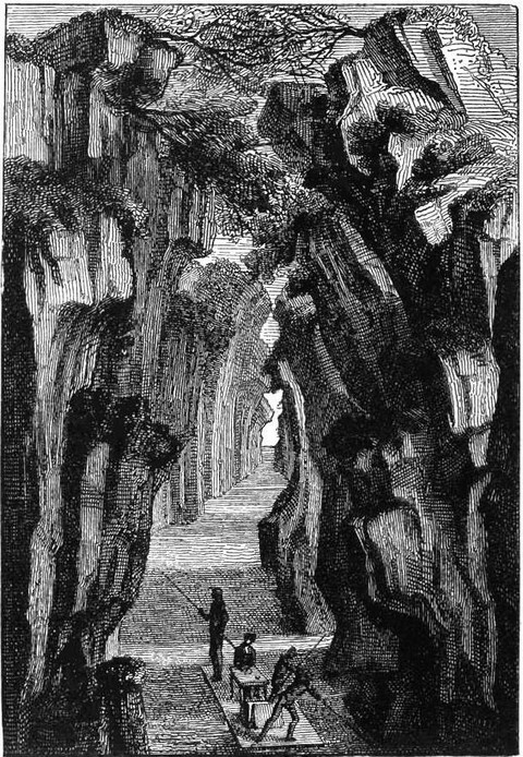 |
| Celebrated Narrows of Manseriche. (Fac-simile of early engraving.) |
In the midst of the woods near the ruined town of Santiago, where Condamine arrived on the 10th July, lived the Xibaro Indians, who had been for a century in revolt against the Spaniards, who tried to force them to labour in the gold-mines.
Beyond the pongo of Manseriche a new world was entered, a perfect ocean of fresh water—a labyrinth of lakes, rivers, and channels, set in an impenetrable forest. Although he had lived in the open air for more than seven years, Condamine was struck dumb by this novel spectacle of water and trees only, with nothing else besides. Leaving Borja on the 14th July, the traveller soon passed the mouth of the Morona, which comes down from the volcano of Sangay, the ashes from which are sometimes flung beyond Guayaquil. He next passed the three mouths of the Pastaca, a river at this time so much swollen that the width of no one of its mouths could be estimated.
On the 19th of the same month Condamine reached Laguna, where Pedro Maldonado, governor of the province of Esmeraldas, who had come down the Pastaca, had been waiting for him for six weeks. At this time Laguna was a large community, of some thousand Indians capable of bearing arms, who recognized the authority of the missionaries of the different tribes.
"In making a map of the course of the Amazon," says Condamine, "I provided myself with a resource against the ennui of a quiet voyage with nothing to break the monotony of the scenery, though that scenery was new to me. My attention was continually on the strain as, compass and watch in hand, I noted the deflexions in the course of the river, the time occupied in passing from one bend to another, the variations in the breadth of its bed and in that of the mouths of its tributaries, the angle formed by the latter at the confluence, the position and size of the islands, and above all the rate of the current and that of the canoe. Now on land and now in the canoe, employing various modes of measurement, which it would be superfluous to explain here, every instant was occupied. I often sounded, and measured geometrically the breadth of the river and that of its tributaries. I took the height of the sun at the meridian every day, and I noted its amplitude at its rising and setting, wherever I went."
On the 25th July, after having passed the Tigre River, Condamine came to a new mission station, that of a tribe called Yameos, recently rescued from the woods by the Fathers. Their language is difficult to learn, and their mode of pronouncing it extraordinary. Some of their words are nine or ten syllables long, and yet they can only count up to three. They use a kind of pea-shooter with great skill, firing from it small arrows tipped with a poison which causes instantaneous death.
The following day the explorer passed the mouth of the Ucayale, one of the most important of the tributaries of the Marañon, and which might even be its source. Beyond it the main stream widens sensibly.
Condamine reached on the 27th the mission station of the Omaguas, formerly a powerful nation, whose dwelling extended along the banks of the Amazon for a distance of 200 leagues below the Napo. Originally strangers in the land, they are supposed to have come down some river rising in Granada, and to have fled from the Spanish yoke. The word Omagua means flat-head in Peruvian, and these people have the singular custom of squeezing the foreheads of new-born babies between two flat pieces of wood, to make them, as they say, resemble the full moon. They also use two curious plants, the floripondio and the curupa, which makes them drunk for twenty-four hours, and causes very wonderful dreams. So that opium and hatchich have their counterparts in Peru.
 |
| Omagua Indians. |
Cinchona, ipecacuanha, simaruba, sarsaparilla, guaiacum, cocoa, and vanilla grow on the banks of the Marañon, as does also a kind of india-rubber, of which the natives make bottles, boots, and syringes, which, according to Condamine, require no piston. They are of the shape of hollow pears, and are pierced at the end with a little hole, into which a pipe is fitted. This contrivance is much used by the Omaguas; and when a fête is given, the host, as a matter of politeness, always presents one to each of his guests, who use them before any ceremonial banquet.
Changing boats at San Joaquin, Condamine arrived at the mouth of Napo in time to witness, during the night of the 31st July or the 1st August, the emersion of the first satellite of Jupiter, so that he was able to determine exactly the latitude and longitude of the spot—a valuable observation, from which all other positions on the journey could be calculated.
Pevas, which was reached the next day, is the last of the Spanish missions on the Marañon. The Indians collected there were neither all of the same race nor all converts to Christianity. They still wore bone ornaments in the nostrils and the lips, and had their cheeks riddled with holes, in which were fixed the feathers of birds of every colour.
St. Paul is the first Portuguese mission. There the river is no less than 900 fathoms wide, and often rises in violent storms. The traveller was agreeably surprised to find the Indian women possessed of pet birds, locks, iron keys, needles, looking-glasses, and other European utensils, procured at Para in exchange for cocoa. The native canoes are much more convenient than those used by the Indians of the Spanish possessions. They are in fact regular little brigantines, sixty feet long by seven wide, manned by forty oarsmen.
Between St. Paul and Coari several large and beautiful rivers flow into the Amazon. On the south the Yutay, Yuruca, Tefé, and Coari; on the north the Putumayo and Yupura. On the shores of the last-named river lives a cannibal race. Here Texeira set up a barrier, on the 26th June, 1639, which was to mark the frontier between the district in which the Brazilian and Peruvian languages respectively were to be used in dealing with the Indians.
Purus River and the Rio Negro, connecting the Orinoco with the Amazon, the banks dotted with Portuguese missions under the direction of the monks of Mount Carmel, were successively surveyed. The first reliable information on the important geographical fact of the communication between the two great rivers, is to be found in the works of Condamine, and his sagacious comments on the journeys of the missionaries who preceded him. It was in these latitudes that the golden lake of Parimé and the fabulous town of Manoa del Dorado are said to have been situated. Here, too, lived the Manaos Indians, who so long resisted the Portuguese.
Now were passed successively the mouth of the Madera River—so called on account of the quantity of timber which drifts down from it, the port of Pauxis—beyond which the Marañon takes the name of the Amazon, and where the tide begins to be felt, although the sea is more than 200 miles distant—and the fortress of Topayos, at the mouth of a river coming down from the mines of Brazil, on the borders of which live the Tupinambas.
Not until September did the mountains come in sight on the north—quite a novel spectacle, since for two months Condamine had not seen a single hill. They were the first buttresses of the Guiana chain.
On the 6th September, opposite Fort Paru, Condamine left the Amazon, and passed by a natural canal to the Xingu River, called by Father D'Acunha the Paramaribo. The port of Curupa was then reached, and lastly Para, a large town, with regular streets and houses of rough or hewn stone. To complete his map, the explorer was obliged to visit the mouth of the Amazon, where he embarked for Cayenne, arriving there on the 20th February, 1774.
This long voyage had the most important results. For the first time the course of the Amazon had been laid down in a thoroughly scientific manner, and the connexion between it and the Orinoco ascertained. Moreover Condamine had collected a vast number of interesting observations on natural history, physical geography, astronomy, and the new science of anthropology, then in its earliest infancy.
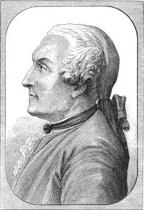
We have now to relate the travels of a man who recognized, better than any one else had done, the connexion between geography and the other physical sciences. We allude to Alexander von Humboldt. To him is due the credit of having opened to travellers this fertile source of knowledge.
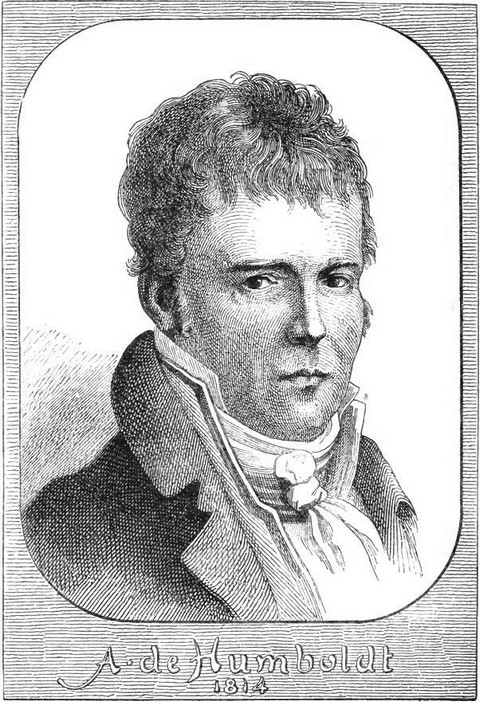 |
| Portrait of Alex. de Humboldt. (Fac-simile of early engraving.) |
Born at Berlin, in 1759, Humboldt's earliest studies were carried on under Campe, the well-known editor of many volumes of travels. Endowed with a great taste for botany, Humboldt made friends at the university of Göttingen with Forster the younger, who had just made the tour of the world with Captain Cook. This friendship, and the enthusiastic accounts given of his adventures by Forster, probably did much to rouse in Humboldt a longing to travel. He took the lead in the study of geology, botany, chemistry, and animal magnetism; and to perfect himself in the various sciences, he visited England, Holland, Italy, and Switzerland. In 1797, after the death of his mother, who objected to his leaving Europe, he went to Paris, where he became acquainted with Aimé Bonpland, a young botanist, with whom he at once agreed to go on several exploring expeditions.
It had been arranged that Humboldt should accompany Captain Baudin, but the delay in the starting of his expedition exhausted the young enthusiast's patience, and he went to Marseilles with the intention of joining the French army in Egypt. For two whole months he waited for the sailing of the frigate which was to take him; and, weary of inaction, he went to Spain with his friend Bonpland, in the hope of obtaining permission to visit the Spanish possessions in America.
This was no easy matter, but Humboldt was a man of rare perseverance. He was thoroughly well-informed, he had first-rate introductions, and he was, moreover, already becoming known. In spite, therefore, of the extreme reluctance of the government, he was at last authorized to explore the Spanish colonies, and take any astronomical or geodesic observations he chose.
The two friends left Corunna on the 5th June, 1799, and reached the Canaries thirteen days later. Of course, as naturalists they were in duty bound not to land at Teneriffe without ascending the Peak.
"Scarcely any naturalist," says Humboldt in a letter to La Metterie, "who, like myself, has passed through to the Indies, has had time to do more than go to the foot of this colossal volcano, and admire the delightful gardens of Orotava. Fortunately for me our frigate, the Pizarro, stopped for six days. I examined in detail the layers of which the peak of Teyde is composed. We slept in the moonlight at a height of 1200 fathoms. At two o'clock in the morning we started for the summit, where we arrived at eight o'clock, in spite of the violent wind, the great heat of the ground, which burnt our boots, and the intense cold of the atmosphere. I will tell you nothing about the magnificent view, which included the volcanic islands of Lancerote, Canaria, and Gomera, at our feet; the desert, twenty leagues square, strewn with pumice-stone and lava, and without insects or birds, separating us from thickets of laurel-trees and heaths; or of the vineyards studded with palms, banana, and dragon-trees, the roots of which are washed by the waves. We went into the very crater itself. It is not more than forty or sixty feet deep. The summit is 1904 fathoms above the sea-level, as estimated by Borda in a very careful geometric measurement.... The crater of the Peak—that is to say, of the summit—has been inactive for several centuries, lava flowing from the sides only. The crater, however, provides an enormous quantity of sulphur and sulphate of iron."
In July, Humboldt and Bonpland arrived at Cumana, in that part of America known as Terra Firma. Here they spent some weeks in examining the traces left by the great earthquake of 1797. They then determined the position of Cumana, which was placed a degree and a half too far north on all the maps—an error due to the fact of the current bearing to the north near La Trinidad, having deceived all travellers. In December, 1799, Humboldt wrote from Caracas to the astronomer Lalande:—
"I have just completed an intensely interesting journey in the interior of Paria, in the Cordillera of Cocolar, Tumeri, and Guiri. I had two or three mules loaded with instruments, dried plants, &c. We penetrated to the Capuchin mission, which had never been visited by any naturalist. We discovered a great number of new plants, chiefly varieties of palms; and we are about to start for the Orinoco, and propose pushing on from it perhaps to San Carlos on the Rio Negro, beyond the equator. We have dried more than 1600 plants, and described more than 500 birds, picked up numberless shells and insects, and I have made some fifty drawings. I think that is pretty well in four months, considering the broiling heat of this zone."
During this first trip Humboldt visited the Chayma and Guarauno Missions. He also climbed to the summit of the Tumiriquiri, and went down into the Guacharo cavern, the entrance to which, framed as it is with the most luxuriant vegetation, is truly magnificent. From it issues a considerable river, and its dim recesses echo to the gloomy notes of birds. It is the Acheron of the Chayma Indians, for, according to their mythology and that of the natives of Orinoco, the souls of the dead go to this cavern. To go down into the Guacharo signifies in their language to die.
The Indians go into the Guacharo cavern once a year, in the middle of summer, and destroy the greater number of the nests in it with long poles. At this time many thousands of birds die a violent death, and the old inhabitants of the cave hover above the heads of the Indians with piercing cries, as if they would defend their broods.
The young birds which fall to the ground are opened on the spot. Their peritoneum is covered with a thick layer of fat, extending from the abdomen to the anus, and forming a kind of cushion between the legs. At the time called at Caripe the oil harvest, the Indians build themselves huts of palm leaves outside the cavern, and then light fires of brushwood, over which they hang clay pots filled with the fat of the young birds recently killed. This fat, known under the name of the Guacharo oil or butter, is half-liquid, transparent, without smell, and so pure that it can be kept a year without turning rancid.
Humboldt continues: "We passed fifteen days in the Caripe valley, situated at a height of 952 Castilian varas above the sea-level, and inhabited by naked Indians. We saw some black monkeys with red beards. We had the satisfaction of being treated with the greatest kindness by the Capuchin monks and the missionaries living amongst these semi-barbarous people."
 |
| Engraved by Morieu. |
From the Caripe valley the two travellers went back to Cumana by way of the Santa Maria Mountains and the Catuaro missions, and on the 21st November they arrived—having come by sea—at Caracas, a town situated in the midst of a valley rich in cocoa, cotton, and coffee, yet with a European climate.
Humboldt turned his stay at Caracas to account by studying the light of the stars of the southern hemisphere, for he had noticed that several, notably the Altar, the Feet of the Centaur, and others, seemed to have changed since the time of La Caille.
At the same time he put his collections in order, despatching part of them to Europe, and most thoroughly examined some rocks, with a view to ascertaining of what materials the earth's crust was here composed.
After having explored the neighbourhood of Caracas, and ascended the Silla, which, although close to the town, had never been scaled by any native, Humboldt and Bonpland went to Valencia, along the shores of a lake called Tacarigua by the Indians, and exceeding in size that of Neufchâtel in Switzerland. Nothing could give any idea of the richness and variety of the vegetation. But the interest of the lake consists not only in its picturesque and romantic beauty; the gradual decrease in the volume of its waters attracted the attention of Humboldt, who attributed it to the reckless cutting down of the forests in its neighbourhood, resulting in the exhaustion of its sources.
Near this lake Humboldt received proof of the truth of the accounts he had heard of an extraordinary tree, the palo de la vaca, or cow-tree, which yields a balsamic and very nutritive milk, drawn off from incisions made in the bark.
The most arduous part of the trip began at Porto Caballo, at the entrance to the llanos, or perfectly flat plains stretching between the hills of the coast and the Orinoco valley.
"I am not sure," says Humboldt, "that the first sight of the llanos is not as surprising as that of the Andes."
Nothing in fact could be more striking than this sea of grass, from which whirls of dust rise up continually, although not a breath of wind is felt at Calabozo, in the centre of this vast plain. Humboldt first tested the power of the gymnotus, or electric eel, large numbers of which are met with in all the tributaries of the Orinoco. The Indians, who were afraid of exposing themselves to the electric discharge of these singular creatures, proposed sending some horses into the marsh containing them.
"The extraordinary noise made by the shoes of the horses," says Humboldt, "made the eels come out of the ooze and prepare for battle. The yellowish livid gymnoti, resembling serpents, swam on the top of the water, and squeezed themselves under the bodies of the quadrupeds which had disturbed them. The struggle which ensued between animals so differently constituted presented a very striking spectacle. The Indians, armed with harpoons and long canes, surrounded the pond on every side, and even climbed into the trees, the branches of which stretched horizontally over the water. Their wild cries, as they brandished their long sticks, prevented the horses from running away and getting back to the shores of the pond; whilst the eels, driven mad by the noise, defended themselves by repeated discharges from their electric batteries. For a long time they appeared victorious, and some horses succumbed to the violence of the repeated shocks which they received upon their vital organs from every side. They were stunned, and sank beneath the water.
"Others, panting for breath, with manes erect, and wild eyes full of the keenest suffering, tried to fly from the scene, but the merciless Indians drove them back into the water. A very few, who succeeded in eluding the vigilance of the guards, regained the bank, stumbling at every step, and lay down upon the sand, exhausted with fatigue, every limb paralyzed from the electric shocks received from the eels.
"I never remember receiving a more terrible shock from a Leyden jar than I did from a gymnotus on which I accidentally trod just after it came out of the water."
The astronomic position of Calabozo having been determined, Humboldt and Bonpland resumed their journey to the Orinoco. The Uriticu, with its numerous and ferocious crocodiles, and the Apure, one of the tributaries of the Orinoco, the banks of which are covered with a luxuriant vegetation such as is only met with in the tropics, were successively crossed or descended.
The latter stream is flanked on either side by thick hedges, with openings here and there, through which boars, tigers, and other wild animals, made their way to quench their thirst. When the shades of night shut in the forest, so silent by day, it resounds with the cries of birds and the howling or roaring of beasts of prey, vying with each other as to which shall make the most noise.
While the Uriticu is inhabited by fierce crocodiles, the Apure is the home of a small fish called the "carabito," which attacks bathers with great fury, often biting out large pieces of flesh. It is only four or five inches long, but more formidable than the largest crocodile, and the waters it frequents are carefully avoided by the Indians, in spite of their fondness for bathing, and the relief it affords them, persecuted as they are by ants and mosquitoes.
Our travellers went down the Orinoco as far as the Temi, which is connected by a short portage with the Cano-Pimichino, a tributary of the Rio Negro.
The banks of the Temi, and the adjacent forests, are often inundated, and then the Indians make waterways, two or three feet wide, between the trees. Nothing could be more quaint or imposing than floating amongst the gigantic growths, beneath their green foliage. Sometimes, three or four hundred leagues inland, the traveller comes upon a troop of fresh-water dolphins, spouting up water and compressed air in the manner which has gained for them the name of blowers.
 |
| Gigantic vegetation on the banks of the Temi. |
It took four days to transport the canoes from the Tenir to the Cano-Pimichino, as a path had to be cleared with axes.
The Pimichino flows into the Rio-Negro, which is in its turn a tributary of the Amazon.
Humboldt and Bonpland went down the Rio-Negro as far as San Carlos, and then up the Casiquiaro, an important branch of the Orinoco, which connects it with the Rio-Negro. The shores of the Casiquiaro are inhabited by the Ydapaminores, who live entirely on smoked ants.
Lastly, the travellers went up the Orinoco nearly to its source, at the foot of the Duida volcano, where their further progress was stopped by the hostility of the Guaharibos and the Guaica Indians, who were skilful marksmen with the bow and arrow. Here was discovered the famous El Dorado lake, with its floating islets of talc.
Thus was finally solved the problem of the junction of the Orinoco and the Marañon, which takes place on the borders of the Spanish and Portuguese territories, two degrees above the equator.
The two travellers then floated with the current down the Orinoco, traversing by this means five hundred leagues in twenty-five days, after which they halted for three weeks at Angostura, to tide over the time of the great heat, when fever is prevalent, regaining Cumana in October, 1800.
"My health," says Humboldt, "was proof against the fatigue of a journey of more than 1300 leagues, but my poor comrade Bonpland, was, immediately on his return, seized with fever and sickness, which nearly proved fatal. A constitution of exceptional vigour is necessary to enable a traveller to bear the fatigue, privations, and interruptions of every kind with which he has to contend in these unhealthy districts, with impunity. We were constantly surrounded by voracious tigers and crocodiles, stung by venomous mosquitoes and ants, with no food for three months but water, bananas, fish, and tapioca, now crossing the territory of the earth-eating Otomaques, now wandering through the desolate regions below the equator, where not a human creature is seen for 130 leagues. Few indeed are those who survive such perils and such exertions, fewer still are those who, having surmounted them, have sufficient courage and strength to encounter them a second time."
We have seen what an important geographical discovery rewarded the perseverance of the explorers who had completed the examination of the whole of the district north of the Amazon, between Popayan and the mountains of French Guiana. The results obtained in other branches of science were no less novel and important.
Humboldt had discovered that there exists amongst the Indians of the Upper Orinoco and the Rio Negro a race with extremely fair complexions, differing entirely from the natives of the coast. He also noticed the curious tribe of the Otomaques.
"These people," he says "who disfigure their bodies with hideous paintings, eat nothing but loam for some three months, when the height of the Orinoco cuts them off from the turtles which form their ordinary food. Some monks say they mix earth with the fat of crocodiles' tails, but this is a very false assertion. We saw provisions made of unadulterated earth, prepared only by slow roasting and moistening with water."
Amongst the most curious of the discoveries made by Humboldt, we must mention that of the "curare," the virulent poison which he saw manufactured by the Catarapeni and Maquiritare Indians, and a specimen of which he sent to the Institute with the "dapiche," a variety of Indian rubber hitherto unknown, being the gum which exudes spontaneously from the roots of the trees known as "jacio" and "cucurma," and dries underground.
Humboldt concluded his first journey by the exploration of the southern districts of San Domingo and Jamaica, and by a short stay in Cuba, where he and his companions made several experiments with a view to facilitating the making of sugar, surveyed the coast of the island, and took some astronomical observations.
These occupations were interrupted by the news of the starting of Captain Baudin, who, it was said, was to double Cape Horn and examine the coasts of Chili and Peru. Humboldt, who had promised to join the expedition, at once left Cuba, and crossed South America, arriving on the coast of Peru in time, as he thought, to receive the French navigator. Although Humboldt had throughout his long journey worked with a view to timing his arrival in the Peruvian capital to meet Baudin, it was only when he reached Quito that he ascertained that the new expedition was making for the Pacific by way of the Cape of Good Hope.
In May, 1801, Humboldt, still accompanied by the faithful Bonpland, embarked at Cartagena, whence he proposed going first to Santa Fé de Bogota, and then to the lofty plains of Quito. To avoid the great heat the travellers spent some time at the pretty village of Turbaco, situated on the heights overlooking the coast, where they made the necessary preparations for their journey. In one of their excursions in the neighbourhood they visited a very strange region, of which their Indian guides had often spoken under the name of Volcanitos.
This is a volcanic district, set in a forest of palms, and of the tree called "tola," about two miles to the east of Turbaco. According to a legend, the country was at one time one vast collection of burning mountains, but the fire was quenched by a saint, who merely poured a few drops of holy water upon it.
In the centre of an extensive plain Humboldt came upon some twenty cones of greyish clay, about twenty-five feet high, the mouths of which were full of water. As the travellers approached a hollow sound was heard, succeeded in a few minutes by the escape of a great quantity of gas. According to the Indians these phenomena had recurred for many years.
Humboldt noticed that the gas which issues from these small volcanoes was a far purer azote than could then be obtained by chemical laboratories.
Santa Fé is situated in a valley 8600 feet above the sea-level. Shut in on every side by lofty mountains, this valley appears to have been formerly a large lake. The Rio-Bogota which receives all the waters of the valley, has forced a passage for itself near the Tequendama farm, on the south-west of Santa-Fé, beyond which it leaves the plain by a narrow channel and flows into the Magdalena basin. As a natural consequence, were this passage blocked, the whole plain of Bogota would be inundated and the ancient lake restored. There exists amongst the Indians a legend similar to that connected with Roland's Pass in the Pyrenees, telling how one of their heroes split open the rocks and drained dry the valley of Bogota, after which, content with his exploit, he retired to the sacred town of Eraca, where he did penance for 2000 years, inflicting upon himself the greatest torture.
The cataract of Tequendama, although not the largest in the world, yet affords a very beautiful sight. When swollen by the addition of all the waters of the valley, the river, a little above the Falls, is 175 feet wide, but on entering the defile which appears to have been made by an earthquake, it is not more than forty feet in breadth. The abyss into which it flings itself, is no less than 600 feet deep. Above this vast precipice constantly rises a dense cloud of foam, which, falling again almost immediately, is said to contribute greatly to the fertility of the valley.
Nothing could be more striking than the contrast between the valley of the Rio Bogota and that of the Magdalena: the one with the climate and productions of Europe, the corn, the oaks and other trees of our native land; the other with palms, sugar-canes, and all the growths of the tropics.
One of the most interesting of the natural curiosities met with by our travellers on the trip, was the bridge of Jcononzo, which they crossed in September, 1801. At the bottom of one of the contracted ravines, known as "cañons," peculiar to the Andes, a little stream, the Rio Suma Paz, has forced for itself a narrow channel. To cross this river would be impossible, had not nature herself provided two bridges, one above the other, which are justly considered marvels of the country.
Three blocks of rock detached from one of the mountains by the earthquake which produced this mighty fissure, have so fallen as to balance each other and form a natural arch, to which access is obtained by a path along the precipice. In the centre of this bridge there is an opening through which the traveller may gaze down into the infinite depth of the abyss, at the bottom of which rolls the torrent, its terrible roar mingled with the incessant screaming of thousands of birds. Sixty feet above this bridge is a second, fifty feet long by forty wide, and not more than eight feet thick in the middle. To serve as a parapet, the natives have made a slender balustrade of reeds along the edges of this second bridge, from which the traveller can obtain a fine view of the magnificent scene beneath him.
The heavy rain and bad roads made the journey to Quito very exhausting, but for all that Humboldt and Bonpland only halted there for an absolutely necessary rest, quickly pressing on for the Magdalena valley, and the magnificent forests clothing the sides of the Trinidiu in the Central Andes.
This mountain is considered one of the most difficult to cross in the whole chain. Even when the weather is favourable, twelve days, at least, are necessary for traversing the forests, in which not a human creature is seen and no food can be obtained. The highest point is 1200 feet above the sea-level, and the path leading up to it is in many parts only one foot wide. The traveller is generally carried, bound to a chair in a sitting posture, on the back of a native, as a porter carries a trunk.
"We preferred to go on foot," says Humboldt in a letter to his brother, "and the weather being very fine we were only seventeen days in these solitudes, where not a trace is to be seen of any inhabitant. The night is passed in temporary huts made of the leaves of the heliconia, brought on purpose. On the western slopes of the Andes marshes have to be crossed, into which one sinks up to the knees; and the weather having changed when we reached them, it rained in torrents for the last few days. Our boots rotted on our feet, and we reached Carthago with naked and bleeding feet, but enriched with a fine collection of new plants.
"From Carthago we went to Popayan by way of Buga, crossing the fine Cauca valley, and skirting along the mountain of Choca, with the platina-mines for which it is famous.
"We spent October, 1801, at Popayan, whence we made excursions to the basaltic mountains of Julusuito and the craters of the Puracé volcano, which discharge hydro-sulphuric steam and porphyritic granite with a terrible noise....
"The greatest difficulties were met with in going from Popayan to Quito. We had to pass the Pasto Paramos, and that in the rainy season, which had now set in. A 'paramo' in the Andes is a district some 1700 or 2000 fathoms high, where vegetation ceases, and the cold is piercing.
"We went from Popayan to Almager and thence to Pasto, at the foot of a terrible volcano, by way of the fearful precipices forming the ascent to the summit of the Cordillera, thus avoiding the heat of the Patia valley, where one night will often bring on the fever known as the Calentura de Patia, lasting three or four months."
The province of Pasto consists entirely of a frozen plateau almost too lofty for any vegetation to thrive on it, surrounded by volcanoes and sulphur-mines from which spiral columns of smoke are perpetually issuing. The inhabitants have no food but batatas, and when they run short they are obliged to live upon a little tree called "achupalla," for which they have to contend with the bear of the Andes. After being wet through night and day for two months, and being all but drowned in a sudden flood, accompanied by an earthquake near the town of Jbarra, Humboldt and Bonpland arrived on the 6th January, 1801, at Quito, where they were received in cordial and princely style by the Marquis of Selva-Alegre.
Quito is a fine town, but the intense cold and the barren mountains surrounding it make it a gloomy place to stay in. Since the great earthquake of the 4th February, 1797, the temperature has considerably decreased, and Bouguer, who registered it at an average of from 15° to 16° would be surprised to find it varying from 4° to 10° Reaumur. Cotopaxi and Pinchincha, Antisana and Illinaza, the various craters of one subterranean fire, were all examined by the travellers, a fortnight being devoted to each.
Humboldt twice reached the edge of the Pinchincha crater, never before seen except by Condamine.
"I made my first trip," he says, "accompanied only by an Indian. Condamine had approached the crater by the lower part of its edge which was covered with snow, and in this first attempt I followed his example. But we nearly perished. The Indian sank to the breast in a crevasse, and we found to our horror that we were walking on a bridge of frozen snow, for a little in advance of us there were some holes through which we could see the light. Without knowing it we were in fact on the vaults belonging to the crater itself. Startled, but not discouraged, I changed my plan. From the outer rim of the crater, flung as it were upon the abyss, rise three peaks, three rocks, which are not covered with snow, because the steam from the volcano prevents the water from freezing. I climbed upon one of these rocks and on the top of it found a stone attached on one side only to the rock and undermined beneath, so as to protrude like a balcony over the precipice. This stone was but about twelve feet long by six broad, and is terribly shaken by the frequent earthquakes, of which we counted eighteen in less than thirty minutes. To examine the depths of the crater thoroughly we lay on our faces, and I do not think imagination could conceive anything drearier, more gloomy, or more awful than what we saw. The crater consists of a circular hole nearly a league in circumference, the jagged edges of which are surrounded by snow. The interior is of pitchy blackness, but so vast is the gulf that the summits of several mountains situated in it can be made out at a depth of some 300 fathoms, so only fancy where their bases must be!
"I have no doubt that the bottom of the crater must be on a level with the town of Quito. Condamine found this volcano extinct and covered with snow, but we had to take the bad news to the inhabitants of the capital, that the neighbouring burning mountain is really active."
Humboldt ascended the volcano of Antisana to a height of 2773 fathoms, but could go no further, as the cold was so intense that the blood started from the lips, eyes, and gums of the travellers. It was impossible to reach the crater of Cotopaxi.
On the 9th June, 1802, Humboldt, accompanied by Bonpland, started from Quito to examine Chimborazo and Tungurunga. The peak of the latter fell in during the earthquake of 1797, and Humboldt found its height to be but 2531 fathoms, whilst in Condamine's time it was 2620 fathoms.
From Quito the travellers went to the Amazon by way of Lactacunga, Ambato and Rio-Bamba situated in the province laid waste by the earthquake of 1797, when 40,000 inhabitants were swallowed up by water and mud. Going down the Andes, Humboldt and his companions had an opportunity of admiring the remains of the Yega road, leading from Cusco to Assuay, and known as the Inca's road. It was built entirely of hewn stones, and was very straight. It might have been taken for one of the best Roman roads. In the same neighbourhood are the ruins of a palace of the Inca Fupayupangi, described by Condamine in the minutes of the Berlin Academy.
After a stay of ten days at Cuença, Humboldt entered the province of Jaen, surveyed the Marañon as far as the Rio Napo, and with the aid of the astronomical observations he was able to make, supplemented Condamine's map. On the 23rd October, 1802, Humboldt entered Lima, where he successfully observed the transit of Mercury.
After spending a month in that capital he started for Guayaquil, whence he went by sea to Acapulco in Spanish America.
The vast number of notes collected by Humboldt during the year he spent in Mexico, and which led to the publication of his Essay on Spanish America, would, after what we have said of his previous proceedings, be enough to prove, if proof were needed, what a passion he had for knowledge, how indomitable was his energy and how immense his power of work.
At one and the same time he was studying the antiquities and the history of Mexico, the character, customs, and language of its people, and taking observations in natural history, physical geography, chemistry, astronomy, and topography.
The Tasco, Moran, and Guanajuato mines, which yield a profit of several million piastres per annum, first attracted the attention of Humboldt, who had early studied geology. He then examined the Jerullo volcano, which, although situated in the centre of an immense plain thirty-six leagues from the sea, and more than forty from any volcano, discharged earth on the 29th September, 1759, and formed a mountain of cinders and clay 1700 feet high.
In Mexico the travellers were able to obtain everything necessary to the arrangement of the immense collections they had accumulated, to classify and compare the observations each had taken, and to prepare their geographical map for publication.
Finally, in January, 1804, they left Acapulco to examine the eastern slopes of the Cordilleras, and to take the dimensions of the two lofty Puebla volcanoes.
"Popocatepetl," says Desborough Cooley, "is always active, although nothing but smoke and ashes have issued from its crater for centuries. It is not only 2000 feet higher than the loftiest mountains of Europe, but is also the loftiest mountain in Spanish America." In spite of the great quantity of snow which had recently fallen, Humboldt accomplished the ascent of the Cofre, 1300 feet higher than the peak of Teneriffe, obtaining from its summit, an extensive and varied view, embracing the Puebla plain and the eastern slopes of the Mexican Cordilleras, clothed with thick forests of "liquidambar," tree-ferns and sensitive plants. The travellers were able to make out the port of Vera Cruz, the castle of San Juan d'Ulloa and the sea-shore.
This mountain owes its name of Cofre to a naked rock of pyramidal form which rises like a tower from its summit at a height of 500 feet.
After this last trip Humboldt went down to Vera Cruz, and having fortunately escaped the yellow fever then decimating the population, he set sail for Cuba, where he had left the greater part of his collection, going thence to Philadelphia. There he remained a few weeks to make a cursory study of the political constitution of the United States, returning to Europe in August, 1804.
The results of Humboldt's travels were such, that he may be justly called the discoverer of Equinoctial America, which before his time had been explored without becoming really known, while many of its innumerable riches were absolutely ignored. It must be fully acknowledged that no traveller ever before did so much as Humboldt for physical geography and its kindred sciences. He was the very ideal of a traveller, and the world is indebted to him for important generalizations concerning magnetism and climate; whose results are plainly seen in the isothermal lines of modern maps. The writings of Humboldt mark an era in the science of geography, and have led to many further researches.