


Bellinghausen, yet another Russian explorer—Discovery of the islands of Traversay, Peter I., and Alexander I.—The whaler, Weddell—The Southern Orkneys—New Shetland—The people of Tierra del Fuego—John Biscoe and the districts of Enderby and Graham—Charles Wilkes and the Antarctic Continent—Captain Balleny—Dumont d'Urville's expedition in the Astrolabe and the Zelée—Coupvent Desbois and the Peak of Teneriffe—The Straits of Magellan—A new post-office shut in by ice—Louis Philippe's Land—Across Oceania—Adélie and Clarie Lands—New Guinea and Torres Strait—Return to France—James Clark Rosset—Victoria.
We have already had occasion to speak of the Antarctic regions, and the explorations made there in the seventeenth, and at the end of the eighteenth century, by various navigators, nearly all Frenchmen, amongst whom we must specially note La Roche, discoverer of New Georgia, in 1675, Bouvet, Kerguelen, Marion, and Crozet. The name of Antarctic is given to all the islands scattered about the ocean which are called after navigators, as well as those of Prince Edward, the Sandwich group, New Georgia, &c.
It was in these latitudes that William Smith, commander of the brig William, trading between Monte Video and Valparaiso, discovered, in 1818, the Southern Shetland Islands, arid and barren districts covered with snow, on which, however, collected vast herds of seals, animals of which the skins are used as furs, and which had not before been met with in the Southern Seas. The news of this discovery led to a rush of whaling-vessels to the new hunting-grounds, and between 1821 and 1822 the number of seals captured in this archipelago is estimated at 32,000, whilst the quantity of sea-elephant oil obtained during the same time may be put down at 940 tons. As males and females were indiscriminately slaughtered, however, the new fields were soon exhausted. The survey of the twelve principal islands, and of the innumerable and all but barren rocks, making up this archipelago, occupied but a short time.
 |
| Hunting sea-elephants. |
Two years later Botwell discovered the Southern Orkneys, and then Palmer and other whalemen sighted, or thought they sighted, districts to which they gave the names of Palmer and Trinity.
More important discoveries were, however, to be made in these hyberborean regions, and the hypothesis of Dalrymple, Buffon, and other scholars of the eighteenth century, as to the existence of a southern continent, forming, so to speak, a counterpoise to the North Pole, was to be unexpectedly confirmed by the work of these intrepid explorers.
The navy of Russia had now for some years been rapidly gaining in importance, and had played no insignificant part in scientific research. We have related the interesting voyages of most Russian circumnavigators; but we have still to speak of Bellinghausen's voyage round the world, which occupies a prominent place in the history of the exploration of the Antarctic seas.
The Vostok, Captain Bellinghausen, and the Mirni, commanded by Lieutenant Lazarew, left Cronstadt on the 3rd July, 1819, en route for the Antarctic Ocean. On the 15th December Southern Georgia was sighted, and seven days later an island was discovered in the south-east, to which the name of Traversay was given, and the position of which was fixed at 52° 15' S. lat., and 27° 21' W. long., reckoning from the Paris meridian.
Continuing their easterly course in S. lat. 60° for 400 miles as far as W. long. 187°, the explorers then bore south to S. lat. 70°, where their further progress was arrested by a barrier of ice.
Bellinghausen, nothing daunted, tried to cut his way eastwards into the heart of the Polar Circle, but at 44° E. long, he was compelled to return northwards. After a voyage of forty miles a large country hove in sight, which a whaler was to discover twelve years later when the ice had broken up.
Back again in S. lat. 62°, Bellinghausen once more steered eastwards without encountering any obstacles, and on the 5th March, 1820, he made for Port Jackson to repair his vessels.
The whole summer was given up by the Russian navigator to a cruise about Oceania, when he discovered no less than seventeen new islands, and on the 31st October he left Port Jackson on a new expedition. The first places sighted on this trip were the Macquarie Islands; then cutting across the 60th parallel, S. lat. in E. long. 160°, the explorers bore east between S. lat. 64° and 68° as far as W. long. 95°. On the 9th January, Bellinghausen reached 70° S. lat., and the next day discovered, in S. lat. 69° 30', W. long. 92° 20', an island, to which he gave the name of Peter I., the most southerly land hitherto visited. Then fifteen degrees further east, and in all but the same latitude, he sighted some more land which he called Alexander I.'s Land. Scarcely 200 miles distant from Graham's Land, it appeared likely to be connected with it, for the sea between the two districts was constantly discoloured, and many other facts pointed to the same conclusion.
From Alexander I.'s Land the two vessels, bearing due north, and passing Graham's Land, made for New Georgia, arriving there in February. Thence they returned to Cronstadt, the port of which they entered in July 1821, exactly two years after they left it, having lost only three men out of a crew of 200.
We would gladly have given further details of this interesting expedition, but we have not been able to obtain a sight of the original account published in Russian at St. Petersburg, and we have had to be content with the résumé brought out in one of the journals of the Geographical Society in 1839.
 |
| Engraved by E. Morieu. |
At the same period a master in the Royal Navy, James Weddell by name, was appointed by an Edinburgh firm to the command of an expedition, to obtain seal-skins in the southern seas, where two years were to be spent. This expedition consisted of the brig Jane, 160 tons, Captain Weddell, and the cutter Beaufort, sixty-five tons, Matthew Brisbane commander.
The two vessels left England on the 17th September, 1822, touched at Bonavista, one of the Cape Verd Islands, and cast anchor in the following December in the port of St. Helena, on the eastern coast of Patagonia, where some valuable observations were taken on the position of that town.
Weddell put to sea again on the 27th December, and steering in a south-easterly direction, came in sight, on the 12th January, of an archipelago to which he gave the name of the Southern Orkneys. These islands are situated in S. lat. 60° 45', and W. long. 45°.
According to the navigator, this little group presents an even more forbidding appearance than New Shetland. On every side rise the sharp points of rocks, bare of vegetation, round which surge the restless waves, and against which dash enormous floating icebergs, with a noise like thunder. Vessels are in perpetual danger in these latitudes, and the eleven days passed under sail by Weddell in surveying minutely the islands, islets, and rocks of this archipelago, were a time of ceaseless exertion for the crew, who were throughout in constant danger of their lives.
Specimens of the principal strata of these islands were collected, and on the return home put into the hands of Professor Jameson, of Edinburgh, who identified them as belonging to primary and volcanic rocks.
Weddell now made for the south, crossed the Antarctic Circle in W. long. 30°, and soon came in sight of numerous ice islands. Beyond S. lat. 70°, these floes decreased in number, and finally disappeared; the weather moderated, innumerable flocks of birds hovered above the ships, whilst large schools of whales played in its wake. This strange and unexpected change in the temperature surprised every one, especially as it became more marked as the South Pole was more nearly approached. Everything pointed to the existence of a continent not far off. Nothing was, however, discovered.
On the 20th February the vessels were in S. lat. 74° 15' and W. long. 34° 16' 45".
"I would willingly," says Weddell, "have explored the south-west quarter, but taking into consideration the lateness of the season, and that we had to pass homeward through 1000 miles of sea strewed with ice islands, with long nights, and probably attended with fogs, I could not determine otherwise than to take advantage of this favourable wind for returning."
Having seen no sign of land in this direction, and a strong southerly wind blowing at the time, Weddell retraced his course as far as S. lat. 58°, and steered in an easterly direction to within 100 miles of the Sandwich Islands. On the 7th February he once more doubled the southern cape, sailed by a sheet of ice fifty miles wide, and on the 20th February reached S. lat. 74° 15'. From the top of the masts nothing was to be seen but an open sea with a few floating ice-islands.
Unexpected results had ensued from these trips in a southerly direction. Weddell had penetrated 240 miles nearer the Pole than any of his predecessors, including Cook. He gave the name of George IV. to that part of the Antarctic Ocean which he had explored. Strange and significant was the fact that the ice had decreased in quantity as the South Pole was approached, whilst fogs and storms were incessant, and the atmosphere was always heavily charged with moisture, and the temperature of surprising mildness.
Another valuable observation made, was that the vibrations of the compass were as slow in these southern latitudes as Parry had noted them to be in the Arctic regions.
Weddell's two vessels, separated in a storm, met again in New Georgia after a perilous voyage of 1200 miles amongst the ice. New Georgia, discovered by La Roche in 1675, and visited in 1756 by the Lion, was really little known until after Captain Cook's exploration of it, but his account of the number of seals and walruses frequenting it had led to being much favoured by whalers, chiefly English and American, who took the skins of their victims to China and sold them at a guinea or thirty shillings each.
"The island," says Weddell, speaking of South Georgia, "is about ninety-six miles long, and its mean breadth about ten. It is so indented with bays, that in several places, where they are on opposite sides, they are so deep as to make the distance from one side to the other very small. The tops of the mountains are lofty, and perpetually covered with snow; but in the valleys, during the summer season, vegetation is rather abundant. Almost the only natural production of the soil is a strong-bladed grass, the length of which is in general about two feet; it grows in tufts on mounds three or four feet from the ground. No land quadrupeds are found here; birds and amphibious animals are the only inhabitants."
Here congregate numerous flocks of penguins, which stalk about on the beach, head in air. To quote an early navigator, Sir John Nasborough, they look like children in white aprons. Numerous albatrosses are also met with here, some of them measuring seventeen feet from tip to tip of their wings. When these birds are stripped of their plumage their weight is reduced one-half.
 |
| "Here congregate flocks of penguins." |
Weddell also visited New Shetland, and ascertained that Bridgeman Island, in that group, is an active volcano. He could not land, as all the harbours were blocked up with ice, and he was obliged to make for Tierra del Fuego.
During a stay of two months here, Weddell collected some valuable information on the advantages of this coast to navigators, and obtained some accurate data as to the character of the inhabitants. In the interior of Tierra del Fuego rose a few mountains, always covered with snow, the loftiest of which were not more than 3000 feet high. Weddell was unable to identify the volcano noticed by other travellers, including Basil Hall in 1822, but he picked up a good deal of lava which had probably come from it. There was, moreover, no doubt of its existence, for the explorer under notice had seen on his previous voyage signs of a volcanic eruption in the extreme redness of the sky above Tierra del Fuego.
Hitherto there had been a good deal of divergence in the opinion of explorers as to the temperature of Tierra del Fuego. Weddell attributes this to the different seasons of their visits, and the variability of the winds. When he was there and the wind was in the south the thermometer was never more than two or three degrees above zero, whereas when the wind came from the north it was as hot as July in England. According to Weddell dogs and otters are the only quadrupeds of the country.
The relations with the natives were cordial throughout the explorer's stay amongst them. At first they gathered about the ship without venturing to climb on to it, and the scenes enacted on the passage of the first European vessel through the states were repeated in spite of the long period which had since elapsed. Of the bread, madeira, and beef offered to them, the natives would taste nothing but the meat; and of the many objects shown to them, they liked pieces of iron and looking-glasses best, amusing themselves with making grimaces in the latter of such absurdity as to keep the crew in fits of laughter. Their general appearance, too, was very provocative of mirth. Their jet black complexions, blue feathers, and faces streaked with parallel red and white lines, like tick, made up a whole of the greatest absurdity, and many were the hearty laughs the English enjoyed at their expense. Presently disgusted at receiving nothing more than the iron hoops of casks from people possessed of such wealth, they proceeded to annex all they could lay hands on. These thefts were soon detected and put a stop to, but they gave rise to many an amusing scene, and proved the wonderful imitative powers of the natives.
"A sailor had given a Fuegan," says Weddell, "a tin-pot full of coffee, which he drank, and was using all his art to steal the pot. The sailor, however, recollecting after awhile that the pot had not been returned, applied for it, but whatever words he made use of were always repeated in imitation by the Fuegan. At length he became enraged at hearing his requests reiterated, and, placing himself in a threatening attitude, in an angry tone, he said, 'You copper-coloured rascal, where is my tin-pot?' The Fuegan, assuming the same attitude, with his eyes fixed on the sailor, called out, 'You copper-coloured rascal, where is my tin-pot?' The imitation was so perfect that every one laughed, except the sailor, who proceeded to search him, and under his arm he found the article missing."
The sterile mountainous districts in this rigorous climate of Tierra del Fuego furnish no animal fit for food, and without proper clothing or nourishment the people are reduced to a state of complete barbarism. Hunting yields them hardly any game, fishing is almost equally unproductive of results; they are obliged to depend upon the storms which now and then fling some huge cetacean on their shores, and upon such salvage they fall tooth and nail, not even taking the trouble to cook the flesh.
In 1828 Henry Foster, commanding the Chanticleer, received instructions to make observations on the pendulum, with a view to determining the figure of the earth. This expedition extended over three years, and was then—i.e. in 1831—brought to an end by his violent death by drowning in the river Chagres. We allude to this trip because it resulted, on the 5th January, 1829, in the identification and exploration of the Southern Shetlands. The commander himself succeeded in landing, though with great difficulty, on one of these islands, where he collected some specimens of the syenite of which the soil is composed, and a small quantity of red snow, in every respect similar to that found by explorers in the Arctic regions.
Of far greater interest, however, was the survey made in 1830 by the whaler John Biscoe. The brig Tula, 140 tons, and the cutter Lively, left London under his orders on the 14th July, 1830. These two vessels, the property of Messrs. Enderby, were fitted up for whale-fishing, and were in every respect well qualified for the long and arduous task before them, which, according to Biscoe's instructions, was to combine discovery in the Antarctic seas with whaling.
After touching at the Falklands, the ships started on the 27th November on a vain search for the Aurora Islands, after which they made for the Sandwich group, doubling its most southerly cape on the 1st January, 1831.
In 59° S. lat. masses of ice were encountered, compelling the explorers to give up the south-western route, in which direction they had noted signs of the existence of land. It was therefore necessary to bear east, skirting along the ice as far as W. long. 9° 34'. It was only on the 16th January that Biscoe was able to cross the 60th parallel of S. lat. In 1775 Cook had here come to a space of open sea 250 miles in extent, yet now an insurmountable barrier of ice checked Biscoe's advance.
Continuing his south-westerly course as far as 68° 51' and 10° E. long., the explorer was struck by the discoloration of the water, the presence of several eaglets and cape-pigeons, and the fact that the wind now blew from the south-south-west, all sure tokens of a large continent being near. Ice, however, again barred his progress southwards, and he had to go on in an easterly direction approaching nearer and nearer to the Antarctic Circle.
"At length, on the 27th February," says Desborough Cooley, "in S. lat. 65° 57' and E. long. 47° 20' land was distinctly seen." This land was of considerable extent, mountainous and covered with snow. Biscoe named it Enderby, and made the most strenuous efforts to reach it, but it was so completely surrounded with ice that he could not succeed. Whilst these attempts were being made a gale of wind separated the two vessels and drove them in a south-easterly direction, the land remaining in sight, and stretching away from east to west for an extent of more than 200 miles. Bad weather, and the deplorable state of the health of the crew, compelled Biscoe to make for Van Diemen's Land, where he was not rejoined by the Lively until some months later.
The explorers had several opportunities of observing the aurora australis, to quote from Biscoe's narrative, or rather the account of his trip drawn up from his log-book, and published in the journal of the Royal Geographical Society. "Extraordinarily vivid coruscations of aurora australis (were seen), at times rolling," says Captain Biscoe, "as it were, over our heads in the form of beautiful columns, then as suddenly changing like the fringe of a curtain, and again shooting across the hemisphere like a serpent; frequently appearing not many yards above our heads, and decidedly within our atmosphere."
Leaving Van Diemen's Land on the 11th January, 1832, Biscoe and his two vessels resumed their voyage in a south-easterly direction. The constant presence of floating sea-weed, and the number of birds of a kind which never venture far from land, with the gathering of low and heavy clouds made Biscoe think he was on the eve of some discovery, but storms prevented the completion of his explorations. At last, on the 12th February, in S. lat. 64° 10' albatrosses, penguins, and whales were seen in large quantities; and on the 15th land was seen in the south a long distance off. The next day this land was ascertained to be a large island, to which the name of Adelaide was given, in honour of the Queen of England. On this island were a number of mountains of conical form with the base very large.
In the ensuing days it was ascertained that this was no solitary island, but one of a chain of islets forming so to speak the outworks of a lofty continent. This continent, stretching away for 250 miles in an E.N.E. and W.S.W. direction, was called Graham, whilst the name of Biscoe was given to the islets in honour of their discoverer. There was no trace either of plants or animals in this country.
To make quite sure of the nature of his discovery, Biscoe landed on the 21st February, on Graham's Land, and determined the position of a lofty mountain, to which he gave the name of William, in S. lat. 64° 45' and W. long. 66° 11', reckoning from the Paris meridian.
To quote from the journal of the Royal Geographical Society,—"The place was in a deep bay, in which the water was so still that could any seals have been found the vessels could have been easily loaded, as they might have been laid alongside the rocks for the purpose. The depth of the water was also considerable, no bottom being found with twenty fathoms of line almost close to the beach; and the sun was so warm that the snow was melted off all the rocks along the water-line, which made it more extraordinary that they should be so utterly deserted."
From Graham's Land, Biscoe made for the Southern Shetlands, with which it seemed possible the former might be connected, and after touching at the Falkland Islands, where he lost sight of the Lively, he returned to England.
As a reward for all he had done, and as an encouragement for the future, Biscoe received medals both from the English and French Geographical Societies.
Very animated were the discussions which now took place as to the existence of a southern continent, and the possibility of penetrating beyond the barrier of ice shutting in the adjacent islands. Three powers simultaneously resolved to send out an expedition. France entrusted the command of hers to Dumont d'Urville; England chose James Ross; and the United States, Lieutenant Charles Wilkes.
The last named found himself at the head of a small fleet, consisting of the Porpoise, two sloops, the Vincennes and the Peacock; two schooners, the Sea-Gull and theFlying-Fish; and a transport ship, the Relief, which was sent on in advance to Rio with a reserve of provisions, whilst the others touched at Madeira, and the Cape Verd Islands.
From the 24th November, 1838, to the 6th January, 1839, the squadron remained in the bay of Rio de Janeiro, whence it sailed to the Rio Negro, not arriving at Port Orange, Tierra del Fuego, until the 19th February, 1839.
There the expedition divided, the Peacock and Flying-Fish making for the point were Cook crossed S. lat. 60°, and the Relief, with the naturalists on board, penetrating into the Straits of Magellan, by one of the passages south-east of Tierra del Fuego; whilst the Vincennes remained at Port Orange; and the Sea-Gull andPorpoise started on the 24th February for the Southern Seas. Wilkes surveyed Palmer's Land for a distance of thirty miles to the point where it turns in a S.S.E. direction, which he called Cape Hope; he then visited the Shetlands and verified the position of several of the islands in that group.
After passing thirty-six days in these inhospitable regions the two vessels steered northwards. A voyage marked by few incidents worthy of record brought Wilkes to Callao, but he had lost sight of the Sea-Gull. The commander now visited the Paumatou group, Otaheite, the Society and Navigator's Islands, and cast anchor off Sydney on the 28th November.
On the 29th December, 1839, the expedition once more put to sea, and steered for the south, with a view to reaching the most southerly latitude between E. long 160° and 145° (reckoning from Greenwich), bearing east by west. The vessels were at liberty to follow out separate courses, a rendezvous being fixed in case of their losing sight of each other. Up to January 22nd numerous signs of land were seen, and some officers even thought they had actually caught sight of it, but it turned out, when the various accounts were compared at the trial Wilkes had to undergo on his return, that it was merely through the accidental deviation before the 22nd January of theVincennes, in a northerly direction, that the English explorers ascertained the existence of land. Not until he reached Sydney did Wilkes, hearing that D'Urville had discovered land on the 19th January, pretend to have seen it on the same day.
 |
| Dumont d'Urville. |
These facts are established in a very conclusive article published by the hydrographer Daussy in the Bulletin de la Société de Géographie. Further on we shall see that d'Urville actually landed on the new continent, so that the honour of being the first to discover it is undoubtedly his.
The Peacock and Flying-Fish, either because they had sustained damages or because of the dangers from the roughness of the sea and floating ice, had steered in a northerly direction from the 24th January to the 5th February, The Vincennes and Porpoise alone continued the arduous voyage as far as E. long. 97°, having land in sight for two or three miles, which they approached whenever the ice allowed them to do so.
"On the 29th of January," says Wilkes, in his report to the National Institution of Washington, "we entered what I have called Piners Bay, the only place where we could have landed on the naked rocks. We were driven out of it by one of the sudden gales usual in those seas. We got soundings in thirty fathoms. The gale lasted thirty-six hours, and after many narrow escapes, I found myself some sixty miles W. to leeward of this bay. It now became probable that this land which we had discovered was of great extent, and I deemed it of more importance to follow its trend than to return to Piners Bay to land, not doubting I should have an opportunity of landing on some portion of it still more accessible; this, however, I was disappointed in, the icy barrier preventing our approach, and rendering it impossible to effect.
"Great quantities of ice, covered with mud, rock, and stone, presented themselves at the edge of the barrier, in close proximity of the land; from these our specimens were obtained, and were quite as numerous as could have been gathered from the rocks themselves. The land, covered with snow, was distinctly seen in many places, and between them such appearances as to leave little or no doubt in my mind of it being a continuous line of coast, and deserving the name bestowed upon it of theAntarctic Continent, lying as it does under that circle. Many phenomena were observed here, and observations made, which will be found under their appropriate head in the sequel.
"On reaching 97° east, we found the ice trending to the northward and continuing to follow it close, we reached to within a few miles of the position where Cook was stopped by the barrier in 1773."
Piners Bay, where Wilkes landed, is situated in E. long. 140° (reckoning from Paris), that is to say it is identical with the place visited by D'Urville on the 21st January. On the 30th January the Porpoise had come in sight of D'Urville's two vessels, and approached to within speaking distance of them, but they put on all sail and appeared anxious to avoid any communication.
On his arrival at Sydney, Wilkes found the Peacock in a state of repair and with that vessel he visited New Zealand, Tonga Tabou, and the Fiji Islands, where two of the junior officers of the expedition were massacred by the natives. The Friendly, Navigator, and Sandwich Islands, Admiralty Straits, Puget Sound, Vancouver's Island, the Ladrones, Manilla, Sooloo, Singapore, the Sunda Islands, St. Helena, and Rio de Janeiro, were the halting places on the return voyage, which terminated on the 9th June, 1842, at New York, the explorers having been absent three years and ten months altogether.
The results to every branch of science were considerable, and the young republic of the United States was to be congratulated on a début so triumphant in the career of discovery. In spite, however, of the interest attaching to the account of this expedition, and to the special treatises by Dana, Gould, Pickering, Gray, Cassin, and Brackenbridge, we are obliged to refrain from dwelling on the work done in countries already known. The success of these publications beyond the Atlantic was, as might be expected in a country boasting of so few explorers, immense.
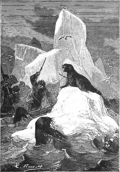
Whilst Wilkes was engaged in his explorations, i.e. in 1839, Balleny, captain of the Elizabeth Scott, was adding his quota to the survey of the Antarctic regions. Starting from Campbell Island, on the south of New Zealand, he arrived on the 7th February in S. lat. 67° 7', and W. long. 164° 25', reckoning from the Paris meridian. Then bearing west and noting many indications of the neighbourhood of land, he discovered two days later a black band in the south-west which, at six o'clock in the evening, he ascertained beyond a doubt to be land. This land turned out to be three islands of considerable size, and Balleny gave them his own name. As may be imagined the captain tried to land, but a barrier of ice prevented his doing so. All he could manage was the determination of the position of the central isle, which he fixed at S. lat. 66° 44' and W. long. 162° 25'.
On the 14th February a lofty land, covered with snow, was sighted in the W.S.W. The next day there were but ten miles between the vessel and the land. It was approached as nearly as possible, and then a boat was put off, but a beach of only three or four feet wide with vertical and inaccessible cliffs rising beyond it rendered landing impossible, and only by getting wet up to their waists were the sailors able to obtain a few specimens of the lava characteristic of this volcanic district.
 |
| "Only by getting wet up to their waists." |
Yet once more, on the 2nd March in S. lat. 65° and about W. long. 120° 24', land was seen from the deck of the Elizabeth Scott. The vessel was brought to for the night, and the next day an attempt was made to steer in a south-west direction, but it was impossible to get through the ice barrier. Naming the new discovery Sabrina, Balleny resumed his northerly route without being able further to verify his discoveries.
In 1837, just as Wilkes had started on his expedition, Captain Dumont d'Urville proposed to the Minister of Marine a new scheme for a voyage round the world. The services rendered by him in 1819-21 in a hydrographic expedition, in 1822 and 1825 on the Coquille, under Captain Duperrey, and lastly in 1826-29 on the Astrolabe, had given him an amount of experience which justified him in submitting his peculiar views to the government, and to supplement so to speak the mass of information collected by himself and others in these little known latitudes.
The minister at once accepted D'Urville's offer, and exerted himself to find for him enlightened and trustworthy fellow-workers. Two corvettes, the Astrolabe and theZelée, fitted up with everything which French experience had proved to be necessary, were placed at his disposal, and amongst his colleagues were many who were subsequently to rise to the rank of general officers, including Jacquinot, commander of the Zelée, Coupvent Desbois, Du Bouzet, Tardy de Montravel, and Perigot, all well-known names to those interested in the history of the French navy.
The instructions given by Vice-Admiral Rosamel to D'Urville differed from those of his predecessors chiefly in his being ordered to penetrate as near as the ice would permit to the South Pole. He was also ordered to complete the great work he had begun in 1827 on the Viti Islands, to survey the Salomon archipelago, to visit the Swan river of Australia, New Zealand, the Chatham Islands, that part of the Caroline group surveyed by Lütke, Mindanao, Borneo, and Batavia, whence he was to return to France viâ the Cape of Good Hope.
These instructions concluded in terms proving the exalted ideas of the government. "His Majesty," said Admiral de Rosamel, "not only contemplates the progress of hydrography and natural science; but his royal solicitude for the interests of French commerce and the development of the French navy is such as to lead him greatly to extend the terms of your commission and to hope for great results from it. You will visit numerous places, the resources of which you must study with a view to the interests of our whaling-ships, collecting all information likely to be of service to them alike in facilitating their voyages and rendering those voyages as remunerative as possible. You will touch at those ports where commercial relations with us are already opened, and where the visit of a state vessel will have salutary effects, and at others hitherto closed to our produce and about which you may on your return give us some valuable details."
In addition to the personal good wishes of Louis Philippe, D'Urville received many marks of the most lively interest taken in his work by the Académie des Sciences morales and the Geographical Society, but not unfortunately from the Académie des Sciences, although he had for twenty years been working hard to increase the riches of the Museum of Natural History.
"Whether from prejudice or from whatever cause," says D'Urville, "they (the members of the Académie des Sciences) showed very little enthusiasm for the contemplated expedition and their instructions to me were as formal as they would have been to a complete stranger."
It is matter of regret that the celebrated Arago, the declared enemy of Polar researches, was one of the bitterest opponents of the new expedition. This was not, however, the case with various scholars of other nationalities, such as Humboldt and Kruzenstern, who wrote to congratulate D'Urville on his approaching voyage and on the important results to science which might be hoped for.
After numerous delays, resulting from the fitting up of two vessels which were to take the Prince de Joinville to Brazil, the Astrolabe and Zelée at last left Toulon on the 7th September, 1837. The last day of the same month they cast anchor off Santa Cruz de Teneriffe which D'Urville chose as a halting-place in preference to one of the Cape Verd Islands, in the hope of laying in a stock of wine and also of being able to take some magnetic observations which he had been blamed for neglecting in 1826, although it was well known that he was not then in a fit state to attend to such things.
In spite of the eagerness of the young officers to go and enjoy themselves on shore they had to submit to a quarantine of four days, on account of rumours of cases of plague having occurred in the lazaretto of Marseilles. Without pausing to relate the details of Messrs. Du Bouzet, Coupvent, and Dumoulin's ascent of the Peak, we will merely quote a few enthusiastic remarks of Coupvent Desbois:—
"Arrived," says that officer, "at the foot of the peak, we spent the last hour of the ascent in crossing cinders and broken stones, arriving at last at the longed-for goal, the loftiest point of this huge volcano. The smoking crater presented the appearance of a hollow sulphurous semi-circle about 1200 feet wide and 300 feet deep, covered with the débris of pumice and other stones. The thermometer, which had marked five degrees at ten a.m., got broken through being placed on the ground where there was an escape of sulphuric vapour. There are upon the sides and in the crater numerous fumerolles which send forth the native sulphur, which forms the base of the peak. The rush of the vapour is so rapid as to sound like shots from a cannon.
"The heat of the ground is so great in some parts that it is impossible to stand on it for a minute at a time. Look around you and see if these three mountains piled one upon the other do not resemble a staircase built up by giants, on which to climb to heaven. Gaze upon the vast streams of lava, all issuing from one point which form the crater, and which a few centuries back you could not have trodden upon with impunity. See the Canaries in the distance, look down, ye pigmies, on the sea, with its breakers dashing against the shores of the island, of which you for the moment form the summit!... See for once, as God sees, and be rewarded for your exertions, ye travellers, whose enthusiasm for the grand scenes of nature has brought you some 12,182 feet above the level of the ocean."
We must add that the explorers testified to the brilliancy of the stars, as seen from the summit of the peak, the clearness of all sounds, and also to the giddiness and headache known as mountain sickness. Whilst part of the staff were engaged in this scientific excursion, several other officers visited the town, where they noticed nothing special except a narrow walk called the Alameda, and the church of the Franciscans. The neighbourhood, however, is interesting enough on account of the curious aqueducts for supplying the town with water, and the Mercede forest which, in D'Urville's opinion, might more justly be called a coppice, for it contains nothing but shrubs and ferns. The population seemed happy, but extremely lazy; economical, but horribly dirty; and the less said about their morals the better.
On the 12th October the two vessels put to sea again, intending to reach the Polar regions as soon as possible. Motives of humanity, however, determined D'Urville to change his plans and touch at Rio, the state of an apprentice with disease of the lungs becoming so rapidly worse that a stay in the Arctic regions would probably have been fatal.
The vessels cast anchor in the roadstead, not the Bay of Rio, on the 13th November, but they only remained there one day, that is to say, just long enough to land young Dupare, and to lay in a stock of provisions. The southerly route was then resumed.
For a long time D'Urville had wished to explore the Strait of Magellan, not with a view to further hydrographical surveys, for the careful explorations of Captain King, begun in 1826, had been finished in 1834 by Fitzroy, leaving little to be done in that direction, but to gather the rich and still unappropriated harvest of facts relating to natural history. How intensely interesting it was, too, to note how real had been the dangers encountered by early navigators, such as the sudden veering of the wind, &c. What a good thing it would be to obtain further and more detailed information about the famous Patagonians, the subject of so many fables and controversies. Yet another motive led D'Urville to anchor off Port Famine, rather than off Staten Island. His perusal of the accounts of the work of explorers who had penetrated into the Southern Seas convinced him that the end of January and the whole of February were the best times for visiting these regions, for then only are the effects of the annual thaw over, and with them the risk of over-fatigue to the crews.
 |
| Anchorage off Port Famine. |
This resolution once taken, D'Urville communicated it to Captain Jacquinot, and set sail for the strait. On the 12th December Cape Virgin was sighted, and Dumoulin, seconded by the young officers, began a grand series of hydrographical surveys. In the intricate navigation of the strait, D'Urville, we are told, showed equal courage and calmness, skill and presence of mind, completely winning over to his side many of the sailors, who, when they had seen him going along at Toulon when suffering with the gout, had exclaimed, "Oh, that old fellow won't take us far!" Now, when his constant vigilance had brought the vessels safely out of the strait, the cry was, "The —— man is mad! He's made us scrape against rocks, reefs, and land, as if he had never taken a voyage before! And we used to think him as useless as a rotten keel!"
We must now say a few words on the stay at Port Famine.
Landing is easy, and there is a good spring and plenty of wood; on the rocks are found quantities of mussels, limpets, and whelks, whilst inland grows celery, and a kind of herb resembling the dandelion. Another fruitful source of wealth in this bay is fish, and whilst the vessels were at anchor, drag-nets, trammels, and lines captured enough mullet, gudgeon, and roaches to feed the whole crew.
"As I was about to re-embark," says D'Urville, "a little barrel was brought to me which had been found hung on a tree on the beach, near a post on which was writtenPost Office. Having ascertained that this barrel contained papers, I took it on board and examined them. They consisted of notes of captains who had passed through the Straits of Magellan, stating the time of their visits, the incidents of their passage, with advice to those who should come after them, and letters for Europe or the United States. It seemed that an American captain, Cunningham by name, had been the originator of this open-air post-office. He had merely, in April, 1833, hung a bottle on a tree, and his fellow-countryman, Waterhouse, had supplemented it by the post with its inscription. Lastly, Captain Carrick of the schooner Mary Ann, from Liverpool, passed through the strait in March 1837, on his way to San Blas, California, going through it again a second time on his way back on the 29th November, 1837, that is to say, sixteen days before our own visit, and he it was who had substituted the barrel for the bottle, adding an invitation to all who should succeed him to use it as the receptacle of letters for different destinations. I mean to improve this ingenious and useful contrivance by forming an actual post-office on the highest point of the peninsula with an inscription in letters of a size so gigantic as to compel the attention of navigators who would not otherwise have touched at Port Famine. Curiosity will then probably lead them to send a canoe to examine the box, which will be fastened to the post. It seems likely that we shall ourselves reap the first fruits of this arrangement, and our families will be agreeably surprised to receive news from us from this wild and lonely district, just before our plunge into the ice of the Polar regions."
At low tide the mouth of the Sedger river, which flows into Famine Bay, is encumbered with sand-banks; some 1000 feet further on the plain is transformed into a vast marsh, from which rise the trunks of immense trees, and huge bones, bleached by the action of time, which have been brought down by the heavy rainfall, swelling the course of the stream.
Skirting this marsh is a fine forest, the entrance to which is protected by prickly shrubs. The commonest trees are the beech, with trunks between eighty and ninety feet high, and three or four in diameter; Winteria aromatica, a kind of bark which has long since replaced the cinnamon, and a species of Barbary. The largest beeches seen by D'Urville measured fifteen feet in diameter, and were about 150 feet high.
Unfortunately, no mammiferous animals or reptiles, or fresh or salt water shell-fish are found on these coasts; and one or two different kinds of birds with a few lichens and mosses were all the naturalist was able to obtain.
Several officers went up the Sedger in a yawl till they were stopped by the shallowness of the water. They were then seven and a half miles from the mouth, and they noted the width of the river where it flows into the sea to be between ninety and a hundred feet.
"It would be difficult," says M. de Montravel, "to imagine a more picturesque scene than was spread out before us at every turn. Everywhere was that indescribable wildness which cannot be imitated, a confused mass of trees, broken branches, trunks covered with moss, which seemed literally to grow before our eyes."
To resume, the stay at Port Famine was most successful; wood and water were easily obtained, repairs, &c., were made, horary, physical, meteorological, tidal, and hydrographical observations were taken, and, lastly, numerous objects of natural history were collected, the more interesting as the museums of France hitherto contained nothing whatever from these unknown regions beyond "a few plants collected by Commerson and preserved in the Herbarium of M. de Jussieu."
On the 28th December, 1837, anchor was weighed without a single Patagonian having been seen, although the officers and crew had been so eager to make acquaintance with the natives.
The difficulties attending navigation compelled the two corvettes to cast anchor a little further on, off Port Galant, the shores of which, bordered by fine trees, are cut by torrents resembling a little distance off magnificent cascades from fifty to sixty feet high. This compulsory halt was not wasted, for a large number of new plants were collected, and the port with the neighbouring bays were surveyed. The commander, however, finding the season already so far advanced, gave up his idea of going out at the westerly end of the strait, and went back the way he came, hoping thus to get an interview with the Patagonians before going to the Polar regions.
St. Nicholas Bay, called by Bougainville the Baie des Français, where the explorers passed New Year's Day, 1838, is a much pleasanter looking spot than Port Galant. The usual hydrographical surveys were there brought to a satisfactory issue by the officers under the direction of Dumoulin. A boat was despatched to Cape Remarkable, where Bougainville said he had seen fossil shells, which, however, turned out to be nothing but little pebbles imbedded in a calcareous gangue.
Interesting experiments were made with the thermometrograph, or marine thermometer, at 290 fathoms, without reaching the bottom, at less than two miles from land. Whereas the temperature was nine degrees on the surface, it was but two at the above-named depth, and as it is scarcely likely that currents convey the waters of the two oceans so far down, one is driven to the belief that this is the usual temperature of such depths.
The vessels now made for Tierra del Fuego, where Dumoulin resumed his surveys. Low exposed, and strewn with rocks which serve as landmarks, there were but few dangers to be encountered here. Magdalena Island, Gente Grande Bay, Elizabeth Island, and Oazy Harbour, where the camp of a large party of Patagonians was made out with the telescope, and Peckett Harbour, where the Astrolabe struck in three fathoms, were successively passed.
"As we struck," says D'Urville, "there were signs of astonishment and even of excitement amongst the crew, and some grumbling was already audible, when in a firm voice I ordered silence, and without appearing at all put out by what had happened, I cried, 'This is nothing at all, and we shall have plenty more of the same kind of thing.' Later these words often recurred to the memory of our sailors. It is more difficult than one would suppose for a captain to maintain perfect calmness and impassiveness in the midst of the worst dangers, even those he has reason to imagine likely to be fatal."
Peckett Harbour was alive with Patagonians, and officers and men were alike eager to land. A crowd of natives on horseback were waiting for them at the place of disembarkation.
Gentle and peaceable they readily replied to the questions put to them, and looked quietly at everything shown to them, expressing no special desire for anything offered to them. They did not seem either to be at all addicted to thieving, and when on board the French vessels they made no attempt to carry anything off.
Their usual height is from four and a half to five feet, but some are a good deal shorter. Their limbs are large and plump without being muscular, and their extremities are of extraordinary smallness. Their most noteworthy characteristic is the breadth of the lower part of the face as compared to the forehead, which is low and retreating. Long narrow eyes, high cheek-bones, and a flat nose, give them something of a resemblance to the Mongolian type.
They are evidently extremely languid and indolent, and wanting in strength and agility. Looking at them squatting down, standing or walking, with their long hair flowing down their backs, one would take them for the women of a harem rather than savages used to enduring the inclemency of the weather and to struggle for existence. Stretched upon skins with their dogs and horses about them, their chief amusement is to catch the vermin with which they swarm. They hate walking so much that they mount horses just to go down and pick up shells on the beach a few yards off.
A white man was living amongst these Patagonians; a miserable, decrepit-looking fellow, who said he came from the United States, but he spoke English very imperfectly, and the explorers took him to be a German-Swiss. Niederhauser, so he called himself, had gone to seek his fortune in the United States, and that fortune being long on the road, he had given ear to the wonderful proposals of a certain whaleman, who wanted to complete his crew. By this whaleman he was left with seven others and some provisions on a desert island off Tierra del Fuego to hunt seals and dress their skins. Four months later the schooner returned laden with skins, left the seal-hunters fresh provisions, went off again, and never came back! Whether it had been shipwrecked, or whether the captain had abandoned his sailors, it was impossible to ascertain. When the poor fellows found themselves deserted and their provisions exhausted, they embarked in their canoe and rowed up the Straits of Magellan, soon meeting with some Patagonians, with whom Niederhauser remained, whilst his companions went on. Well received by the natives, he lived their life with them, faring well when food was plentiful, drawing in his belt and living on roots when food was scarce.
Weary, however, of this miserable existence, Niederhauser entreated D'Urville to take him on board, urging that another month of the life he was leading would kill him. The captain consented, and received him as a passenger.
During his three months' residence amongst them, Niederhauser had learnt something of the language of the Patagonians, and with his aid D'Urville drew up a comparative vocabulary of a great many words in Patagonian, French, and German.
The war costume of the Fuegans includes a helmet of tanned leather protected by steel-plates and surmounted by a crest of cock's feathers, a tunic of ox-hide dyed red with yellow stripes, and a kind of double-bladed scimitar. The chief of Peckett Harbour allowed his visitors to take his portrait in full martial costume, thereby showing his superiority to his subjects, who would not do the same for fear of witchcraft.
On the 8th January anchor was finally weighed, and the second entrance to the strait was slowly navigated against the tide. The Straits of Magellan having now been crossed from end to end, and a survey made of the whole of the eastern portion of Tierra del Fuego, thus bridging over an important gulf in hydrographic knowledge, no detailed map of this coast having previously been made, the vessels steered for the Polar regions, doubling Staten Island without difficulty, and on the 15th January coming in sight of the first ice, an event causing no little emotion, for now was to begin the really hard work of the voyage.
Floating ice was not the only danger to be encountered in these latitudes: a dense fog, which the keenest sight could not penetrate, soon gathered about the vessels, paralyzing their movements, and though they were under a foresail only, rendering a collision with the ice-masses imminent. The temperature fell rapidly, and the thermometrograph marked only two degrees on the surface of the sea, whilst the deep water was below zero. Half-melted snow now began to fall, and everything bore witness that the Antarctic regions were indeed entered.
Clarence, New South Orkney Islands, could not be identified. Every one's attention had to be concentrated on avoiding blocks of ice. At midday on the 20th January the vessels were in S. lat. 62° 3' and W. long. 49° 56', not far from the place were Powell encountered compact ice-fields, and an immense ice-island was soon sighted, some 6000 feet in extent and 300 in height, with perpendicular sides greatly resembling land under certain conditions of the light. Numerous whales and penguins were now seen swimming about the vessels, whilst white petrels continually flew across them. On the 21st observations gave S. lat. 62° 53', and D'Urville was expecting soon to reach the 65th parallel, when at three a.m. he was told that further progress was arrested by an iceberg, across which it did not seem possible to cut a passage. The vessels were at once put about and slowly steered in an easterly direction, the wind having fallen.
"We were thus enabled," says D'Urville, "to gaze at our leisure upon the wonderful spectacle spread out before our eyes. Severe and grand beyond expression it not only excited the imagination but filled the heart with involuntary terror, nowhere else is man's powerlessness more forcibly brought before him.... A new world displays itself to him, but it is a motionless, gloomy, and silent world, where everything threatens the annihilation of human faculties. Should he have the misfortune to be left here alone, no help, no consolation, no spark of hope, would soothe his last moments. One is involuntarily reminded of the famous inscription on the gate of the Inferno of Dante—
"'Lasciate ogni speranza, voi ch' entrate.'"
D'Urville now set to work on a very strange task, which, as compared with others of a similar kind, was likely to be of considerable value. He had an exact measurement taken of the outlines of the iceberg. Had other navigators done the same we should have had some precise information as to the direction taken by icebergs, their movements, &c., in the southern Polar regions, a subject still wrapped in the greatest obscurity.
On the 22nd, after doubling a point, it was ascertained that the iceberg was bearing S.S.W. by W. A lofty and broken piece of land was sighted in these latitudes. Dumoulin had begun to survey it, and D'Urville was about, as he thought, to identify it with the New South Greenland of Morrell, when its outlines became dim and it sunk beneath the horizon. On the 24th the two corvettes crossed a series of floating islets, and entered a plain where the ice was melting. The passage, however, became narrower and narrower, and they were obliged to veer round, to save themselves from being blocked in.
Everything pointed to the conclusion that the edge of the ice was melting, the ice-islands fell apart with loud reports, the ice running off in little rivulets: there was undoubtedly a thaw, and Fanning had been right in saying that these latitudes should not be visited before February.
D'Urville now decided to steer for the north, and try to reach the islands of New South Orkney, the map of which had not yet been accurately laid down. The commander was anxious to survey that archipelago thoroughly, and to spend several days there before resuming his southerly course, so as to be in the Antarctic regions at the same time of year as Weddell.
For three days the explorer coasted along the southern shores of New South Orkney without being able to land; he then once more turned southwards, and came in sight of the ice again in S. lat. 62° 20' and W. long. 39° 28'.
A few minutes before midday a kind of opening was discovered, through which the vessels were forced at all risks. This bold manoeuvre was successful, and in spite of the heavy snow, the explorers penetrated into a small basin scarcely two miles in extent and hemmed in on every side by lofty walls of ice. It was decided to make fast to the ice, and when the order to cast anchor was given a young middy on board the Zelée cried naively, "Is there a port here? I shouldn't have thought there were people living on the ice."
Great indeed was now the joyful enthusiasm on both vessels. Some of the young officers of the Zelée had come to empty a bowl of punch with their comrades of theAstrolabe, and the commander could hear their shouts of delight from his bed. He himself did not, however, look upon the situation in quite the same favourable light. He felt that he had done a very imprudent thing. Shut into a cul-de-sac, he could only go out as he had come, and that he could not do until he had the wind right aft. At eleven o'clock D'Urville was awoke by a violent shock, accompanied by a noise of breaking, as if the vessel had struck on some rocks. He got up, and saw that theAstrolabe, having drifted, had struck violently against the ice, where she remained exposed to collision with the masses of ice which the current was sweeping along more rapidly than it did the vessel herself.
When day dawned the adventurers found themselves surrounded by ice, but in the north a blackish blue line seemed to betray the existence of an open sea. This direction was at once taken, but a thick fog immediately and completely enveloped both ships, and when it cleared off they found themselves face to face with a compact ice barrier, beyond which stretched away as far as the eye could reach AN OPEN SEA!
D'Urville now resolved to cut himself a passage, and began operations by dashing the Astrolabe with all possible speed against the obstacle. The vessel penetrated two or three lengths into the ice, and then remained motionless. The crew climbed out of her on to the ice armed with pickaxes, pincers, mattocks, and saws, and merrily endeavoured to cut a passage. The fragment of ice was already nearly crossed when the wind changed, and the motion of the waves in the offing began to be felt, causing the officers to agree in urging a retreat into the shelter of the ice-walls, for there was some danger if the wind freshened of the vessel being embayed against the ice and beaten to pieces by the waves and floating débris.
The corvettes had traversed twelve or fifteen miles for nothing, when an officer, perched in the shrouds, sighted a passage in the E.N.E. That direction was at once taken, but again it was found impossible to cut a passage, and when night came the crew had to make the ship fast to a huge block of ice. The loud cracking noises which had awoke the commander the night before now began with such violence that it really seemed impossible for the vessel to live till daylight.
After an interview with the captain of the Zelée, however, D'Urville made for the north, but the day passed without any change being effected in the position of the vessels, and the next day during a storm of sleet the swell of the sea became so powerful as completely to raise the ice plain in which they were imprisoned.
More careful watch than ever had now to be kept, to guard against the pieces of ice flung long distances by this motion, and the rudder had to be protected from them by a kind of wooden hut.
 |
| "The rudder had to be protected." |
With the exception of a few cases of ophthalmia, resulting from the continual glare of the snow, the health of the crews was satisfactory, and this was no little satisfaction to the leaders of the expedition, compelled as they were to be continually on the qui-vive. Not until the 9th February were the vessels, favoured by a strong breeze, able to get off, and once more enter a really open sea. The ice had been coasted for a distance of 225 leagues. The vessels had actually sustained no further damage than the loss of a few spars and a considerable portion of the copper sheathing, involving no further leakage than there had been before.
The next day the sun came out, and observations could be taken, giving the latitude as 62° 9' S., and the longitude 39° 22' W.
Snow continued to fall, the cold was intense, and the wind very violent for the three succeeding days. This continuance of bad weather, together with the increasing length of the nights, warned D'Urville of the necessity of giving up all idea of going further. When, therefore, he found himself in S. lat. 62° and W. long. 33° 11', in other words in that part of the ocean where Weddell had been able to sail freely in 1823, and the new explorer had met with nothing but impassable ice, he steered for New South Orkney. A whole month passed amongst the ice and fogs of the Antarctic Ocean had told upon the health of the crews, and nothing could be gained for science by a continuance of the cruise.
On the 20th the archipelago was again sighted, and D'Urville was once more driven out of his course in a northerly direction by the ice, but he was able to put off with two boats, the crews of which collected on Weddell Island a large number of geological specimens, lichens, &c., and some twenty penguins and chionis.
On the 25th February Clarence Island was seen, forming the eastern extremity of the New South Shetland Archipelago, a very steep and rugged district covered with snow except on the beach, and thence the explorers steered towards Elephant Island, resembling Clarence Island in every respect, except that it is strewn with peaks rising up black against the plains of snow and ice. The islets of Narrow, Biggs, O'Brien, and Aspland were successively identified, but covered as they are with snow they are perfectly inaccessible to man. The little volcano of Bridgeman was also seen, and the naturalists tried in vain to land upon it from two boats.
"The general colour of the soil," says the narrative, "is red, like that of burnt brick with particles of grey, suggestive of the presence of pumice-stone, or of calcined cinders. Here and there on the beach are seen great blackish-looking blocks, which are probably lava. This islet has, however, only one true crater, although thick columns of smoke are emitted from it, nearly all of them issuing from the base on the western side, whilst in the north are two other fumerolles, thirty or forty feet along the water. There are none on the eastern or northern side, or at the top, which is smooth and round. The bulk appears recently to have undergone some considerable modification, as indeed it must have done, or it could not now resemble so little the description given by Powell in December, 1822."
D'Urville soon resumed his southerly route, and on the 27th February sighted a considerable belt of land in the south-east on which he was prevented from landing by the fog and the continuous fall of very fine snow. He was now in the latitude of Hope Island—i.e. in S. lat. 62° 57'. He approached it very closely, and sighted before reaching it a low-lying land, to which he gave the name of Joinville. Then further on in the south-west he came to an extensive district which he named Louis Philippe, and between the two in a kind of channel, encumbered with ice, an island he called Rosamel.
"Now," says D'Urville, "the horizon was so light that we could trace all the irregularities of Louis Philippe's Land. We could see it stretching away from Mount Bransfield in the north (62° W. long.) to the S.S.W., where it faded away on the horizon. From Mount Bransfield to the south it is lofty, and of fairly uniform surface, resembling a vast, unbroken ice-field. In the south, however, it rises in the form of a fine peak (Mount Jacquinot), which is equal perhaps, indeed superior, to Bransfield; but beyond this peak it stretches away in the form of a mountain chain, ending in the south-west in a peak loftier than any of the others. For the rest, the effect of the snow and ice, together with the absence of any objects with which they can be compared, aid in exaggerating the height of all irregularities, and, as a matter of fact, the results of the measurements taken by M. Dumoulin showed all these mountains, which then appeared to us gigantic and equal to the Alps and Pyrenees at least, to be after all of very medium size. Mount Bransfield, for instance, was not more than about 2068 feet high, Mount Jacquinot 2121 feet, and Mount d'Urville, the loftiest of them all, about 3047 feet. Except for the islets grouped about the mainland, and a few peaks rising above the snow, the whole country is one long series of compact blocks of ice, and it is impossible to do more than trace the outlines of this ice-crust, those of the land itself being quite indistinguishable."
On the 1st March soundings gave only eighty fathoms with a bottom of rock and gravel. The temperature is 1°9 on the surface, and 0°2 at the bottom of the sea. On the 2nd of March, off Louis Philippe's Land, an island was sighted which was named Astrolabe, and the day after a large bay, or rather strait, to which the name of Orleans Channel was given was surveyed between Louis Philippe's Land, and a lofty, rocky belt, which D'Urville took for the beginning of Trinity Land, hitherto very inaccurately laid down.
From the 26th February then to the 5th March D'Urville remained in sight of the coast, skirting along it a little distance off, but unable entirely to regulate his course on account of the incessant fogs and rain. Everything bore witness to the setting in of a very decided thaw; the temperature rising at midday to five degrees above zero, whilst the ice was everywhere melting and running off in little streams of water, or falling with a formidable crush into the sea in the form of blocks, the wind meanwhile blowing strongly from the west.
All this decided D'Urville against the further prosecution of this voyage. The sea was heavy, the rain and fog incessant. It was therefore necessary to leave this dangerous coast, and make for the north, where on the following day he surveyed the most westerly islands of the New Shetland group.
D'Urville next steered for Conception, and very arduous was the voyage there, for, in spite of every precaution, the crews of both corvettes, especially that of the Zelée, were attacked with scurvy. It was now that D'Urville measured the heights of some of the waves, with a view to the disproving of the charge of exaggeration which had been brought against him when he had estimated those he had seen break over Needle Bank at a height of between eighty and a hundred feet.
With the help of some of his officers, that there might be no doubt as to his accuracy, D'Urville measured some waves of which the vertical height was thirty-five feet, and which measured not less than 196½ feet from the crest to the lowest point, making a total length of 393 feet for a single wave. These measurements were an answer to the ironical assertion of Arago, who, settling the matter in his own study, would not allow that a wave could exceed from five to six feet in height. One need not hesitate a single moment to accept, as against the eminent but impulsive physicist, the measurements of the navigators who had made observations upon the spot.
On the 7th April, 1838, the expedition cast anchor in Talcahuano Bay, where the rest so sorely needed by the forty scrofulous patients of the Zelée was obtained. Thence D'Urville made for Valparaiso, after which, having entirely crossed Oceania, he cast anchor on the 1st January, 1839, off Guam, arrived at Batina in October, and went thence to Hobart's Town, whence, on the 1st January, 1840, he started on a new trip in the Antarctic regions.
At this time D'Urville knew nothing either of Balleny's voyage, or of the discovery of Sabrina's Land. He merely intended to go round the southern extremity of Tasmania with a view to ascertaining beneath which parallel he would meet with ice. He was under the impression that the space between 120° and 160° E. long. had not yet been explored, so that there was still a discovery to be made.
At first navigation was beset with the greatest difficulties. The swell was very strong, the currents bore in an easterly direction, the sanitary condition of the crews was far from satisfactory, and 58° S. lat. had not yet been reached when the presence of ice was ascertained.
The cold soon became very intense, the wind veered round to the W.N.W., and the sea became calm, a sure indication of the neighbourhood of land or of ice. The former was the more generally received hypothesis, for the ice-islands passed were too large to have been formed in the open ocean. On the 18th January, S. lat. 64° was reached, and great perpendicular blocks of ice were met with, the height of which varied from ninety to 100 feet, whilst the breadth exceeded 3000.
The next day, January 19th, 1840, a new land was sighted, to which the name of Adélie was given. The sun was now burning hot, and the ice all seemed to be melting, immense streams running down from the summits of the rocks into the sea. The appearance of the land was monotonous, covered as it was with snow. It ran from west to east, and seemed to slope gradually down to the sea. On the 21st the wind allowed the vessels to approach the beach, and deep ravines were soon made out, evidently the result of the action of melted snow.
 |
| View of Adélie Land. (Fac-simile of early engraving.) |
 |
| Reduced Map of D'Urville's discoveries in the Antarctic regions. |
As the ships advanced navigation became more and more perilous, for the ice-islands were so numerous that there was hardly a large enough channel between them for any manoeuvring.
"Their straight walls," says D'Urville, "rose far above our masts, glowering down upon our vessels, which appeared of absurdly small dimensions, as compared with their huge masses. The spectacle spread out before us was alike grand and terrible. One might have fancied oneself in the narrow streets of a city of giants."
 |
| "Their straight walls rose far above our masts." |
The corvettes soon entered a huge basin, formed by the coast and the ice-islands which had just been passed. The land stretched away in the south-east and north-west as far as the eye could reach. It was between three and four thousand feet high, but nowhere presented any very salient features. In the centre of the vast snow plain rose a few rocks. The two captains at once sent off boats with orders to bring back specimens which should testify to the discovery made. We quote from the account of Du Bouzet, one of the officers told off on this important survey.
"It was nearly nine o'clock when to our great delight we landed on the western side of the most westerly and loftiest islet. The Astrolabe boat had arrived one moment before ours, and its crew were already clambering up the steep sides of the rock, flinging down the penguins as they went, the birds showing no small surprise at being thus summarily dispossessed of the island, of which they had been hitherto the only inhabitants. I at once sent one of our sailors to unfurl a tricolour flag on these territories, which no human creature had seen or trod before ourselves. According to the old custom—to which the English have clung tenaciously—we took possession of them in the name of France, together with the neighbouring coast, which we were prevented from visiting by the ice. The only representatives of the animal kingdom were the penguins, for in spite of all our researches we did not find a single shell. The rocks were quite bare, without so much as the slightest sign of a lichen. We had to fall back on the mineral kingdom. We each took a hammer and began chipping at the rock, but, it being of granite, was so extremely hard that we could only obtain very small bits. Fortunately in climbing to the summit of the island the sailors found some big pieces of rock broken off by the frost, and these they embarked in their boats. Looking closely at them, I noticed an exact resemblance between these rocks and the little bits of gneiss which we had found in the stomach of a penguin we had killed the day before. The little islet on which we landed is part of a group of eight or ten of similar character and form; they are between five hundred and six hundred yards from the nearest coast. We also noticed on the beach several peaks and a cape quite free from snow. These islets, close as they are to each other, seem to form a continuous chain parallel with the coast, and stretching away from east to west."
On the 22nd and 23rd the survey of this coast was continued; but on the second day an iceberg soldered to the coast compelled the vessels to turn back towards the north, whilst at the same time a sudden and violent snow-storm overtook and separated them. The Zelée especially sustained considerable damage, but was able to rejoin her consort the next day.
Throughout it all, however, sight of the land had not, so to speak, been lost, but on the 29th the wind blew so strongly and persistently from the east, that D'Urville had to abandon the survey of Adélie Land. It was on this same day that he sighted the vessels of Lieutenant Wilkes. D'Urville complains of the discourtesy of the latter, and says that his own manoeuvres intended to open communications with them had been misunderstood by the Americans.
"We are no longer," he says, "in the days when navigators in the interests of commerce thought it necessary carefully to conceal their route and their discoveries, to avoid the competition of rival nations. I should, on the contrary, have been glad to point out to our emulators the result of our researches, in the hope that such information might be of use to them and increase our geographical knowledge."
On the 30th January a huge wall of ice was sighted, as to the nature of which opinions were divided. Some said it was a compact and isolated mass, others—and this was D'Urville's opinion—thought these lofty mountains had a base of earth or of rocks, or that they might even be the bulwarks of a huge extent of land which they called Clarie. It is situated in 128° E. long.
The officers had collected sufficient information in these latitudes to determine the position of the southern magnetic pole, but the results obtained by them did not accord with those given by Duperrey, Wilkes, and Ross.
On the 17th February the two corvettes once more cast anchor off Hobart's Town, and on the 25th set sail again for New Zealand, where they completed the hydrographical surveys of the Uranie. They then made for New Guinea, ascertained that it was not separated by a strait from the Louisiade Archipelago, surveyed Torres Strait with the greatest care, in spite of dangers from currents, coral reefs, &c.; arrived at Timor on the 20th, and returned to Toulon on the 8th November, after touching at Bourbon and St. Helena.
When the news of the grand discoveries made by the United States reached England, a spirit of emulation was aroused, and the learned societies decided on sending an expedition to the regions in which Weddell and Biscoe had been the only explorers since the time of Cook.
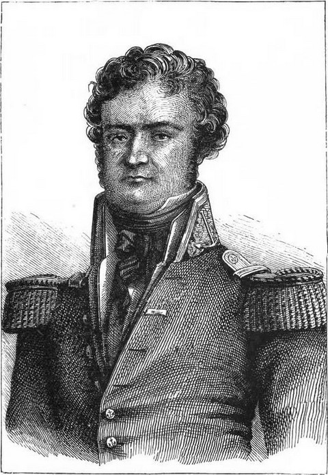
Captain James Clark Ross, who was appointed to the command of this expedition, was the nephew of the famous John Ross, explorer of Baffin's Bay. Born in 1800, James Ross was a sailor from the age of twelve. He accompanied his uncle in 1818 in his first Arctic expedition, had taken part under Parry in four expeditions to the same latitudes, and from 1829-1833 he had been his uncle's constant and faithful companion. Entrusted with the taking of scientific observations, he had discovered the north magnetic pole, and he had also made a good many excursions across the ice on foot and in sledges. He was, therefore, now one of the most experienced of British naval officers in Polar expeditions.
 |
| Captain John Ross. |
Two vessels, the Erebus and the Terror, were entrusted to him, and his second in command was an accomplished sailor, Captain Francis Rowdon Crozier, companion of Parry in 1824; of Ross in 1835 in Baffin's Bay; and the future companion of Franklin in the Terror, in his search for the north-west passage. It would have been impossible to find a braver or more experienced sailor.
The instructions given to James Ross by the Admiralty differed essentially from those received by Wilkes and Dumont d'Urville. For the latter the exploration of the Antarctic regions was but one incident of their voyage round the world, whereas it was the very raison d'être of Ross's journey. Of the three years he would be away from Europe, the greater part was to be spent in the Antarctic regions, and he would only leave the ice to repair the damages to his vessels or recruit the health of his crew, worn out as they would probably be by fatigue and sickness.
The vessels had been equally judiciously chosen, stronger than those of D'Urville, they were better fitted to resist the repeated assaults of the ice, and their seasoned crews had been chosen from sailors familiar with polar navigation.
The Erebus and Terror, under the command of Ross and Crozier, left England on the 29th September, 1839, and touched successively at Madeira, the Cape Verd Islands, St. Helena, and the Cape of Good Hope, where numerous magnetic observations were taken.
On the 12th April Ross reached Kerguelen's Island, and there landed his instruments. The scientific harvest was abundant. Some fossil trees were extracted from the lava of which this island is formed, and some rich layers of coal were discovered, which have not yet been worked. The 29th was fixed for simultaneous magnetic observations in different parts of the globe, and by a singular coincidence some magnetic storms such as had already visited Europe, were on this very day observed in these latitudes. The instrument registered the same phenomena as at Toronto, Canada, proving the vast extent of these meteoric disturbances, and the incredible rapidity with which they spread.
On his arrival at Hobart Town, where his old friend John Franklin was now governor, Ross heard of the discovery of Adélie and of Clarie Lands by the French, and the simultaneous survey of them by Wilkes, who had even left a sketch of his map of the coasts.
Ross, however, decided to make for E. long. 170°, because it was in that direction that Balleny had found an open sea extending to S. lat. 69°. He duly reached first the Auckland and then the Campbell Islands, and after having, like his predecessors, tacked about a great deal in a sea strewn with ice-islands, he came beyond the sixty-third degree to the edge of the stationary ice, and on the 1st January, 1841, crossed the Antarctic Circle.
The floating ice did not in any respect resemble that of the Arctic regions, as James Ross very soon discovered. It consisted of huge blocks, with regular and vertical walls, whilst the ice-fields, less compact than those of the north, move about in chaotic confusion, looking, to quote Wilkes' imaginative simile, like a heaving land, as they alternately break away from each other and reunite.
To Ross the ice barrier did not present so formidable an appearance as it had done to the French and Americans. He did not at first venture upon it, however, being kept in the offing by storms. Not until the 5th January was he able to penetrate to S. lat. 66° 45', and E. long. 174° 16'. Circumstances could not have been more favourable, for the sea and wind were both acting upon and loosening the ice, and thanks to the strength of his vessels, Ross was able to cut a passage. As he advanced further and further southward, the fog became denser and the constant snow-storms added to the already serious dangers of navigation. Encouraged, however, by the reflection in the sky of an open sea, a phenomenon which turned out to be trustworthy, he pushed on, and on the 9th January, after crossing 200 miles of ice he actually entered that open sea!
On the 11th January land was sighted 100 miles ahead in S. lat. 70° 47' and E. long. 172° 36'. This, the most southern land ever yet discovered, consisted of snow-clad peaks with glaciers sloping down to the sea, the peaks rising to a height of from nine to twelve thousand feet. This estimate, judging from D'Urville's remarks on Graham's Land, may, however, possibly be an exaggerated one. Here, there, and everywhere, black rocks rose up from the snow, but the coast was so shut in with ice that landing was impossible. This curious series of huge peaks received the name of Admiralty chain, and the country itself that of Victoria.
 |
| Engraved by E. Morieu. |
A few little islands were made out in the south-east before the vessels left this coast, and on the 12th January the two captains, with some of their officers, disembarked on one of the volcanic islets, and took possession of it in the name of England. Not the slightest trace of vegetation was found upon it.
Ross soon ascertained that the eastern side of this vast land sloped towards the south, whilst the northern stretched away to the north-west. He, therefore, skirted along the eastern beach, forcing a passage in a southerly direction beyond the magnetic pole, which he places near S. lat. 76°, and then returning by the west, thus entirely circumnavigating his new discovery, which he looked upon as a very large island. The mountain chain extends all along the coast. Ross gave to the principal peaks the names of Herschell, Whewell, Wheatstone, Murchison, and Melbourne. He was unable, however, on account of the ever-increasing quantity of ice about the coast, to make out the details of its outlines. On the 23rd January the seventy-fourth degree, the most southerly latitude ever reached, was passed.
The vessels were now considerably hampered by fogs, southerly gales, and violent snow-storms, but they managed to continue their cruise along the coast, and on the 27th January the English disembarked on a little volcanic island in S. lat. 76° 8' and E. long. 168° 12', to which they gave the name of Franklin.
The next day a huge mountain was seen, which rose abruptly to a height of 12,000 feet above a far-stretching land. The summit, of regular form, and completely covered with snow, was every now and then wrapped in a thick cloud of smoke, no less than 300 feet in diameter. Taking this diameter as a standard of measure, the height of the cloud, in shape like an inverted cone, would be about one-half of it. When this cloud of smoke dispersed, a bare crater was discovered, lit up by a bright red glow, visible even in broad daylight. The sides of the mountain were covered with snow up to the very crater, and it was impossible to make out any signs of a flow of lava.
A volcano is always a magnificent spectacle, and the sight of this one rising up from amongst the Antarctic ice, and excelling Etna and Teneriffe in its marvellous activity, could not fail to make a vivid impression upon the minds of the explorers. The name of Erebus was given to it, and that of Terror to an extinct crater on the east of it, both titles being admirably appropriate.
The two vessels continued their cruise along the northern coast of Victoria, until their further passage was barred by a huge mass of ice towering 505 feet above their masts. Behind this barrier rose another mountain chain, which sunk out of sight in the S.S.E., and to which the name of Parry was given. Ross skirted along the ice barrier in an easterly direction until the 2nd February, when he reached S. lat. 78° 4', the most southerly point attained on this trip, during which he had followed the shores of the land he had discovered for more than 300 miles. He left it in E. long. 191° 23'.
But for the strong favourable winds which now blew, it seems probable that the vessels would never have issued in safety from amongst the formidable ice masses through which they finally worked their way at the cost of incredible exertions and fatigues, and in face of incessant danger.
On the 15th February yet another attempt was made in S. lat. 76° to reach the magnetic pole; but further progress was barred by land in S. lat. 76° 12' and E. long. 164°, i.e. sixty-five ordinary miles from the position assigned to it (the magnetic pole) by Ross, and the appearance of this land was forbidding and the sea so rough that the explorer gave up all idea of continuing his researches on shore.
After identifying the islands discovered in 1839 by Balleny, Ross found himself on the 6th March amongst the mountains alluded to by Wilkes.
"On the 4th March," says Ross's narrative, "they recrossed the Antarctic Circle, and being necessarily close by the eastern extreme of those patches of land which Lieut. Wilkes has called 'the Antarctic Continent,' and having reached the latitude on the 5th, they steered directly for them; and at noon on the 6th, the ship being exactly over the centre of this mountain range, they could obtain no soundings with 600 fathoms of line; and having traversed a space of eighty miles in every direction from this spot, during beautiful clear weather, which extended their vision widely around, were obliged to confess that this position, at least, of the pseudo-antarctic continent, and the nearly 200 miles of barrier represented to extend from it, have no real existence."
The expedition got back to Tasmania without having a single case of sickness on board or sustaining the slightest damage. The vessels were here refitted, and the instruments regulated before starting on a second trip, on which Sydney and Island's Bay, New Zealand, and Chatham, were the first stations touched at by Ross to make magnetic observations. On the 18th December, in S. lat. 62° 40' and E. long, 146°, ice was encountered 300 miles further north than in the preceding year. The vessels had arrived too early, but Ross, nevertheless, endeavoured to break through this formidable barrier. After penetrating for 300 miles he was stopped by masses so compact that it was impossible to go further, and he did not cross the Antarctic Circle until the 1st January, 1842. On the 19th of the same month the two vessels encountered the most violent storm just as they were entering an open sea; the Erebus and Terror lost their helms, floating ice washed over them, and for twenty-six hours they were in danger of going down.
The detention of the expedition amongst the ice lasted no less than forty-six days, and not until the 22nd did Ross reach the great barrier of stationary ice, which was considerably lower beyond Erebus, where it was no less than 200 feet high. When Ross came to it this year it was only 107 feet high, and it was 150 miles further east than it had been on the previous expedition. The acquisition of this piece of geographical information was the only result of this arduous campaign, extending over 136 days, and greatly excelling in dramatic interest the preceding expedition.
The vessels now made for Cape Horn, and sailed up the coast as far as Rio de Janeiro, where they found everything of which they stood in need. As soon as they had laid in a stock of provisions they again put to sea and reached the Falkland Islands, whence, on the 17th December, 1842, they started on their third trip.
The first ice was this time met with near Clarence Island, and on the 25th December Ross found his further progress barred by it. He then made for the New Shetland Islands, completed the survey of Louis Philippe and Joinville Lands, discovered by Dumont d'Urville, named Mts. Haddington and Parry, ascertained that Louis Philippe's Land is only a large island, and visited Bransfield Strait, separating it from Shetland. Such were the marvellous results obtained by James Ross in his three expeditions.
To assign to the three explorers, whose work in the Antarctic regions we have been reviewing, his just meed of praise, we may say that D'Urville first discovered the Antarctic continent; Wilkes traced its shores for a considerable distance, for we cannot fail to recognize the resemblance between his map and that of the French navigator; and that James Ross visited the most southerly and most interesting part.
But is there such a continent after all? D'Urville was not quite sure about it, and Ross did not believe in it. We must leave the decision of this great question to the later explorers who were to follow in the footsteps of the intrepid sailors whose voyages and discoveries we have related.