


The decipherment of cuneiform inscriptions, and the study of Assyrian remains up to 1840—Ancient Iran and the Avesta—The survey of India and the study of Hindustani—The exploration and measurement of the Himalaya mountains—The Arabian Peninsula—Syria and Palestine—Central Asia and Alexander von Humboldt—Pike at the sources of the Mississippi, Arkansas, and Red River—Major Long's two expeditions—General Cass—Schoolcraft at the sources of the Mississippi—The exploration of New Mexico—Archæological expeditions in Central America—Scientific expeditions in Brazil—Spix and Martin—Prince Maximilian of Wied-Neuwied—D'Orbigny and American man.
Although the discoveries which we are now to relate are not strictly speaking geographical, they nevertheless throw such a new light on several early civilizations, and have done so much to extend the domain of history and ideas, that we are compelled to dedicate a few words to them.
The reading of cuneiform inscriptions, and the decipherment of hieroglyphics are events so important in their results, they reveal to us so vast a number of facts hitherto unknown, or distorted in the more or less marvellous narratives of the ancient historians Diodorus, Ctesias, and Herodotus, that it is impossible to pass over scientific discoveries of such value in silence.
Thanks to them, we form an intimate acquaintance with a whole world, with an extremely advanced civilization, with manners, habits, and customs differing essentially from our own. How strange it seems to hold in our hands the accounts of the steward of some great lord or governor of a province, or to read such romances as those of Setna and the Two Brothers, or stories such as that of the Predestined Prince.
Those buildings of vast proportions, those superb temples, magnificent hypogæa, and sculptured obelisks, were once nothing more to us than sumptuous monuments, but now that the inscriptions upon them have been read, they relate to us the life of the kings who built them, and the circumstances of their erection.
How many names of races not mentioned by Greek historians, how many towns now lost, how many of the smallest details of the religion, art, and daily life, as well as of the political and military events of the past, are revealed to us by the hieroglyphic and cuneiform inscriptions.
Not only do we now see into the daily life of these ancient peoples, of whom we had formerly but a very superficial knowledge, but we get an idea even of their literature. The day is perhaps not far distant when we shall know as much of the life of the Egyptians in the eighteenth century before Christ as that of our forefathers in the seventeenth and eighteenth centuries of our own era.
Carsten Niebuhr was the first to make and bring to Europe an exact and complete copy of inscriptions at Persepolis in an unknown character. Many attempts had been made to explain them, but all had been vain, until in 1802 Grotefend, the learned Hanoverian philologist, succeeded, by an inspiration of genius, in solving the mystery in which they were enveloped.
Truly these cuneiform characters were strange and difficult to decipher! Imagine a collection of nails variously arranged, and forming groups horizontally placed. What did these groups signify? Did they represent sounds and articulations, or, like the letters of our alphabet, complete words? Had they the ideographic value of Chinese written characters? What was the language hidden in them? These were the problems to be solved! It appeared probable that the inscriptions brought from Persepolis were written in the language of the ancient Persians, but Rask, Bopp, and Lassen had not yet studied the Iranian idioms and proved their affinity with Sanskrit.
It would be beyond our province to give an account of the ingenious deductions, the skilful guesses, and the patient groping through which Grotefend finally achieved the recognition of an alphabetic system of writing, and succeeded in separating from certain groups of words what he believed to be the names of Darius and Xerxes, thus attaining a knowledge of several letters, by means of which he made out other words. It is enough for us to say that the key was found by him, and to others was left the task of completing and perfecting his work.
More than thirty years passed by, however, before any notable progress was made in these studies. It was our learned fellow-countryman Eugène Burnouf who gave them a decided impulse. Turning to account his knowledge of Sanskrit and Zend, he found that the language of the inscriptions of Persepolis was but a Zend dialect used in Bactriana, which was still spoken in the sixth century B.C., and in which the books of Zoroaster were written. Burnouf's pamphlet bears date 1836. At the same period Lassen, a German scholar of Bonn, came to the same conclusion on the same grounds.
The inscriptions already discovered were soon all deciphered; and with the exception of a few signs, on the meaning of which scholars were not quite agreed, the entire alphabet became known. But the foundations alone were laid; the building was still far from finished. The Persepolitan inscriptions appeared to be repeated in three parallel columns. Might not this be a triple version of the same inscription in the three chief languages of the Achæmenian Empire, namely, the Persian, Median, and Assyrian or Babylonian. This guess proved correct; and owing to the decipherment of one of the inscriptions, a test was obtained, and the same plan was followed as that of Champollion with regard to the Rosetta stone, on which was the tri-lingual inscription in Greek, Demotic or Enchorial, and hieroglyphic characters.
In the second and third inscriptions were recognized Syro-Chaldee, which, like Hebrew, Himyaric, and Arabic, belong to the Semitic group, and a third idiom, to which the name of Medic was given, resembling the dialects of the Turks and Tartars. But it would be presumptuous of us to enlarge upon these researches. That was to be the task of the Danish scholar Westergaard, of the Frenchmen De Saulcy and Oppert, and of the Englishmen Morris and Rawlinson, not to mention others less celebrated. We shall have to return to this subject later.
The knowledge of Sanskrit, and the investigation of Brahmanic literature, had inaugurated a scientific movement which has gone on ever since with increasing energy.
Long before Nineveh and Babylon were known as nations, a vast country, called Iran by orientalists, which included Persia, Afghanistan, and Beloochistan, was the scene of an advanced civilization, with which is connected the name of Zoroaster, who was at once a conqueror, a law-giver, and the founder of a religion. The disciples of Zoroaster, persecuted at the time of the Mohammedan conquest, and driven from their ancient home, where their mode of worship was still preserved, took refuge, under the name of Parsees, in the north-west of India.
At the end of the last century, the Frenchman Aquetil Duperron brought to Europe an exact copy of the religious books of the Parsees, written in the language of Zoroaster. He translated them, and for sixty years all the savants had found in them the source of all their religious and philological notions of Iran. These books are known under the name of the Zend-Avesta, a word which comprises the name of the language, Zend, and the title of the book, Avesta.
As the knowledge of Sanskrit increased, however, that branch of science required to be studied afresh by the light of the new method. In 1826 the Danish philologist Rask, and later Eugène Burnouf, with his profound knowledge of Sanskrit, and by the help of a translation in that language recently discovered in India, turned once more to the study of the Zend. In 1834 Burnouf published a masterly treatise on the Yacna, which marked an epoch. From the resemblance between the archaic Sanskrit and the Zend came the recognition of the common origin of the two languages, and the relationship, or rather, the identity, of the races who speak them. Originally the names of the deities, the traditions, the generic appellation, that of Aryan, of the two peoples, are the same, to say nothing of the similarity of their customs. But it is needless to dwell on the importance of this discovery, which has thrown an entirely new light on the infancy of the human race, of which for so many centuries nothing was known.
From the close of the eighteenth century, that is to say from the time when the English first obtained a secure footing in India, the physical study of the country was vigorously carried on, outstripping of course for a time that of the ethnology and kindred subjects, which require for their prosecution a more settled country and less exciting times. It must be owned, however, that knowledge of the races of the country to be controlled is as essential to the government as it is to commercial enterprise; and in 1801 Lord Wellesley, as Governor for the Company, recognizing the importance of securing a good map of the English territories, commissioned Brigadier William Lambton, to connect, by means of a trigonometrical survey, the eastern and western banks of the Indus with the observatory of Madras. Lambton was not content with the mere accomplishment of this task. He laid down with precision one arc of the meridian from Cape Comorin to the village of Takoor-Kera, fifteen miles south-east of Ellichpoor. The amplitude of this arc exceeded twelve degrees. With the aid of competent officers, amongst whom we must mention Colonel Everest, the Government of India would have hailed the completion of the task of its engineers long before 1840, if the successive annexation of new territories had not constantly added to the extent of ground to be covered.
At about the same time with this progress in our knowledge of the geography of India an impulse was given to the study of the literature of India.
In 1776 an extract from the most important native codes, then for the first time translated under the title of the Code of the Gentoos was published in London. Nine years later the Asiatic Society was founded in Calcutta by Sir William Jones, the first who thoroughly mastered the Sanskrit language. In "Asiatic Researches," published by this society, were collected the results of all scientific investigations relating to India. In 1789, Jones published his translation of the drama of S'akuntala, that charming specimen of Hindu literature, so full of feeling and refinement. Sanskrit grammars and dictionaries were now multiplied, and a regular rivalry was set on foot in British India, which would undoubtedly soon have spread to Europe, had not the continental blockade prevented the introduction of works published abroad. At this time an Englishman named Hamilton, a prisoner of war in Paris, studied the Oriental MSS. in the library of the French capital, and taught Frederick Schlegel the rudiments of Sanskrit, which it was no longer necessary to go to India to learn.
Lassen was Schlegel's pupil, and together they studied the literature and antiquities of India, examining, translating, and publishing the original texts; whilst at the same time Franz Bopp devoted himself to the study of the language, making his grammars accessible to all, and coming to the conclusion which was then startling, although it is now generally accepted, of the common origin of the Indo-European languages.
It was proved that the Vedas, that collection of sacred writings held in too universal veneration to be tampered with, were written in a very ancient and very pure idiom which had not been revived, and whose close resemblance with the Zend, put back the date of the composition of the books beyond the time of the separation of the Aryan family into two branches. The Mahabharata and the Ramayana, dating from the Brahminical or the period succeeding that of the Vedas, were next studied, together with the Puranas. Owing to a profounder knowledge of the language and a more intimate acquaintance with the mythology of the Hindus, scholars were able to fix approximately the date of the composition of these poems, to ascertain the numberless interpolations, and to extract everything of actual historical or geographical value from those marvellous allegories.
The result of these patient and minute investigations was a conviction that the Celtic, Greek, Latin, Germanic, Slave, and Persian languages had one common parent, and that parent none other than Sanskrit. If, then, their language was the same, it followed as a matter of course that the people had been also identical. The differences now existing between these various idioms are accounted for by the successive breakings up of the primitive people, approximate dates enable us to realize the greater or less affinity of those languages with the Sanskrit, and the nature of the words which they have borrowed from it, words corresponding by their nature to the different degrees of advance in civilization.
Moreover a very clear and definite notion was obtained of the kind of life led by the founders of the Indo-European race, and the changes brought about in it by the progress of civilization. The Vedas give us a picture of the Aryan race before it migrated to India, and occupied the Punjab and Cabulistan. By the aid of these poems we can look on at struggles against the primitive races of Hindustan; whose resistance was all the more desperate in that the conqueror, of their caste divisions, left them only the lowest and most degraded. Thanks to the Vedas we can realize every detail of the pastoral and patriarchal life of the Aryans, a life so domestic and unruffled, that we mentally ask ourselves whether the eager strife of the modern peoples is not a poor exchange for the peaceful existence which their few wants secured to their forefathers.
We cannot dwell longer on this subject, but the little that we have said will be enough to show the reader the importance to history, ethnography, and philology, of the study of Sanskrit. For further details we refer him to the special works of Orientalists and to the excellent historical manuals of Robiou, Lenormant, and Maspero. All the scientific results of whatever kind obtained up to 1820 are also skilfully and impartially summed up in Walter Hamilton's large work, "A Geographical, Statistical, and Historical Description of Hindustan, and the neighbouring Countries." This is a book which, by recording the various stages of scientific progress, marks with accuracy the point reached at any given epoch.
After this brief review of the labours of scholars in reference to the intellectual and social life of the Hindus, we must turn to those studies whose aim was a knowledge of the physical character of the country.
One of the most surprising results obtained by the travels of Webb and Moorcroft was the extraordinary height attributed by them to the Himalaya mountains. According to them their elevation exceeded that of the loftiest summits of the Andes. Colonel Colebrook had estimated the average height of the chain at 22,000 feet, and even this would appear to be less than the reality. Webb measured Yamunavatri, one of the most remarkable peaks of the chain, and estimated its height above the level of the plateau from which it rises as 20,000 feet, whilst the plateau in its turn is 5000 feet above the plain. Not satisfied, however, with what he looked upon as too perfunctory an estimate, he measured, with all possible mathematical accuracy, the Dewalagiri or White Mountain, and ascertained its height to be no less than 27,500 feet.
The most remarkable feature of the Himalaya chain is the succession of these mountains, the ranges of heights rising one above the other. This gives a far more vivid impression of their loftiness than would one isolated peak rising from a plain and with its head lost among the clouds.
The calculations of Webb and Colebrook, were soon verified by the mathematical observations of Colonel Crawford, who measured eight of the highest peaks of the Himalayas. According to him the loftiest of all was Chumulari, situated near the frontiers of Bhoutan and Thibet, which attains to a height of 30,000 feet above the sea-level.
Results such as these, confirmed by the agreement of so many observers, who could not surely all be wrong, took the scientific world by surprise. The chief objection urged was the fact that the snow-line must in these districts be something like 30,000 feet above the sea-level. It appeared, therefore, impossible to believe the assertion of all the explorers, that the Himalayas were covered with forests of gigantic pines. Finally, however, actual personal observation upset theory. In a second journey, Webb climbed the Niti-Ghaut, the loftiest peak in the world, the height of which he fixed at 16,814 feet, and not only did he find no snow, but even the rocks rising 300 feet above it were quite free from snow in summer. Moreover, the steep sides, where breathing was difficult, were clothed with magnificent forests of tapering pines, and firs, and wide-spreading cypress and cedar-trees.
"The high limits of perpetual snow on the Himalaya mountains," says Desborough Cooley, "are justly ascribed by Mr. Webb to the great elevation of the table-land or terrace from which these mountain peaks spring. As the heat of our atmosphere is derived chiefly from the radiation of the earth's surface, it follows that the temperature of any elevated point must be modified in a very important degree by the proximity and extent of the surrounding plains. These observations seem satisfactorily to refute the objections made by certain savants respecting the great height of the Himalaya mountains, which may be, therefore, safely pronounced to be the loftiest mountain chain on the surface of the globe."
We must now refer briefly to an expedition in the latitudes already visited by Webb and Moorcroft. The traveller Fraser, with neither the necessary instruments nor knowledge for measuring the lofty peaks he ascended, was endowed with a great power of observation, and his account of his journey is full of interest, and here and there very amusing. He visited the source of the Jumna, and, at a height of more than 25,000 feet, he found numerous villages picturesquely perched on slopes carpetted with snow. He then made his way to Gangoutri, in spite of the opposition of his guides, who represented the road thither as extremely dangerous, declaring that it was swept by a pestilential wind which would deprive any traveller, who ventured to expose himself to it, of his senses. The explorer, however, was more than rewarded for all his dangers and fatigues by the enjoyment he derived from the grandeur and magnificence of the views he obtained.
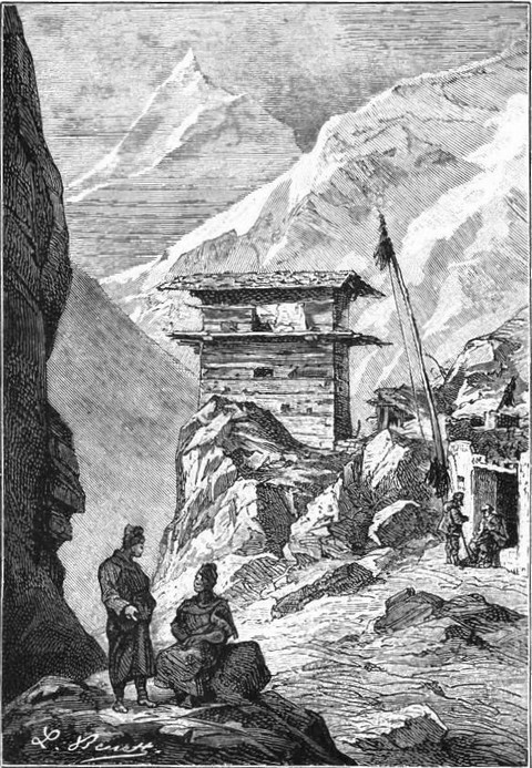 |
| "Villages picturesquely perched." |
"There is that," says Desborough Cooley in reference to Fraser's journey, "in the appearance of the Himalaya range, which every person who has seen them will allow to be peculiarly their own. No other mountains that I have ever seen bear any resemblance to their character; their summits shoot in the most fantastic and spiring peaks to a height that astonishes, and, when viewed from an elevated situation, almost induce the belief of an ocular deception."
We must now leave the peninsula of the Ganges for that of Arabia, where we have to record the result of several interesting journeys. That of Captain Sadler of the Indian army, claims the first rank. Sent by the Governor of Bombay in 1819, on an embassy to Ibrahim Pacha, who was then at war with the Wahabees, that officer crossed the entire peninsula from Port El Katif on the Persian Gulf to Yambo on the Red Sea.
Unfortunately the interesting account of this crossing of Arabia, never before accomplished by a European, has not been separately published, but is buried in a book which it is almost impossible to obtain, "The Transactions of the Literary Society of Bombay."
At about the same time, 1821-1826, the English Government commissioned Captains Moresby and Haines, of the naval service, to make hydrographical surveys with a view to obtaining a complete chart of the coasts of Arabia. These surveys were to be the foundation of the first trustworthy map of the Arabian peninsula.
We have now only to mention the two expeditions of the French naturalists, Aucher Eloy in the country of Oman, and Emile Botta in Yemen, and to refer to the labours in reference to the idioms and antiquities of Arabia of the French consul at Djedda, Fulgence Fresnel. He was the first, in his letters on the history of the Arabs before Islamism, published in 1836, to explain the Himyarite or Homeric language and to recognize that it resembles rather the early Hebrew and Syriac dialects, than the Arabic of the present day.
At the beginning of this volume we spoke of the explorations and archæological and historical researches of Seetzen and Burckhardt in Syria and Palestine. We have still to say a few words on an expedition the results of which were entirely geographical. We refer to the journey of the Bavarian naturalist Heinrich Schubert.
Schubert was a devout Catholic and an enthusiastic student, and the melancholy scenery of the Holy Land with its wonderful legends, and the lovely banks of the mysterious Nile with its historic memories, had for him an extraordinary fascination. In his account of his journey we find the deep impressions of the believer combined with the scientific observations of the naturalist.
In 1837, Schubert, having crossed Lower Egypt and the peninsula of Sinai, entered the Holy Land. The learned Bavarian pilgrim was accompanied by two friends, Dr. Erdl and Martin Bernatz, a painter.
The travellers landed at El Akabah on the Red Sea, and went with a small Arab caravan to El Khalil, the ancient Hebron. The route they followed had never before been trodden by a European. It led through a wide, flat valley terminating at the Dead Sea; a valley through which the waters of the Dead Sea were supposed at one time to have flowed towards the Red Sea. This hypothesis was shared by Burckhardt and many others who had only seen the district from a distance, and who attributed the cessation of the drainage to an upheaval of the soil. The heights, as taken by the travellers, showed this hypothesis to be altogether erroneous.
In fact from the lower end of the Persian Gulf the country presents a continuous ascent for two or three days' march to the point called by the Arabs the Saddle, from thence it begins to sink and slopes down towards the Dead Sea. The Saddle is about 2100 feet above the sea-level, at least that was the estimate given a year later by Count Bertou, a Frenchman, who visited those localities at that time.
On their way down to the Bituminous Lake, Schubert and his companions took some other barometrical observations, and were very much surprised to find their instrument marking ninety-one feet below the Red Sea, the levels gradually decreasing in height as they advanced. At first they thought there must be some mistake, but finally, the evidence was too strong for them, and it became proved beyond a doubt that the Dead Sea could never have emptied its waters into the Red Sea for the very excellent reason that the level of the former is very much lower than that of the latter.
The depression of the Dead Sea is very much more noticeable when Jericho is approached from Jerusalem. In that case the way lies through a long valley with a very rapid slope, all the more remarkable as the hilly plains of Judea, Peræ, and El Harran are very lofty, the latter rising to a height of nearly 3000 feet above the sea-level.
The appearance of the country and the testimony of the instruments were in such contradiction to the prevalent belief, that Messrs. Erdl and Schubert were very unwilling to accept the results obtained, which they attributed to their barometer being out of order and to a sudden disturbance of the atmosphere. But on their way back to Jerusalem the barometer returned to the mean height it had registered before they started for Jericho. There was nothing for it then but to admit, whether they liked it or not, that the Dead Sea was at least 600 feet below the level of the Mediterranean, an estimate, as later researches showed, which fell one-half short of the truth.
This, it will be admitted, was a fortunate rectification, which would have considerable influence, by calling the attention of savants to a phenomenon which was soon to be verified by other explorers.
At the same time, the survey of the basin of the Dead Sea was completed and rectified. In 1838, two American Missionaries, Edward Robinson and Eli Smith, gave quite a new impulse to Biblical geography. They were the forerunners of that phalanx of naturalists, historians, archæologists, and engineers, who, under the patronage or in conjunction with the English Exploration Society, were soon to explore the land of the patriarchs from end to end, making maps of it, and achieving discoveries which threw a new light on the history of the ancient peoples who, by turns, were possessors of this corner of the Mediterranean basin.
But it was not only the Holy Land, so interesting on account of the many associations it has for every Christian, which was the scene of the researches of scholars and explorers; Asia Minor was also soon to yield up her treasures to the curiosity of the learned world. That country was visited by travellers in every direction. Parrot visited Armenia; Dubois de Monpereux traversed the Caucasus in 1839. In 1825 and 1826, Eichwald explored the shores of the Caspian Sea; and lastly, Alexander von Humboldt at the expense of the generous Nicholas, Emperor of Russia, supplemented his intrepid work as a discoverer in the New World by an exploration of Western Asia and the Ural Mountains. Accompanied by the mineralogist Gustave Rose, the naturalist Ehrenberg, well known for his travels in Upper Egypt and Nubia, and Baron von Helmersen, an officer of engineers, Humboldt travelled through Siberia, visited the gold and platinum mines of the Ural Mountains, and explored the Caspian steppes and the Altai chain to the frontiers of China. These learned men divided the work, Humboldt taking astronomical, magnetic, and physical observations, and examining the flora and fauna of the country, while Rose kept the journal of the expedition, which he published in German between 1837 and 1842.
Although the explorers travelled very rapidly, at the rate of no less than 11,500 miles in nine months, the scientific results of their journey were considerable. In a first publication which appeared in Paris in 1838, Humboldt treated only the climatology and geology of Asia, but this fragmentary account was succeeded in 1843 by his great work called "Central Asia." "In this," says La Roquette, "he has laid down and systematized the principal scientific results of his expedition in Asia, and has recorded some ingenious speculation as to the shape of the continents and the configuration of the mountains of Tartary, giving special attention to the vast depression which stretches from the north of Europe to the centre of Asia beyond the Caspian Sea and the Ural River."
We must now leave Asia and pass in review the various expeditions in the New World, which have been sent out in succession since the beginning of the present century. In 1807, when Lewis and Clarke were crossing North America from the United States to the Pacific Ocean, the Government commissioned a young officer, Lieutenant Zabulon Montgomery Pike, to examine the sources of the Mississippi. He was at the same time to endeavour to open friendly relations with any Indians he might meet.
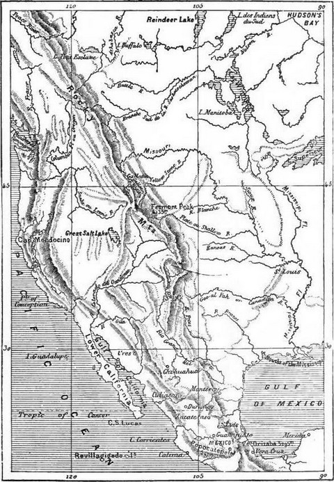 |
| Map of the Missouri. |
Pike was well received by the Chief of the powerful Sioux nation and presented with the pipe of peace, a talisman which secured to him the protection of the allied tribes; he ascended the Mississippi, passing the mouths of the Chippeway and St. Peter, important tributaries of that great river. But beyond the confluence of the St. Peter with the Mississippi as far as the Falls of St. Anthony, the course of the main river is impeded by an uninterrupted series of falls and rapids. A little below the 45th parallel of North latitude, Pike and his companions had to leave their canoes and continue their journey in sledges. To the severity of a bitter winter were soon added the tortures of hunger. Nothing, however, checked the intrepid explorers, who continued to follow the Mississippi, now dwindled down to a stream only 300 roods wide, and arrived in February at Leech Lake, where they were received with enthusiasm at the camp of some trappers and fur hunters from Montreal.
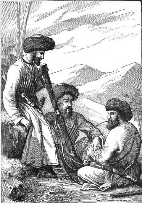 |
| Circassians. (Fac-simile of early engraving.) |
After visiting Red Cedar Lake, Pike returned to St. Louis. His arduous and perilous journey had extended over no less than nine months; and although he had not attained its main object, it was not without scientific results. The skill, presence of mind, and courage of Pike were recognized, and the government soon afterwards conferred on him the rank of major, and appointed him to the command of a fresh expedition. This time he was to explore the vast tract of country between the Mississippi and the Rocky Mountains, and to discover the sources of the Arkansas and Red River. With twenty-three companions Pike ascended the Arkansas, a fine river navigable to the mountains in which it rises, that is to say for a distance of 2000 miles, except in the summer, when its bed is encumbered with sand-banks. On this long voyage, winter, from which Pike had suffered so much on his previous trip, set in with redoubled vigour. Game was so scarce that for four days the explorers were without food. The feet of several men were frostbitten, and this misfortune added to the fatigue of the others. The major, after reaching the source of the Arkansas, pursued a southerly direction and soon came to a fine stream which he took for the Red River.
This was the Rio del Norte, which rises in Colorado, then a Spanish province, and flows into the Gulf of Mexico.
From what has been already said of the difficulties which Humboldt encountered before he obtained permission to enter the Spanish possessions in America, we may judge with what jealous suspicion the arrival of strangers in Colorado was regarded. Pike was surrounded by a detachment of Spanish soldiers, made prisoner with all his men, and taken to Santa Fé. Their ragged garments, emaciated forms, and generally miserable appearance did not speak much in their favour, and the Spaniards at first took the Americans for savages. However, when the mistake was recognized, they were escorted across the inland provinces to Louisiana, arriving at Natchitoches on the 1st July, 1807.
The unfortunate end of this expedition cooled the zeal of the government, but not that of private persons, merchants, and hunters, whose numbers were continually on the increase. Many even completely crossed the American continent from Canada to the Pacific. Amongst these travellers we must mention Daniel William Harmon, a member of the North-West Company, who visited Lakes Huron and Superior, Rainy Lake, the Lake of the Woods, Manitoba, Winnipeg, Athabasca, and the Great Bear Lake, all between N. lat. 47° and 58°, and reached the shores of the Pacific. The fur company established at Astoria at the mouth of the Columbia also did much towards the exploration of the Rocky Mountains.
Four associates of that company, leaving Astoria in June, 1812, ascended the Columbia, crossed the Rocky Mountains, and following an east-south-east direction, reached one of the sources of the Platte, descended it to its junction with the Missouri, crossed a district never before explored, and arrived at St. Louis on the 30th May, 1813.
In 1811, another expedition composed of sixty men, started from St. Louis and ascended the Missouri as far as the settlements of the Ricara Indians, whence they made their way to Astoria, arriving there at the beginning of 1812, after the loss of several men and great suffering from fatigue and want of food.
These journeys resulted not only in the increase of our knowledge of the topography of the districts traversed, but they also brought about quite unexpected discoveries. In the Ohio valley between Illinois and Mexico for instance, were found ruins, fortifications, and entrenchments, with ditches and a kind of bastion, many of them covering five or six acres of ground. What people can have constructed works such as these, which denote a civilization greatly in advance of that of the Indians, is a difficult problem of which no solution has yet been found.
Philologists and historians were already regretting the dying out of the Indian tribes, who, until then, had been only superficially observed, and lamenting their extinction before their languages had been studied. A knowledge of these languages and their comparison with those of the old world, might have thrown some unexpected light upon the origin of the wandering tribes.
Simultaneously with the discovery of the ruins the flora and geology of the country began to be studied, and in the latter science great surprises were in store for future explorers. It was so important for the American government to proceed rapidly to reconnoitre the vast territories between the United States and the Pacific, that another expedition was speedily sent out.
In 1819, the military authorities commissioned Major Long to explore the districts between the Mississippi and the Rocky Mountains, to trace the course of the Missouri and of its principal tributaries, to fix the latitude and longitude of the chief places, to study the ways of the Indian tribes, in fact to describe everything interesting either in the aspect of the country or in its animal, vegetable, and mineral productions.
Leaving Pittsburgh on the 5th March, 1819, on board the steamship Western Engineer, the expedition arrived in May of the following year at the junction of the Ohio with the Mississippi, and ascended the latter river as far as St. Louis. On the 29th June, the mouth of the Missouri was reached. During the month of July, Mr. Say, who was charged with the zoological observations, made his way by land to Fort Osage, where he was joined by the steamer. Major Long turned his stay at Fort Osage to account by sending a party to examine the districts between the Kansas and the Platte, but this party was attacked, robbed, and compelled to turn back after losing all their horses. After obtaining at Cow Island a reinforcement of fifteen soldiers, the expedition reached Fort Lisa, near Council Bluff, on the 19th September. There it was decided to winter. The Americans suffered greatly from scurvy, and having no medicines to check the terrible disorder, they lost 100 men, nearly a third of the whole party. Major Long, who had meanwhile reached Washington in a canoe, brought back orders for the discontinuation of the voyage up the Missouri, and for a journey overland to the sources of the Platte, whence the Mississippi was to be reached by way of the Arkansas and Red River. On the 6th June, the explorers left Engineer's Fort, as they called their winter quarters, and ascended the Platte Valley for more than a hundred miles, its grassy plains, frequented by vast herds of bisons and deer, supplying them with plenty of provisions.
Those boundless prairies, whose monotony is unbroken by a single hillock, were succeeded by a sandy desert gradually sloping up, for a distance of nearly four hundred miles, to the Rocky Mountains. This desert, broken by precipitous ravines, cañons, and gorges, at the bottom of which gurgles some insignificant stream, its banks clothed with stunted and meagre vegetation, produces nothing but cacti with sharp and formidable prickles.
On the 6th July, the expedition reached the foot of the Rocky Mountains. Dr. James scaled one of the peaks, to which he gave his own name, and which rises to a height of 11,500 feet above the sea level.
"From the summit of the peak," says the botanist, "the view towards the north, west, and south-west, is diversified with innumerable mountains all white with snow, and on some of the more distant it appears to extend down to their bases. Immediately under our feet on the west, lay the narrow valley of the Arkansas; which we could trace running towards the north-west, probably more than sixty miles. On the north side of the peak was an immense mass of snow and ice.... To the east lay the great plain, rising as it receded, until, in the distant horizon, it appeared to mingle with the sky."
Here the expedition was divided into two parties, one, under the command of Major Long, to make its way to the sources of the Red River, the other, under Captain Bell, to go down the Arkansas as far as Port Smith. The two detachments separated on the 24th July. The former, misled by the statements of the Kaskaia Indians and the inaccuracy of the maps, took the Canadian for the Red River, and did not discover their mistake until they reached its junction with the Arkansas. The Kaskaias were the most miserable of savages, but intrepid horsemen, excelling in lassoing the wild mustangs which are descendants of the horses imported into Mexico by the Spanish conquerors. The second detachment was deserted by four soldiers, who carried off the journals of Say and Lieutenant Swift with a number of other valuable effects. Both parties also suffered from want of provisions in the sandy deserts, whose streams yield nothing but brackish and muddy water. The expedition brought to Washington sixty skins of wild animals, several thousands of insects, including five hundred new species, four or five hundred specimens of hitherto unknown plants, numerous views of the scenery, and the materials for a map of the districts traversed.
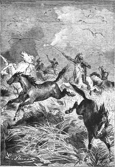 |
| "Excelling in lassoing the wild mustangs." |
The command of another expedition was given in 1828 to Major Long, whose services were thoroughly appreciated. Leaving Philadelphia in April, he embarked on the Ohio, and crossed the state of the same name, and those of Indiana and Illinois. Having reached the Mississippi, he ascended that river to the mouth of the St. Peter, formerly visited by Carver, and later by Baron La Hontan. Long followed the St. Peter to its source, passing Crooked Lake and reaching Lake Winnipeg, whence he explored the river of the same name, obtained a sight of the Lake of the Woods and Rainy Lake, and arrived at the plateau which separates the Hudson's Bay valley from that of the St. Lawrence. Lastly, he went to Lake Superior by way of Cold Water Lake and Dog River.
Although all these districts had been constantly traversed by Canadian pathfinders, trappers, and hunters for many years previously, it was the first time an official expedition had visited them with a view to the laying down of a map. The explorers were struck with the beauty of the neighbourhood watered by the Winnipeg. That river, whose course is frequently broken by picturesque rapids and waterfalls, flows between two perpendicular granite walls crowned with verdure. The beauty of the scenery, succeeding as it did to the monotony of the plains and savannahs they had previously traversed, filled the explorers with admiration.
The exploration of the Mississippi, which had been neglected since Pike's expedition, was resumed in 1820 by General Cass, Governor of Michigan. Leaving Detroit at the end of May with twenty men trained to the work of pathfinders, he reached the Upper Mississippi, after visiting Lakes Huron, Superior, and Sandy. His exhausted escort halted to rest whilst he continued the examination of the river in a canoe. For 150 miles the course of the Mississippi is rapid and uninterrupted, but beyond that distance begins a series of rapids extending over twelve miles to the Peckgama Falls.
Above this cataract the stream, now far less rapid, winds through vast savannahs to Leech Lake. Having reached Lake Winnipeg, Cass arrived on the 21st July at a new lake, to which he gave his own name, but he did not care to push on further with his small party of men and inadequate supply of provisions and ammunition.
The source of the Mississippi had been approached, but not reached. The general opinion was that the river took its rise in a small sheet of water known as Deer Lake, sixty miles from Cass Lake. Not until 1832, however, when General Cass was Secretary of State for war, was this important problem solved.
The command of an expedition was then given to a traveller named Schoolcraft, who had in the previous year explored the Chippeway country, north-west of Lake Superior. His party consisted of six soldiers, an officer qualified to conduct hydrographic surveys, a surgeon, a geologist, an interpreter, and a missionary.
Schoolcraft left St. Marie on the 7th June, 1832, visited the tribes living about Lake Superior, and was soon on the St. Louis river. He was then 150 miles from the Mississippi, and was told that it would take him no less than ten days to reach the great river, on account of the rapids and shallows. On the 3rd July, the expedition reached the factory of a trader named Aitkin, on the banks of the river, and there celebrated on the following day the anniversary of the independence of the United States.
Two days later Schoolcraft found himself opposite the Peckgama Falls, and encamped at Oak Point. Here the river winds a great deal amongst savannahs, but guides led the party by paths which greatly shortened the distance. Lake Winnipeg was then crossed, and on the 10th July, Schoolcraft arrived at Lake Cass, the furthest point reached by his predecessors.
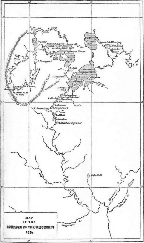 |
A party of Chippeway Indians led the explorers to their settlement on an island in the river. The friendliness of the natives led Cass to leave part of his escort with them, and, accompanied by Lieutenant Allen, the surgeon Houghton, a missionary, and several Indians, he started in a canoe.
Lakes Tasodiac and Crooked were visited in turn. A little beyond the latter, the Mississippi divides into two branches or forks. The guide took Schoolcraft up the eastern, and after crossing Lakes Marquette, La Salle, and Kubbakanna, he came to the mouth of the Naiwa, the chief tributary of this branch of the Mississippi. Finally, after passing the little lake called Usawa, the expedition reached Lake Itasca, whence issues the Itascan, or western branch of the Mississippi.
Lake Itasca, or Deer Lake, as the French call it, is only seven or eight miles in extent, and is surrounded by hills clothed with dark pine woods. According to Schoolcraft it is some 1500 feet above the sea level; but we must not attach too much importance to this estimate, as the leader of the expedition had no instruments.
On their way back to Lake Cass, the party followed the western branch, identifying its chief tributaries. Schoolcraft then studied the ways of the Indians frequenting these districts, and made treaties with them.
To sum up, the aim of the government was achieved, and the Mississippi had been explored from its mouth to its source. The expedition had collected a vast number of interesting details on the manners, customs, history, and language of the people, as well as numerous new or little known species of flora and fauna.
The people of the United States were not content with these official expeditions, and numbers of trappers threw themselves into the new districts. Most of them being however absolutely illiterate, they could not turn their discoveries to scientific account. But this was not the case with James Pattie, who has published an account of his romantic adventures and perilous trips in the district between New Mexico and New California.
On his way down the River Gila to its mouth, Pattie visited races then all but unknown, including the Yotans, Eiotaws, Papawans, Mokees, Umeas, Mohawas, and Nabahoes, with whom but very little intercourse had yet been held. On the banks of the Rio Eiotario he discovered ruins of ancient monuments, stone walls, moats, and potteries, and in the neighbouring mountains he found copper, lead, and silver mines.
We owe a curious travelling journal also to Doctor Willard, who, during a stay of three years in Mexico, explored the Rio del Norte from its source to its mouth.
Lastly, in 1831 Captain Wyeth and his brother explored Oregon, and the neighbouring districts of the Rocky Mountains.
After Humboldt's journey in Mexico, one explorer succeeded another in Central America. In 1787, Bernasconi discovered the now famous ruins of Palenque. In 1822, Antonio del Rio gave a detailed description of them, illustrated with drawings by Frederick Waldeck, the future explorer of Palenque, that city of the dead.
Between 1805 and 1807, three journeys were successively taken in the province of Chiapa and to Palenque by Captain William Dupaix and the draughtsman Castañeda, and the result of their researches appeared in 1830 in the form of a magnificent work, with illustrations by Augustine Aglio, executed at the expense of Lord Kingsborough.
Lastly, Waldeck spent the years 1832 and 1833 at Palenque, searching the ruins, making plans, sections, and elevations of the monuments, trying to decipher the hitherto unexplained hieroglyphics with which they are covered, and collecting a vast amount of quite new information alike on the natural history of the country and the manners and customs of the inhabitants.
We must also name Don Juan Galindo, a Spanish colonel, who explored Palenque, Utatlan, Copan, and other cities buried in the heart of tropical forests.
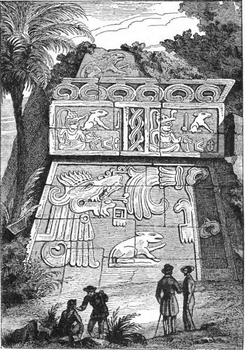 |
| View of the Pyramid of Xochicalco. (Fac-simile of early engraving.) |
After the long stay made by Humboldt in equinoctial America, the impulse his explorations would doubtless otherwise have given to geographical science was strangely checked by the struggle of the Spanish colonies with the mother country. As soon, however, as the native governments attained to at least a semblance of stability, intrepid explorers rushed to examine this world, so new in the truest sense, for the jealousy of the Spanish had hitherto kept it closed to the investigations of scientific men.
Many naturalists and engineers now travelled or settled in South America. Soon indeed, that is in 1817-1820, the Austrian and Bavarian Governments sent out a scientific expedition, to the command of which they appointed Doctors Spix and Martins, who collected a great deal of information on the botany, ethnography, and geography of these hitherto little known districts—Martins publishing, at the expense of the Austrian and Bavarian governments, a most important work on the flora of the country, which may be looked upon as a model of its kind.
At the same time the editors of special publications, such as Malte Brun's Annales des Voyages and the Bulletin de la Société de Géographie, cordially accepted and published all the communications addressed to them, including many on Brazil and the province of Minas Geraës.
About this period too a Prussian Major-General, the Prince of Wied-Neuwied, who had been at leisure since the peace of 1815, devoted himself to the study of natural science, geography, and history, undertaking moreover, in company with the naturalists Freirciss and Sellow, an exploring expedition in the interior of Brazil, having special reference to its flora and fauna.
A few years later, i.e. in 1836, the French naturalist Alcide d'Orbigny, who had won celebrity at a very early age, was appointed by the governing body of the Museum to the command of an expedition to South America, the special object of which was the study of the natural history of the country. For eight consecutive years D'Orbigny wandered about Brazil, Uruguay, the Argentine Republic, Patagonia, Chili, Bolivia, and Peru.
"Such a journey," says Dumour in his funeral oration on D'Orbigny, "in countries so different in their productions, climate, the character of their soil, and the manners and customs of their inhabitants, was necessarily full of ever fresh perils. D'Orbigny, endowed with a strong constitution and untiring energy, overcame obstacles which would have daunted most travellers. On his arrival in the cold regions of Patagonia, amongst savage races constantly at war with each other, he found himself compelled to take part, and to fight in the ranks of a tribe which had received him hospitably. Fortunately for the intrepid student his side was victorious, and he was left free to proceed on his journey."
It took thirteen years of the hardest work to put together the results of D'Orbigny's extensive researches. His book, which embraces nearly every branch of science, leaves far behind it all that had ever before been published on South America. History, archæology, zoology, and botany all hold honoured positions in it; but the most important part of this encyclopædic work is that relating to American man. In it the author embodies all the documents he himself collected, and analyzes and criticizes those which came to him at second hand, on physiological types, and on the manners, languages, and religions of South America. A work of such value ought to immortalize the name of the French scholar, and reflect the greatest honour on the nation which gave him birth.
END OF THE FIRST PART.