


Anjou and Wrangell—The "polynia"—John Ross's first expedition—Baffin's Bay closed—Edward Parry's discoveries on his first voyage—The survey of Hudson's Bay, and the discovery of Fury and Hecla Straits—Parry's third voyage—Fourth voyage—On the ice in sledges in the open sea—Franklin's first trip—Incredible sufferings of the explorers—Second expedition—John Ross—Four winters amongst the ice—Dease and Simpson's expedition.
We have more than once alluded to the great impulse given to geographical science by Peter I. One of the earliest results of this impulse was the discovery by Behring of the straits separating Asia from America, and the most important was the survey thirty years later of the Liakhov Archipelago, or New Siberia.
In 1770 a merchant named Liakhov noticed a large herd of reindeer coming across the ice from the north, and he reflected that they could only have come from a country where there were pastures enough to support them. A month later he started in a sledge, and after a journey of fifty miles he discovered between the mouths of the Lena and Indighirka three large islands, the vast deposits of fossil ivory on which have since become celebrated all over the world.
In 1809 Hedenstroem received instructions to make a map of this new discovery. He made several attempts to cross the frozen ocean on a sledge, but was always turned back by ice which would not bear him. He came to the conclusion that there must be an open sea beyond, and he founded this opinion on the immense quantity of warm water which flows into the Arctic Ocean from the great rivers of Asia.
In March, 1821, Lieutenant (afterwards Admiral) Anjou crossed the ice to within forty-two miles of the north of the island of Kotelnoï, and in N. lat. 76° 38' saw a vapour which led him to believe in the existence of an open sea. In a second trip he actually saw this sea with its drifting ice, and came back convinced of the impossibility of going further in a sledge on account of the thinness of the ice.
Whilst Anjou was thus employed, another naval officer, Lieutenant Wrangell, collected some important traditions about the existence of land the other side of Cape Yakan.
From a Tchouktchi chief he learnt that in fine weather—though never in the winter—from the coast and some reefs at the mouth of a river mountains covered with snow could be seen far away in the north; and that in former days when the sea was frozen over reindeer used to come from there. The chief had himself once seen a herd of reindeer on their way back to the north by this route and he had followed them in a sledge for a whole day until the state of the ice compelled him to give up the experiment.
His father had told him, too, that a Tchouktchi had once gone there with a few companions in a skin boat, but he did not know what they had discovered or what had become of them. He was sure that the land in the north was inhabited, because a dead whale had once been washed on to Aratane Island with spears tipped with slate in its flesh, and the Tchouktchis never used such weapons.
These facts were very curious, and they increased Wrangell's desire to penetrate to the unknown northern districts; but the truth of all the rumours was not verified until our own day.
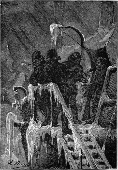
Between 1820 and 1824 Wrangell made four expeditions in sledges from the mouth of the Kolyma, which he made his headquarters, first exploring the coast to Cape Tchelagskoi, and enduring thirty-five degrees of cold; and in his second trip trying how far he could go across the ice, an experiment resulting in a journey of 400 miles from the land. In the third year (1822), Wrangell started in March with a view to verifying the report of a native who said he had seen land in the offing. He now came to an icefield, on which he advanced safely for a long distance, when it began to be less compact and was soon not solid enough to bear many sledges, so two small ones were selected, on which were packed a wherry, some planks, and some tools. The explorer then ventured on some melting ice which broke under his feet.
 |
| "Two small sledges were selected." |
"At the outset," says Wrangell, "I had to make way for seven wersts across a bed of brine; further on appeared a surface furrowed with great crevasses, which we could only succeed in clearing by the help of our planks. I noticed in this part several small mounds of ice in such a liquefying condition that the slightest touch would suffice to break it and convert the mound into a round slough. The ice upon which we were travelling was without consistency, was but a foot in thickness, and—what was more—was riddled with holes.... I could only compare the appearance of the sea, at this stage, to an immense morass; and indeed the muddy water which issued from these thousands of crevasses, opening up in every direction, the melting snow mixed with earth and sand, those little mounds whence numerous streamlets were issuing,—all these combined to make the illusion perfect."
Wrangell had advanced some 140 miles, and it was the open sea or the polynia—as he calls vast expanses of water—north of Siberia, the outskirts of which he had reached, the same in fact as that already sighted by Leontjew in 1764, and Hedenstroem in 1810.
On his fourth voyage Wrangell and his small party of followers started from Cape Yakan, the nearest point to the Arctic regions, and, after passing Cape Tchelagskoi, made for the north; but a violent storm broke up the ice, there only three feet thick, and involved the explorers in the greatest danger. Now dragged across some large unbroken slab, now wet to the waist on a moving plank, sometimes above and sometimes under water, or moored to a block serving as a ferryboat, which the swimming dogs dragged along, they at last succeeded in crossing the shifting reverberating ice and regaining the land, owing their life to the strength and agility of their teams of dogs alone. Thus closed the last attempt made to reach the districts north of Siberia.
The Arctic calotte was meanwhile being attacked from the other side with equal energy and yet more perseverance. It will be remembered with what untiring enthusiasm the famous north-west passage had been sought. No sooner had the peace of 1815 necessitated the disarmament of numerous English vessels and set free their officers on half-pay, than the Admiralty, unwilling to let experienced seamen rust in idleness, sought for them some employment. It was under these circumstances that the search for the north-west passage was resumed.
The Alexander, 252 tons, and the Isabel, 385, under command of the experienced officers, John Ross and Lieutenant Parry, with James Ross, Back, and Belcher, who were to win honour in Arctic explorations amongst their subordinates, were sent by the Government to explore Baffin's Bay and set sail on the 18th April. After touching at the Shetland Islands, and seeking in vain for the submerged land seen by Bass in N. lat. 57° 28', the explorers came on the 26th May to the first ice, and on the 2nd June surveyed the western coast of Greenland, hitherto very imperfectly laid down in maps, finding it greatly encumbered by ice. Indeed the governor of the Dutch settlement of Whale Island told them that the severity of the winter months had been steadily increasing during the eleven years of his residence in the country.
Hitherto it had been supposed that the country was uninhabited beyond 75° N. lat., and the travellers were therefore greatly surprised to see a whole tribe of Esquimaux arrive by way of the ice. They knew nothing of any race but their own, and stared at the English without daring to touch them, one of them even addressing to the vessels in a grave and solemn voice the inquiries, Who are you? Whence do you come? From the sun or from the moon?
 |
| Esquimaux family. (Fac-simile of early engraving.) |
Although in many respects far inferior to the Esquimaux who had become to some extent civilized by long intercourse with Europeans, the new-comers understood the use of iron, of which a few of them had even succeeded in making knives. This iron as far as the English could gather was dug out of a mountain. It was probably of meteoric origin.
As public opinion in England subsequently confirmed, Ross, in spite of qualities as a naval officer of the highest order, showed extraordinary apathy and levity on this voyage, appearing not to trouble himself in the least about the geographical problems for the solution of which the expedition was organized. He passed Wolstenholme and Whale Sounds and Smith's Strait, opening out of Baffin's Bay, without examining them, the last named at so great a distance that he did not even recognize it. Still worse than that was his conduct later. Cruising down the western shores of Baffin's Bay a long deep gulf no less than fifty miles across gradually came in sight of the eager explorers, yet when on the 29th August the two vessels had sailed up it for thirty miles only Ross gave orders to tack about, on the ground that he distinctly saw at the further end a chain of lofty mountains to which he gave the name of Croker. His officers did not share his opinion; they could not see so much as the slightest sign of a hill, for the very excellent reason that the gulf they had entered was really Lancaster Sound, so named by Baffin, and connecting his bay with the western Arctic Ocean.
The same sort of thing occurred again and again in the voyage along this deeply indented coast, the vessels keeping so far off shore that not a detail could be made out. Thus it came about that Cumberland Bay was passed on the 1st October without any survey of that most important feature of Davis Strait, and Ross returned to England, having literally turned his back on the glory awaiting him.
When accused of apathy and neglect of duty, Ross replied with supreme indifference, "I trust, as I believe myself, that the objects of the voyage have been in every important point accomplished; that I have proved the existence of a bay, from Disco to Cumberland Strait, and set at rest for ever the question of a north-west passage in this direction."
It would have been impossible to make a more complete mistake. But fortunately the failure of this expedition did not in the least discourage other explorers. Some saw in it a brilliant confirmation of the venerable Baffin's discovery, others looked upon the innumerable inlets, with their deep waters and strong currents, as something more than mere bays. They were straits, and all hope of the discovery of the north-west passage was not yet lost.
 |
| Engraved by E. Morieu. |
These suggestions so far weighed with the English Admiralty as to lead to the equipment of two small vessels, the bomb-vessel Hecla and the brigantine Griper, which left the Thames on the 5th May, 1819, under command of Lieutenant William Parry, whose opinion as to the existence of the north-west passage had not coincided with that of his chief. The vessels reached Lancaster Sound without meeting with any special adventures, and after a delay of seven days amongst the ice which encumbered the sea for a distance of eighty miles, they entered the supposed Bay "shut in by a mountain chain" of John Ross, to find not only that this mountain chain did not exist, but that the bay was a strait more than 310 fathoms deep, where the influence of the tide could be felt. The temperature of the water rose some ten degrees, and in the course of a single day no less than eighty full-grown whales were seen.
On the 31st July the explorers landed on the shores of Possession Bay, visited by them the previous year, and found there their own footprints, a sign of the small quantity of snow and hoar frost which had fallen during the winter. All hearts beat high when with a favourable wind and all sails set the two vessels entered Lancaster Sound.
"It is more easy," says Parry, "to imagine than to describe the almost breathless anxiety which was now visible in every countenance, while, as the breeze continued to a fresh gale, we ran quickly up the sound. The mast-heads were crowded by the officers and men during the whole afternoon; and an unconcerned observer, if any could have been unconcerned on such an occasion, would have been amused by the eagerness with which the various reports from the crow's-nest were received; all, however, hitherto favourable to our most sanguine hopes."
The two coasts extended in a parallel line as far as the eye could reach, that is to say for a distance exceeding fifty miles, and the height of the waves together with the absence of ice combined to convince the English that they had reached the open sea by way of the long sought passage, when an island framed in masses of ice checked their further progress.
An arm of the sea, however, some twelve leagues wide, opened on the south, and by it the explorers hoped to find a passage less encumbered with ice. Strange to say, as they had advanced in a westerly direction through Lancaster Sound, the vibrations of the pendulum had increased, whilst now it appeared to have lost all motion, and "we now therefore witnessed for the first time the curious phenomenon of the directive power of the needle becoming so weak as to be completely overcome by the attraction of the ship; so that the needle might now be properly said to point to the north pole of the ship."
The arm of the sea widened as the vessels advanced in a westerly direction, and the shores seemed to bend sensibly towards the south-west, but after making some 120 miles further progress was again barred by ice. The explorers therefore returned to Barrow's Strait, of which Lancaster Sound is but the entry, and once more entered the sea, now free from the ice, by which it had been encumbered a few days previously.
In W. long. 92° 1' 4" was discovered an inlet called Wellington Channel, about eight leagues wide, entirely free from ice and apparently not bounded by any land. The existence of these numerous straits led the explorers to the conclusion that they were in the midst of a vast archipelago, an opinion daily receiving fresh confirmation. The dense fogs, however, made navigation difficult, and the number of little islands and shallows increased whilst the ice became more compact. Parry, however, was not to be deterred from pressing on towards the west, and presently his sailors found, on a large island, to which the name of Bathurst was given, the remains of some Esquimaux huts and traces of the former presence of reindeer. Magnetic observations were now taken, pointing to the conclusion that the magnetic pole had been passed on the north.
Another large island, that of Melville, soon came in sight, and in spite of the fogs and ice the expedition succeeded in passing W. long. 110°, thus earning the reward of 100l. sterling promised by the English Government. A promontory near Melville Island was named Cape Munificence, whilst a good harbour close by was called Hecla and Griper Bay. It was in Winter Harbour at the end of this bay that the vessels passed the winter. "Dismantled for the most part," says Parry, "the yards however being laid for walls and roofed in with thick wadding tilts, they were sheltered from the snow, whilst stoves and ovens were fixed inside." Hunting was useless, and resulted in nothing but the frost-biting of the limbs of some of the hunters, as Melville Island was deserted at the end of October by all animals except wolves and foxes. To get through the long winter without dying of ennui was no easy matter, but the officers hit upon the plan of setting up a theatre, the first representation in which was given on the 6th November, the day of the disappearance of the sun for three months. A special piece was given on Christmas day, in which allusion was made to the situation of the vessels, and a weekly paper was started called the North Georgia Gazette and Winter Chronicle, which with Sabine, as editor, run into twenty-one numbers, all printed on the return to Europe of the expedition.
In January scrofula broke out, and with such virulence as to cause considerable alarm, but the evil was soon checked by skilful treatment and the daily distribution of mustard and cress, which Parry had managed to grow in boxes round his stove.
On the 7th February the sun reappeared, and although many months must elapse before it would be possible to leave Melville Island, preparations for a start were at once begun. On the 30th April the thermometer rose to zero, and the sailors taking this low temperature for summer wanted to leave off their winter clothes. The first ptarmigan appeared on the 12th May, and on the following day were seen traces of reindeer and of musk goats on their way to the north; but what caused the greatest delight and surprise to the crews was the fall of rain on the 24th May.
"We had been so unaccustomed to see water naturally in a fluid state at all, and much less to see it fall from the heavens, that such an occurrence became a matter of considerable curiosity, and I believe every person on board hastened on deck to witness so interesting as well as novel a phenomenon."
 |
| Rain as a novel phenomenon. |
During the first fortnight in June, Parry, accompanied by some of his officers, made an excursion to the most northerly part of Melville Island. On his return, vegetation was everywhere to be seen, the ice was beginning to melt, and it was evident that a start could soon be made. The vessels began to move on the 1st August, but the ice had not yet broken up in the offing, and they got no further than the eastern extremity of Melville Island, of which the furthest point reached by Parry was in N. lat. 113° 46' 13" and W. long. 113° 46' 43". The voyage back was unmarked by any special incident, and the expedition got back to England towards the middle of November.
The results of this voyage were numerous and important. Not only had a vast extent of the Arctic regions been surveyed; but physical and magnetic observations had been taken, and many new details collected on their climate and animal and vegetable life. In fact in a single trip Parry did more than was accomplished in thirty years by all who followed in his steps.
Satisfied with the important results obtained by him, the Admiralty appointed Parry to the command in 1821 of the Hecla and the Fury, the latter built on the model of the former. On this new trip the explorer surveyed with the greatest care the shores of Hudson's Bay and the coast of the peninsula of Melville, not to be confounded with the island of the same name. The winter was passed on Winter Island on the eastern coast of this peninsula, and the same amusements were resorted to which had succeeded so well on the previous expedition, supplemented most effectively by the arrival on the 1st February of a party of Esquimaux from across the ice. Their huts, which had not been discovered by the English, were built on the beach; and numerous visits paid to them during the eighteen months passed on Winter Island gave a better notion than had ever before been obtained of the manners, customs, character, &c., of this singular people.
The thorough survey of the Straits of Fury and Hecla, separating the peninsula of Melville from Cockburn Island, involved the passing of a second winter in the Arctic regions, and though the quarters were now more comfortable, time dragged heavily, for the officers and men were dreadfully disappointed at having to turn back just as they had thought to start for Behring's Strait. On the 12th August the ice broke up, and Parry wanted to send his men to Europe, and himself complete by land the exploration of the districts he had discovered, but Captain Lyon dissuaded him from a plan so desperate. The vessels therefore returned to England with all hands after an absence of twenty-seven months, having lost but five men, although two consecutive winters had been spent in the Arctic regions.
Although the results of the second voyage were not equal to those of the first, some of them were beyond price. It was now known that the American coast did not extend beyond the 70° N. lat., and that the Atlantic was connected with the Arctic Ocean by an immense number of straits and channels, most of them—the Fury, Hecla, and Fox, for instance—obstructed with ice brought down by the currents. Whilst the ice barrier on the south-east of Melville Peninsula appeared permanent, that at Regent's Inlet was evidently the reverse. It might, therefore, be possible to penetrate through it to the Polar basin, and it was with this end in view that the Fury andHecla were once more equipped, and placed under the orders of Parry.
This voyage was the least fortunate of any undertaken by this skilful seaman, not on account of any falling off in his work, but because he was the victim of unlucky accidents and unfavourable circumstances. Meeting, for instance, with an unusual quantity of ice in Baffin's Bay, he had the greatest trouble to reach Prince Regent's inlet. Had he arrived three weeks earlier he would probably have been able to land on the American coast, but as it was he was obliged to make immediate preparations for going into winter-quarters.
It was no very formidable matter to this experienced officer to spend a winter under the Polar circle. He knew what precautions to take to preserve the health of his crews, to keep himself well, and what occupations and amusements would best relieve the tedium of a three months' night. Races between the officers, masquerades and theatrical entertainments, with the temperature maintained at 50° Fahrenheit kept all the men healthy and happy until the thaw, which set in on the 20th July, 1825, enabled Parry to resume exploring operations.
He now skirted along the eastern coast of Prince Regent's Inlet, but the floating ice gathered about the vessels and drove them on shore. The Fury was so much damaged that though four pumps were constantly at work she could hardly be kept afloat, and Parry was trying to get her repaired under shelter of a huge block of ice when a tempest came on, broke in pieces the extemporary dock and flung the vessel again upon the shore, where she had to be abandoned. Her crew were received on the Hecla, which, after such an accident as this, was of course obliged to return to England.
Parry's tempered spirit was not broken even by this last disaster. If the Arctic Ocean could not be reached from Baffin's Bay, were there not other routes still to be attempted? The vast tract of ocean between Greenland and Spitsbergen, for instance, might turn out less dangerous, freer as it of necessity would be from the huge icebergs which gather about the Arctic coasts. The earliest expeditions in these latitudes of which we have any record are those of Scoresby, who long cruised about them in search of whales. In 1806 he penetrated in E. long. 16° (reckoning from Paris), beyond Spitzbergen, i.e. to N. lat. 81° 30', where he saw ice stretching away in the E.N.E., whilst between that and the S.E. the sea was open for a distance of thirty miles. There was no land within 100 miles. It seems a matter of regret that the whaler did not take advantage of the favourable state of the sea to have advanced yet further north, when he might have made some important discovery, perhaps even have reached the Pole itself.
Parry now resolved to do what the exigencies of his profession had rendered impossible to Scoresby, and leaving London on the Hecla on the 27th March, 1827, he reached Lapland in safety, and having at Hammerfest embarked dogs, reindeer, and canoes, he proceeded on his way to Spitzbergen. Port Snweerenburg, where he wished to touch, was still shut in with ice; and against this barrier the Hecla struggled until the 24th May, when Parry left her in Hinlopen Strait, and advanced northwards with Ross, Crozier, a dozen men, and provisions for seventy-two days in a couple of canoes. After leaving a depôt of provisions at Seven Islands he packed his food and boats on sledges specially constructed for the occasion, hoping to cross in them the barrier of solid ice, and to find beyond a navigable if not an entirely open sea. The ice did not, however, as Parry expected, turn out to form a homogeneous mass. There were here and there vast gaps to be forded or steep hills to be climbed, and in four days the explorers only advanced about eight miles in a northerly direction. On the 2nd July, in a dense fog, the thermometer marked 1° 9' above zero in the shade, and 8° 3' in the sun; and as may be imagined the march across the broken surface, gaping everywhere with fissures, was terribly arduous, whilst the difficulties were aggravated by the continual glare from the snow and ice. In spite, however, of all obstacles the party pressed bravely on, and on the 20th July found they had got no further than N. lat. 82° 37', i.e. only about five miles beyond the point reached three days previously. Now, as they had undoubtedly made at least about fourteen miles in the interval, it was evident that the ice on which they were was being drifted southwards by a strong current.
Parry at first concealed this most discouraging fact from his men; but it soon became evident to every one that no progress was being made, but the slight difference between their own speed as they struggled over the many obstacles in their path and that of the current bearing the ice-field in the opposite direction. Moreover, the expedition now came to a place where the half-broken ice was not fit to bear the weight of the men or of the sledges. It was in fact nothing more than an immense accumulation of blocks of ice, which, tossed about by the waves, made a deafening noise as they crashed against each other; provisions too were running short, the men were discouraged, Ross was hurt, Parry was suffering from inflammation of the eyes, and the wind had veered into a contrary direction, driving the explorers southwards. There was nothing for it but to turn back.
This venturesome trip, throughout which the thermometer had not sunk beneath 2° 2, might have succeeded had it been undertaken a little earlier in the season, for then the explorers could have penetrated beyond 82° 4'. In any case they would certainly not have had to turn back on account of rain, snow, and damp, all signs of the summer thaw.
When Parry got back to the Hecla, he found that she had been in the greatest danger. Driven before a violent gale, her chains had been broken by the ice, and she had been flung upon the beach, and run aground. When got off, she had been taken to Waygat Strait. All dangers past, however, the explorers got back safely in the rescued vessel to the Orkneys, where they landed, and whence they returned to London, arriving there on the 30th September.
Whilst Parry was seeking a passage to the Pacific, by way of Baffin's or Hudson's Bay, several expeditions were organized to complete the discoveries of Mackenzie, and survey the North American coast. These expeditions were not fraught with any great danger, and the results might be of the most vital importance alike to geographical and nautical science. The command of the first was entrusted to Franklin afterwards so justly celebrated, with whom were associated Dr. Richardson, George Back, then a midshipman in the royal navy, and two common seamen.
The explorers arrived on the 30th August at York Factory on the shores of Hudson's Bay, and having obtained from the fur-hunters all the information necessary to their success, they started again on the 9th September, reaching Cumberland House, 690 miles further, on the 22nd October. The season was now nearly at an end, but Franklin and Back nevertheless succeeded in penetrating to Fort Chippeway on the western side of Lake Athabasca, where they proposed making preparations for the expedition of the ensuing summer. This trip of 857 miles was accomplished in the depth of winter with the thermometer at between 40° and 50° below zero.
Early in spring, Dr. Richardson joined the rest of the party at Fort Chippeway, and all started together on the 18th July, 1820, in the hope of reaching comfortable quarters at the mouth of the Coppermine before the bad season set in; Franklin and his people did not, however, make sufficient allowance for the difficulties of the route or for the obstacles resulting from the severity of the weather, and it took them till the 20th August to cross the waterfalls, shallows, lakes, rivers, and portages which impeded their progress. Game too was scarce. At the first appearance of ice on the ponds the Canadian guides began to complain; and when flocks of wild geese were seen flying southwards they refused to go any further. Annoyed as he was at this absence of good will in the people in his service, Franklin was compelled to give up his schemes, and when 550 miles from Fort Chippeway, in N. lat. 64° 28', W. long. 118° 6', he built on the banks of Winter River a wooden house, which he called Fort Enterprise.
Here the explorers collected as much food as they could, manufacturing with reindeer flesh what is known throughout North America as pemmican. At first the number of reindeer seen was considerable; no less than 2000 were once sighted in a single day, but this was only a proof that they were migrating to more clement latitudes. Thepemmican prepared from eighty reindeer and the fish obtained in Winter River both run short before the expedition was able to proceed. Whole tribes of Indians, on hearing of the arrival of the whites, collected about the camp, greatly harassing the explorers by their begging, and soon exhausted the supply of blankets, tobacco, &c., which had been brought as means of barter.
Disappointed at the non-arrival of reinforcements with provisions, Franklin sent Back with an escort of Canadians to Fort Chippeway on the 18th October.
"I had the pleasure," says Back, writing after his return, "of meeting my friends all in good health, after an absence of nearly five months, during which I travelled 1104 miles in snow-shoes, and had no other covering at night in the woods than a blanket and deerskin, with the thermometer frequently at 40°, and once at 57° below zero, and sometimes passing two or three days without tasting food."
Those who remained at the fort also suffered terribly from cold, the thermometer sinking three degrees lower than it had done when Parry was at Melville Island, nine degrees nearer the pole. Not only did the men suffer from the extreme severity of the cold, but the trees were frozen to the pith, and axes broke against them without making so much as a notch.
Two interpreters from Hudson's Bay had accompanied Back to Fort Enterprise, one of whom had a daughter said to be the loveliest creature ever seen, and who, though only sixteen, had already been married twice. One of the English officers took her portrait, to the terrible distress of her mother, who feared that if the "great chief of England" saw the inanimate representation he would fall in love with the original.
On the 14th June the Coppermine River was sufficiently free from ice to be navigable, and although their provisions were all but exhausted, the explorers embarked upon it. As it fortunately turned out, however, game was very plentiful on the green banks of the river, and enough musk oxen were killed to feed the whole party.
The mouth of the Coppermine was reached on the 18th July, when the Indians, afraid of meeting their enemies, the Esquimaux, at once returned to Fort Enterprise, whilst the Canadians scarcely dared to launch their frail boats on the angry sea. Franklin at last succeeded in persuading them to run the risk; but he could not get them to go further than Cape Turn-again in N. lat. 68° 30', a promontory at the opening of a deep gulf dotted with islands, to which the leader of the expedition gave the name of Coronation, in memory of the accession of George IV.
Franklin had begun to ascend Hood River, when he was stopped by a cataract 250 feet high, compelling him to make his way overland across a barren, unknown district, and through snow more than two feet deep. The fatigue and suffering involved in this return journey can be more easily imagined than described; suffice it to say that the party arrived on the 11th October in a state of complete exhaustion—having eaten nothing for five days—at Fort Enterprise, which they found utterly deserted. Ill and without food, there seemed to be nothing left for Franklin to do but to die. The next day, however, he set to work to look for the Indians, and those of his party who had started before him, but the snow was so thick he had to return without accomplishing anything. For the next eighteen days life was supported by a kind of bouilli made from the bones and the skin of the game killed the previous year, and at last, on the 29th October, Dr. Richardson arrived with John Hepburn, only looking thin and worn, and scarcely able to speak above a whisper. It seemed as if they were doomed! We quote the following from Desborough Cooley:—
"Dr. Richardson had now a melancholy tale to relate. For the first two days his party had nothing whatever to eat. On the third day, Michel arrived with a hare and partridge, which afforded each a small morsel. Then another day passed without food. On the 11th, Michel offered them some flesh, which he said was part of a wolf; but they afterwards became convinced that it was the flesh of one of the unfortunate men who had left Captain Franklin's party to return to Dr. Richardson. Michel was daily growing more insolent and shy, and it was strongly suspected that he had a hidden supply of meat for his own use. On the 20th, while Hepburn was cutting wood near the tent, he heard the report of a gun, and looking towards the spot saw Michel dart into the tent. Mr. Hood was found dead; a ball had entered the back part of his head, and there could be no doubt but that Michel was the murderer. He now became more mistrustful and outrageous than before; and as his strength was superior to that of the English who survived, and he was well armed, they became satisfied that there was no safety for them but in his death. 'I determined,' says Dr. Richardson, 'as I was thoroughly convinced of the necessity of such a dreadful act, to take the whole responsibility upon myself; and, upon Michel coming up, I put an end to his life by shooting him through the head!'"
Many of the Indians who had accompanied Richardson and Hepburn had died of hunger, and the two leaders were on the brink of the grave when, on the 7th November, three Indians, sent by Back, brought them help. As soon as they felt a little stronger, the two Englishmen made for the Company's settlement, where they found Back, to whom they had twice owed their lives on this one expedition.
The results of this journey, in which 5500 miles had been traversed, were of the greatest importance to geographical, magnetic, and meteorological science, and the coast of America had been surveyed as far as Cape Turn-again.
In spite of all the fatigue and suffering so bravely borne, the explorers were quite ready to make yet another attempt to reach the shores of the Polar Sea, and at the end of 1823 Franklin received instructions to survey the coast west of Mackenzie River, all the agents of the Company being ordered to supply his party with provisions, boats, guides, and everything else they might require.
After a hearty reception at New York, Franklin went to Albany, by way of the Hudson, ascended the Niagara from Lewiston to the famous Falls, made his way thence to Fort St. George on the Ontario, crossed the lake, landed at York, the capital of Upper Canada (sic), passed Lakes Siamese, Huron, and Superior, where he was joined by twenty-four Canadians, and on the 29th June, 1825, came to Lake Methye, then alive with boats.
Whilst Dr. Richardson was surveying the eastern coast of Great Bear Lake, and Back was superintending the preparations for the winter, Franklin reached the mouth of the Mackenzie, the navigation of which was very easy, no obstacles being met with, except in the Delta. The sea was free from ice, and black and white whales and seals were playing about at the top of the water. Franklin landed on the small island of Garry, the position of which he determined as N. lat. 69° 2', W. long. 135° 41', a valuable fact, proving as it did, how much confidence was to be placed in the observations of Mackenzie.
The return journey was made without difficulty, and on the 5th September the explorers arrived at the fort to which Dr. Richardson had given the name of Franklin. The winter was passed in festivities, such as balls, &c., in which Canadians, English, Scotch, French, Esquimaux, and Indians of various tribes took part.
On the 22nd June a fresh start was made, and on the 4th July the fort was reached where the Mackenzie divides into two branches. There the expedition separated into two parties, one going to the east and the other to the west, to explore the shores of the Arctic Ocean. Franklin and his companions had hardly left the river when he met near a large bay a numerous party of Esquimaux, who at first testified great delight at the rencontre, but soon became obstreperous, and tried to carry off the boat. Only by the exercise of wonderful patience and tact were the English able to avert bloodshed on this emergency.
Franklin now surveyed and gave the name of Clarence to the river separating the English from the Russian territories, and a little further on was discovered another stream, which he called the Canning. On the 16th April, finding he had only made half of the distance between Mackenzie River and Icy Cape, though the winter was rapidly approaching, Franklin turned back and embarked on the beautiful Peel River, which he mistook for that of Mackenzie, not discovering his error till he came in sight of a chain of mountains on the east. On the 21st September he got back to the fort, after having in the course of three months traversed 2048 miles, and surveyed 372 miles of the American coast.
Richardson meanwhile had advanced into much deeper water with far less floating ice, and had met with a great many Esquimaux of mild and hospitable manners. He surveyed Liverpool and Franklin Bays, and discovered opposite the mouth of the Coppermine a tract of land separated from the continent by a channel not more than twenty miles wide, to which he gave the name of Wollaston. His boats arrived at Coronation Gulf, explored on the previous trip, on the 7th August; and on the 1st September they got back to Fort Franklin, without having sustained any damage.
In dwelling on Parry's voyages, we have, for the time, turned aside from those made at the same time by Ross, whose extraordinary exploration of Baffin's Bay had brought upon him the censure of the Admiralty, and who was anxious to regain his reputation for skill and courage. Though the Government had lost confidence in him, he won the esteem of a rich ship-owner, who did not hesitate to entrust to him the command of the steamship Victory, on which he started for Baffin's Bay on the 25th May, 1830.
For four years nothing was heard of the courageous navigator, but on his return, at the end of that time, it turned out that his voyage had been as rich in discoveries as had been Parry's first trip. Ross, entering Prince Regent's Inlet, by way of Barrow and Lancaster Sounds, had revisited the spot where the Fury had been abandoned four years previously; and continuing his voyage in a southerly direction, he wintered in Felix Harbour—so named after the equipper of the expedition—ascertaining whilst there that the lands he had passed formed a large peninsula attached on the south to the northern coast of America.
In April, 1830, James Ross, nephew of the leader of the party, set out in a canoe to examine the shores of this peninsula, and those of King William's Land; and in November of the same year all had once more to go into winter-quarters in Sherif Harbour, it being impossible to get the vessel more than a few miles further north. The cold was intense, and it was agreed by the sailors of the Victory that this was the very severest winter ever spent by them in the Arctic regions.
The summer of 1831 was devoted to various surveys, which proved that there was no connexion between the two seas. All that was accomplished this season was to bring the Victory as far as Discovery Harbour, a very little further north than that of Sherif. The ensuing winter was so intensely severe, that the vessel could not be extricated from her ice prison, and but for the fortunate discovery of the provisions left by the Fury, the English would have died of hunger. As it was, they endured daily greater and greater privations and sufferings before the summer of 1833 at last enabled them finally to leave their winter-quarters and go by land to Prince Regent's and Barrow Straits. They had just reached the shores of Baffin's Bay when a vessel appeared, which turned out to be the Isabel, once commanded by Ross himself, and which now received the refugees from the Victory.
But England had not all this time been forgetful of her children, and had sent an expedition in search of them every year. In 1833 Back, Franklin's companion, was the leader, and he starting from Fort Revolution, on the shore of Slave Lake, made his way northwards, discovered Thloni-Tcho-Deseth River, and settled down in winter-quarters, with the intention of reaching the next year the Polar Sea, where he supposed Ross to be held prisoner, when he heard of his incredible return journey overland. Back, therefore, gave up the next season to the survey of the fine Fish River, discovered the previous year, and sighted the Queen Adelaide Mts., with Capes Booth and Ross.
1836 found him at the head of a new expedition, which was to attempt to connect by sea the discoveries of Ross and Franklin. It failed, and the accomplishment of the task assigned to it was reserved to Peter Williams, Dease, and Thomas Simpson, all officers in the service of the Hudson's Bay Company, who, leaving Fort Chippeway on the 1st June, 1837, went down the Mackenzie, arriving on the sea-coast on the 9th July, and making their way along it to N. lat. 71° 3' and W. long. 156° 46', i.e. to a cape they named Simpson, after the governor of their company.
Thomas Simpson now made his way overland with five men to Port Barrow, already sighted in the direction of Behring Strait by one of Beechey's officers, so that the whole of the North American coast from Cape Turn-again to Behring's Strait was now complete, and there was nothing left to do but to explore the space between the former and Point Ogle, a task accomplished by the explorers in a later expedition.
Leaving the Coppermine in 1838, they followed the eastern coast, arriving on the 9th August at Cape Turn-again, which was too much encumbered with ice to be rounded. Thomas Simpson therefore remained near it for the winter, discovered Victoria Land, and on the 12th August, 1839, arrived at Back River. The rest of the month he devoted to the exploration of Boothia.
 |
| Discovery of Victoria Land. |
The whole of the coast-line of North America was now accurately laid down, but at the cost of what struggles, devotion, privations, and sufferings? What, however, is human life when weighed in the balance with the progress of science? and with what disinterestedness and enthusiasm must be embued the savants, sailors, and explorers, who give up all the joys of existence to contribute to the best of their power to the progress of knowledge and to the moral and intellectual development of humanity.
With the voyages last recorded the discovery of the earth was completed, and with our account of them our work, which began with the first attempts of the earliest explorers, also closes. The shape of the earth is now known, the task of explorers, is done. The land on which man lives is henceforth familiar to him, and he has now only to turn to account the vast resources of the countries to which access has recently become easy, or of which he can without difficulty possess himself.
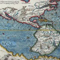
How rich in lessons of every kind is this history of twenty centuries of exploration. Let us cast a glance behind us and enumerate the main features of the progress made in this long series of years. If we take the map of the world of Hecatæus, who lived 500 years before the Christian era, what do we see? When it was published the known world did not extend beyond the basin of the Mediterranean, and the whole, with a terribly distorted outline, is represented only by a very small portion of southern Europe, the interior of Asia, and part of North Africa; whilst encircling them all is a river without beginning or end, to which is given the name of Ocean.
Side by side with this map, ancient monument as it is of antique science, let us place a planisphere representing the world as known in 1840, and on this vast surface we shall find the portion known, and that but imperfectly to Hecatæus, occupying but an infinitesimal space.
Taking these two typical maps as our starting-point, we shall be able to judge of the magnitude of the discoveries of modern times. Imagine for a moment all that is involved in thorough knowledge of the whole world, and you will marvel at the results achieved by the efforts of so many explorers and martyrs, you will grasp the importance of their discoveries and the intimate relations between geography and all the other sciences. This is the point of view from which can best be seen all the philosophic bearings of a work to which so many generations have devoted themselves.
Doubtless the motives actuating these various explorers differ greatly. First, we have the natural curiosity of the owner anxious to know thoroughly every part of the domain belonging to him, so that he may estimate the extent of the habitable districts, and determine the boundaries of the seas, &c.; and secondly, we have the natural outcome of a trade, which, though still in its infancy, introduced even in remote Norway the products of Central Asian industry. In the time of Herodotus the aim of explorers was loftier: they wished to learn the history, manners, customs, and religion of foreign races; and later, the Crusades, which, whatever else they accomplished, certainly vulgarized oriental studies, inspired some few with a fervent desire to wrest from infidels the scene of our Lord's Passion, but the greater number with a lust of pillage and a yearning to explore the unknown.
Columbus, seeking a new route to the Indies, came across America on the way, and his successors were only anxious to make rapid fortunes, differing greatly indeed from the noble Portuguese who sacrificed their private interests to the glory and colonial prosperity of their country, and were the poorer for the offices conferred on them with a view to doing them honour.
In the sixteenth century religious persecution and civil war drove to the New World the Huguenots and Puritans, who, whilst laying for England the foundations of colonial prosperity, were to bring about a radical change in America. The next century was essentially one of colonization. In America the French, in India the English, and in Oceania the Dutch established counting-houses and offices, whilst missionaries endeavoured to win over to the Christian faith and modern ideas the unchangeable "Empire of the Mean."
The eighteenth century, ushering in our own, rectified received errors, and surveyed minutely alike continents and archipelagoes; in a word brought to perfection the work of its predecessors. The same task has occupied modern explorers, who pride themselves on not passing over in their surveys the smallest corner of the earth, or the tiniest islet. With a similar enthusiasm are imbued the intrepid navigators who penetrate the ice-bound solitudes of the two poles, and tear away the last fragments of the veil which has so long hidden from us the extremities of the globe.
All then is now known, classed, catalogued, and labelled! Will the results of so much toil be buried in some carefully laid down atlas, to be sought only by professionalsavants? No! it is reserved to our use, and to develope the resources of the globe, conquered for us by our fathers at the cost of so much danger and fatigue. Our heritage is too grand to be relinquished. We have at our command all the facilities of modern science for surveying, clearing, and working our property. No more lands lying fallow, no more impassable deserts, no more useless streams, no more unfathomable seas, no more inaccessible mountains!
We suppress the obstacles nature throws in our way. The isthmuses of Panama and Suez are in our way; we cut through them! The Sahara interferes with the connexion of Algeria and Senegal; we will throw a railway across it. The Pas de Calais prevents two nations so well fitted for cordial friendship from shaking each other by the hand; we will pierce it with a railway!
This is our task and that of our contemporaries. Is it less grand than that of our predecessors, that it has not yet succeeded in inspiring any great writer of fiction? To dwell upon it ourselves would be to exceed the limits we laid down for our work. We meant to write the History of the Discovery of the World, and we have written it. Our task therefore is complete.